Cleveland Digital Library
Image
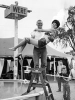
Photo, A man standing on a ladder holds a..., Cuyahoga County Fair, 1964
Annotation

Featuring primarily maps, texts, and images, this gateway site is designed to be a resource for those interested in the history of the greater Cleveland area. The site includes approximately 35 journal articles (from journals such as the Saturday Evening Post) on the history of Cleveland, its newspapers, its railroads and industries, and a few prominent citizens; 36 digitized books; seven manuscript collections (three merely describe the contents of the collection, while four offer digitized resources); an audio file and a video file; two cartoon collections; and nine photograph collections, containing about 600 photographs. Although many of the collections are located on outside websites, visitors can access the collections by subject, date, geographic location, or format.

For educators, the site includes 20 lesson plans, under such categories as American Heritage and Democratic Process. The classroom activities are well-conceived; they feature problem solving and critical thinking exercises like the Mystery Photo Album, in which students attempt to figure out where in the Cleveland area historical photographs were taken, and By the Neck Until Dead, an e-book that details the history of Cuyahoga County, OH, hangings. The site also maintains a list of local history websites.

Meeting of Frontiers

Image
Chromolithograph, "Attack on Port Money," 1904
Annotation

In conjunction with the Russian State Library in Moscow, the National Library of Russia in St. Petersburg, and the Rasmuson Library of the University of Alaska in Fairbanks, the Library of Congress has digitized more than 2,500 items, comprising approximately 70,000 images, and provided transcriptions and commentaries in English and Russian to offer a comparative history of American and Russian expansion through frontier territories in each nation's continent. The site presents an overview of expansion into Siberia and the American West in six sections: Exploration, Colonization, Development, Alaska, Frontiers and National Identity, and Mutual Perceptions. Each section contains from two to 11 modules that call attention to similarities and differences between the two histories with regard to subjects such as migration—forced and otherwise, missionaries, religious flight, mining, railroads, agriculture, cities, popular culture, and tourism, and even compares Cossacks with cowboys.

The site offers more than 40 complete books, including manuals, handbooks, fiction, and travelers accounts; 77 maps and one atlas; 438 items from the Russian-Ukrainian Pamphlet and Brochure Collection; materials from six complete manuscript collections, regarding exploration, trade, and commercial activities; four tour-of-the-century films; 125 newspaper articles; 11 dime novel covers; five photographic collections; and one sound recording of a Russian folk song. Provides a 500-title bibliography and links to 30 related sites. Valuable for those studying the American West and Russian history and investigating ways to explore frontiers of comparative histories in order to expand beyond limits of national history narratives. Listen to the audio review: .

Historical Atlas of the Twentieth Century

Image
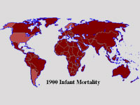
Map, "1900 Infant Mortality"
Annotation

Through a series of maps of the world, continents, and specific countries, users can trace large-scale demographic, economic, and political trends and developments covering the twentieth century. Topics charted on these maps include changes in agricultural workforce, infant mortality rates, life expectancy, literacy, persons with telephones, systems of government, alliances, borders between countries, and political violence, including wars. While examining any one map, click on buttons to find contextual information from additional maps. The site also includes informative timelines. Created by a librarian, the atlas provides a quick and easy way to see comparative change over time on a worldwide basis. Users should be aware, however, that the categorization scheme does not necessarily reflect the views of professional historians.

Mapping the National Parks

Image
Graphic, Mapping the National Parks
Annotation

Funded by the Rockefeller Corporation and part of the Library of Congress American Memory Project, this site features approximately 200 maps that document the history, cultural aspects, and geological features of the areas that became the Acadia, Grand Canyon, Great Smoky Mountains, and Yellowstone National Parks. The maps date from the 17th century to the present and include early European, exploration, geological, environmental, United States Geological Survey, and National Park Service maps.

The site is divided into four sections, one for each of the featured national parks. Each section includes a 1200-word essay describing the history of the area and the process by which it became a national park, illustrated with five to seven maps.

The site also includes a bibliography of over 200 scholarly works on related topics. Other links include a 750-word general history of the mapping of national parks and a "Learn More About It" section that offers links to 14 Library of Congress Special Presentations and related collections and exhibits. The collection is keyword searchable and can be browsed by geographic location, subject, creator, and title. This easily navigable site is ideal for students and teachers interested in cartography, the National Parks system, and conservation in America.

Florida Heritage Collection

Image
Graphic, Florida Heritage Collection
Annotation

This project provides a collection of more than 280 digitized materials documenting the history of Florida from pre-contact to the present. It includes materials relating to Florida history, culture, arts, literature, and social sciences in a number of major thematic areas, including Native American and minority populations, exploration and development, tourism, natural environment, and regional interests. These materials are drawn from the archives, special collections, and libraries of the 10 state universities in the Florida system.

Items include family papers, local history books and booklets, diaries, advertising materials, and Civil War letters, business records, maps, and photographs. Many of the materials are regional or local in scope.

The site also includes an extensive (5000-word) Florida history narrative timeline from pre-contact (before 1492) to the present. A user guide and tutorial are provided, and the documents are searchable by county name, keyword, subject, author, or title. The search engine has an option for listing either electronic holdings only or all collection holdings under a particular subject. Entries in the electronic catalog include the archive in which the original is located as well as a 20-word description of the item and its contents.

Note that a few links are still under construction with no completion date indicated. The site is ideal for researching Florida's state and local history.

Boston Streets: Mapping Directory Data

Image
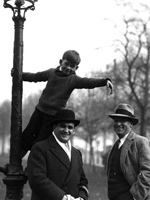
Photo, MacJannet student up a lamp post as Emory Foster, ca. 1930, 1930
Annotation

This website uses photographs, historical maps and atlases, and city directories to contextualize "the people, places, and events that have shaped the city from the years before the American Civil War through 20th-century urban renewal." The site has four exhibits, each accompanied by an introduction. Moments is a searchable collection of more than 2,500 historic maps and photographs that includes some of the earliest urban photography in the country. Places presents three historic atlases of the city, from 1874, 1898, and 1928. Each of the 94 plates in the atlases can be viewed individually. People offers nine city directories from 1845 to 1925 and five examples of how people's histories can be traced in the directories and how the directories can be combined with the images and maps from the site to "contextualize in time and place a single history or the history of millions."

Cowpaths allows users to plot information gathered from the images and directories on a map as an aid to tracing the history of the city and its people. Users can define their own data layers, query the data, and have results mapped on historical maps. An illustrated primer on how to use "Cowpaths" is available.

Each exhibit is individually searchable with basic or advanced searches. This site is a useful resource for those interested in the history of Boston and is also of interest to those studying urban history.

Harrisburg's Old 8th Ward

Image
Photo, 418 Walnut Street
Annotation

This website is devoted solely to the study of 8th Ward from Harrisburg, PA, in the 19th century, with essays, images, maps, and directory lists. A virtual walking tour offers more than 70 pictures of 8th Ward buildings and a Then and Now tour pairs views of streets and buildings in the 19th century with views of the same areas today.

The site has three informational directories on businesses, institutions, and residents. The business directory lists businesses found in the Old 8th Ward organized by goods or services and provides the owner's name, dates of operation, and links to photographs. The institutions directory lists charitable organizations, churches, fire companies, market houses, and schools with links to photographs and a brief description. The extensive resident directory is organized by streets and lists residents with their occupation, ethnicity, years of residence, and other available information.

A guide to student research on the Old 8th Ward includes 16 scholarly essays on such topics as business and industry, churches and synagogues, newspaper accounts, politics, residents, and saloons. Additionally, there are six period maps and a miscellanea section with advertisements, newspaper articles, postcards, and real estate listings. There is no search capability. In addition to those interested in Harrisburg itself, the site is of interest to anyone studying urban development in the 19th century.

Military Campaign Maps

Image
Annotation

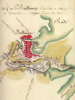
This collection offers more than 1,000 digitized maps that show troop movements, defensive structures, roads, campsites and local buildings, topography, and vegetation. They are invaluable in studying battles and military history. Divided into three sections, "The American Revolution and its Era" (390 maps), "Civil War Maps" (nearly 850 maps), and "Additional Military Battles and Campaigns" (31 maps), the site also includes maps of non-American battle sites (including Iraq and Afghanistan). The maps are not modern; they were drawn at the time of or just after the conflict they illustrate.

Maps open in separate browser windows, and users can zoom in and out of the maps or download high-quality versions. Visitors can search the collection by keyword, or can browse by subject, creator, geographic location, or title. The site includes a section illustrating the map digitizing process. The availability and ease of use of these primary sources make this site a tremendous resource for student, teachers, and historians, especially those interested in maps or military history.

Connecticut History Online

Image
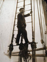
Photo, Captain George Comer of East Haddam in rigging..., 1907
Annotation

This site is a collaborative effort between the Connecticut Historical Society, the Thomas H. Dodd Research Center at the University of Connecticut, and the Mystic Seaport Museum, funded by a National Leadership Grant from the Institute of Museum and Library Services. It offers approximately 14,000 images depicting Connecticut's history from the beginning of the 19th century to the middle of the 20th century.

The images are divided into categories: "Artifacts," "Manuscripts and Documents," Maps, Charts, and Bird's-eye Views," "Newspapers and Magazines," "Photographs, Prints, and Drawings," "Posters/Broadsides," and "Sound Recordings and Transcripts." Each image includes notes on the creator, date, and place created, medium, repository information, and a brief (40-word) description of the subject. Visitors can search the site by keyword, subject, creator, title, and date.

The site also includes four sample lesson plans for middle school classes comparing and contrasting two Connecticut families and the roles of men and women through exercises interpreting the site's images, a list of ideas for future topics, and themes for secondary-level classrooms. This site is ideal for teachers and students interested in the history of Connecticut and its communities.

Bethlehem Digital History Project

Image
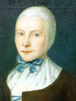
Oil on canvas, Johannetta Ettwein, John Valentine Haidt, 1754
Annotation

This collection of materials addresses the Moravian community of Bethlehem, PA, from its founding in 1741 to 1844, when the community first opened to non-Moravians. Most documents are available in three formats: facsimile of original in German type, transcription, and translation into English. All documents may be read in English.

A 650-word essay introduces visitors to Bethlehem history. The community kept a diary that visitors may read for the years 1742 to 1745. The Journal of the Commission of the Brethren of Bethlehem, from 1752 to 1760, allows further access to the inner workings of the community. The death register currently lists 400-word obituaries for five women and six men. Birth and marriage registers are to be added to the site.

Moravians of this era read memoirs (2,000–3,000 words) at the funerals of community members, sometimes incorporating autobiographical writing. Visitors may read 34 of these memoirs.

The records of the community also include four maps, a survey, and the ledgers of the town finances from 1747 to 1765. Inventories of four shops may also be examined.

Other material includes a 32-page 1876 historical sketch of the Bethlehem Seminary for Young Ladies, a 19-page scholarly essay on the Moravian approach to business, and a 1762 discussion of how to finance the Single Sisters' Choir. Visitors may search the site by subject. The site will be very interesting for research in colonial history and the history of religion in America.