Chicago Imagebase

Image
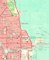
Map, Chicago
Annotation

Dedicated to "enhancing knowledge about the built environment of the Chicago region," this site hopes to offer a comprehensive "system for indexing, storing, retrieving, comparing, and analyzing images, maps, data, literature, and other geographically-based materials" on Chicago.

Contains an array of historical and recent maps, photographs, and illustrations, plus textual information about Chicago's history and architecture.

Includes approximately 600 aerial photographs taken in 1996 by Alex S. MacLean; 83 photographs by C. William Brubaker; 14 by Robert Thall; multiple images of 55 buildings and historic sites; four Works Progress Administration land use maps; more than 30 images dealing with the Chicago Fire of 1871; 20 photographs by William Henry Jackson and Charles Dudley Arnold of the 1893 World's Columbian Exposition; 22 Rand McNally "Bird's Eye Views" from 1893; and numerous additional maps and images.

An animated map shows the city's expansion and the development of neighborhood communities from 1850 to 1990.

Presently, the site focuses on four Chicago areas: the "Loop," Lawndale, Armour Square, and Bridgeport. Though not updated since 1999, the site contains useful materials documenting Chicago's development.
Mapping History

Image
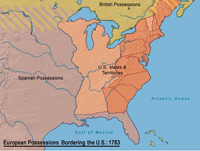
Map, European Possessions Bordering the US, 1783
Annotation

This collection of historical maps, includes maps of the United States divided into 38 topical sections covering pre-1500 through 2000. These units include a variety of materials—from a text introduction and review questions to interactive graphs and maps.

The collection also offers 18 modules on European, Latin American, and African history, ranging in time between Greek civilization and 2000.

Interactive maps and graphs require a shockwave plug-in to access. Useful as geographic aids for those studying U.S. explorations in North America, westward expansion, campaigns against Native Americans, and slavery, among other topics in U.S. and world history.

New Jersery History Partnership Project

Image
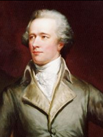
Portrait, Alexander Hamilton, Daniel Huntington, NJ History Partnership Project
Annotation

This project was designed to teach U.S. history through New Jersey history. Currently, materials are organized under two themes. "American Revolution" contains 10 lectures and nine lesson plans, seven images of New Jersey historic sites such as Liberty Hall and Morven, 47 primary source documents on topics such as women, African Americans, the state constitution, the Quakers, and the Lenape, seven video clips on topics such as republican motherhood, the Great Awakening, and the battles of Trenton and Princeton, and an interactive exercise on the 1776-1777 campaign in New Jersey. Lesson plan topics include revolutionary heroes, African American quest for freedom, and the Battle of Trenton. A timeline integrating U.S. and state history events from 1734 to 1807 is also included.

A less extensive thematic section "Market Revolution" offers a lecture, a lesson plan, and a video clip on New Jersey's transportation revolution, seven primary source documents that include an 1839 map of New Jersey and a map of the Morris Canal, and a timeline. Links are provided to three partner institutions, eight history centers or organizations, and 30 New Jersey history centers, organizations, or historic sites. This website provides useful resources for those teaching the 18th- or early 19th-century history of New Jersey.

A Century of Progress: The 1933-34 Chicago World's Fair

Image
Introductory graphic, A Century of Progress
Annotation

This website provides materials published for the 1933-34 World's Fair including copies of official publications, press releases, souvenir albums, guidebooks, maps, brochures, postcards, photographs, and newspaper clippings. Users can search the checklist of the Official Publications of the Century of Progress International Exposition and Its Exhibitors containing over 1,225 items, some 350 of which are available online. The checklist can also be browsed by author, title, or subject. Additionally, the site provides links to websites related to the 1933-34 World's Fair.

Benjamin Franklin: In His Own Words

Image
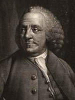
Mezzotint, Benjamin Franklin of Philadelphia, 1763, Edward Fisher, LoC
Annotation

This exhibition "indicates the depth and breadth of Franklin's public, professional, and scientific accomplishments," offering documents, letters, books, broadsides, and cartoons. Eight sections exploring periods or aspects of Franklin's life are focused around items from the Library's collections with accompanying explanatory text.

Topics include Franklin's role in events prior to the Revolution, his role in the Continental Congress, his role as a diplomat in Paris and in negotiating the Treaty of Paris, his role in the early republic as President of Pennsylvania and delegate to the Constitutional Convention, his life as a scientist and inventor, and his activities as a printer and writer. There are more than 60 documents and other items available in the exhibition. There is also a Benjamin Franklin chronology from 1706 to 1790, a bibliography with 11 books and seven books for young readers, and four links to related websites. A good starting point for researching Franklin's life or the political and diplomatic history of colonial America or the early United States.

Historic Pittsburgh

Image
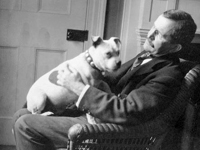
Photo, Charles Hart Spencer. . . , 1905, Spencer family, Historic Pittsburgh
Annotation

This site offers an extensive archive of material on the history and culture of Pittsburgh, including full-text published works, maps, images, and census records, as well as archival finding aids. The full-text collection, covering the colonial period through World War I, presents more than 500 books on Pittsburgh and Pennsylvania history, including manuscripts, reports, dictionaries, diaries, and periodicals. The collection can be browsed by author, genre, date published, or categories such as culture and society or people and personalities. It can also be searched by keyword or bibliographic information including author, title, and subject. The map collection offers visitors the ability to search and view 1,122 plates from 26 volumes of Hopkins Real Estate maps (1872 ñ 1939) and the 1914 Warrantee Atlas of Allegheny County. The more than 8,000 images can be browse by time period (1860s to 1980s), location, collection, or through four thematic presentations focused on work, play, home life, and personalities.

Also available are searchable U.S. census schedules for Pittsburgh from 1850 to 1880 and for Allegheny City from 1850 to 1870 and archival finding aids to 700 archival collections. Additionally, there is a timeline of Pittsburgh history from 1750 to 2000 and two lesson plans for teachers based on the material in the site's collections, one on using census data and one on using the map collections. A useful resource with a variety of primary source material for anyone researching the social or cultural history of Pittsburgh.

Stephen Foster's Sketchbook

Image
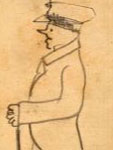
Sketch, Over the Calm. . . , 1851, Stephen Foster, Stephen Foster's. . . site
Annotation

This website makes available the full contents of the sketchbook of 19th-century American composer Stephen Foster. It contains handwritten drafts of 64 Foster songs, including some that were never published. Selecting "Song List" brings up the full list of songs contained in the sketchbook and clicking on the links takes the visitor to the pages with the draft of the song. Clicking on the thumbnail image of the page brings up a transcript, a larger image, and bibliographic data. Drafts of several of Foster's most popular songs appear here including "Old Folks Home" (or "Way Down Under the Swanee River"), "My Old Kentucky Home," and "Jeanie with the Light Brown Hair." The unpublished songs are indicated in brackets. The visitor can browse all 250 page images individually or search by keyword. A useful resource for those researching Foster or the history of 19th-century American music and culture.

Madison: Celebrating 150 Years

Image
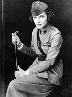
Photo, Irene Castle in Uniform, WWI or later, Madison: Celebrating 150 Years
Annotation

In 2006, Madison, WI, celebrated the 150th anniversary of its incorporation as a city. To mark the occasion, this website features 6,952 images, several articles and documents, maps and information on Madison's buildings, and links to virtual exhibits, entreating users to investigate Madison's past. This diverse collection of materials highlights both the experiences of the American Indian groups that had lived in the Madison area for many thousands of years, as well as those of the Yankee, English, Irish, German and Scandinavian settlers who began to arrive in 1837.

Visitors can view a map of American Indian village and mound sites, built for burial and ceremonial purposes, which are still visible around the city today. Also available are the recollections of George W. Stoner, one of the first settlers to arrive in Madison, through which one can learn about the construction of the city's first buildings and businesses, its first election, and its first suicide. Moving into the 20th century, visitors can also learn of the Federal Government's attempts to enforce Prohibition in Madison, which one official described as "queen of the bootleggers." This website is useful for those interested not only in Wisconsin history, but also in the history of urbanization in the United States more generally.

Panoramic Maps, 1847-1929

Image
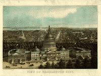
Image, View of Washington City, E. Sachse & Co., 1871
Annotation

This site presents more than 1,000 original panoramic maps, "a popular cartographic form" during the late 19th and early 20th centuries. The maps, often prepared for civic organizations, such as chambers of commerce and real estate agents, to promote an area's commercial potential, cover the contiguous 48 states and four Canadian provinces of British Columbia, Nova Scotia, Ontario, and Quebec between 1847 and 1929. While most of these maps were not drawn to scale, viewers can zoom in to find artists' renderings of individual streets, buildings, and landscape features. The site also includes a 1,200-word history of panoramic mapping; a bibliography comprised of 24 titles; and background essays (1,000 words) and images relating to five prominent panoramic artists: Albert Ruger (1829-1899), Thadeus Mortimer Fowler (1842-1922), Oakley H. Bailey (1843-1947), Lucien R. Burleigh (1853-1923), and Henry Wellge (1850-1917). This site is an excellent resource for those studying urbanization, cities, business growth, and the art of mapmaking.

Alabama Maps

Image
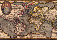
Image, "Typus Orbis Terrarum" Matthais Quad,1596
Annotation

This site contains more than 3,500 scanned and digitized maps divided into two indexes—historical and contemporary. The historical maps index contains several sections. The most voluminous section, "Alabama," is divided into time periods, geological features, Alabama counties, rivers, and state highways. Another section indexes 13 other southeastern states, including Texas, the Carolinas, and Florida. There are also maps of the Western Hemisphere, North America, Mexico, and the Caribbean, some dating before 1700.

An especially valuable feature of the historical index is the "Special Topics" which contains maps of the Civil War, including the battles in Gettysburg and Antietam, railroad routes, and ten Native American maps, mostly illustrating the boundaries of Cherokee territories. The contemporary map index is divided into eighteen themes, including education, housing, politics, federal expenditures, climate, and recreation. There are more than 100 world maps of Africa, Asia, Europe, the Middle East, and the South Pacific. Users will also find links to the University of Alabama's Department of Geography and the publications of the Cartographic Laboratory. Created for educators and the business community, this is valuable resource for those researching the history of Alabama or contemporary themes in Alabama, the United States, and the world.