National Park Service: Links to the Past

Image
Image, History & Culture, http://www.nps.gov/history/.
Annotation

Visitors to this site are invited to explore historical aspects of the roughly 200 National Park Service locations designated important to U.S. history and prehistory. Materials are organized by "cultural resource subjects," including archeology, architecture and engineers, cultural groups, cultural landscapes, historic buildings, mapping, maritime and military history, and "cultural resource programs," such as the American Indian Liaison Program and Heritage Preservation Services.

Visitors can search for information on more than 2.5 million Civil War soldiers and sailors; more than 71,000 properties listed in the National Register of Historic Places; and approximately 240,000 reports on federal archaeological projects in the National Archaeological Database. National Register Travel Itineraries provide historic guides to 18 cities and communities. The National Underground Railroad Network to Freedom contains information on 51 sites of importance and on slavery and antislavery efforts.

Also of interest are bibliographies on the African American west and public history, and full-text publications on the Antiquities Act of 1906 and the promotion of the city of Seattle during the gold rush era. The homepage—"History and Culture"—presents several topical, comprehensive historical exhibits including the "Eisenhower Virtual Museum."
Historic USGS Maps of New England

Image
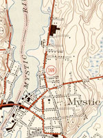
Map, "Mystic, CT-NY-RI Quadrangle," 1944
Annotation

A collection of more than 1,100 topographical maps created by the United States Geological Survey from the 1890s to the 1950s covering all of New England—Maine, New Hampshire, Vermont, Rhode Island, Massachusetts, and Connecticut—and selected areas of New York. The maps—which reveal roads, buildings, rail lines, bodies of water, and elevations—occur in 15-minute and 7.5-minute quadrangle series (a minute is one-sixtieth of a degree of latitude or longitude). In addition, the collection includes six maps with 30-minute quadrangles.

For states other than New York, users can view a state image map and select a point within a grid marked off in 15-minute increments to find listings for available images accompanied by dates the maps were surveyed, created, and revised. Towns within each quadrangle are also listed along with names of adjacent areas. Users also may search an alphabetical list of towns within each state. For New York, only an index of quadrangles names is available. Maps are presented in JPEG format. According to the site, "Each image is typically 2 megabytes, so download times are likely to be slow." A useful site for those studying changes in the New England landscape during the first half of the 20th century.

Lewis and Clark: Maps of Exploration 1507-1814

Image
Logo, Lewis & Clark, The Maps of Exploration
Annotation

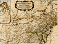
This 1995 exhibition presents approximately 70 maps designed to help "understand [Thomas] Jefferson's views of the West and the nature of the quest to the Pacific," and to "show the evolution of cartographic knowledge of North America up to the time that [Meriwether] Lewis and [William] Clark set out."

Arranged into five sections, it treats the period from the arrival of Columbus in North America to Lewis and Clark's 1803 voyage.

Well-written background essays describe relevant monographs and journals, explain the role of technology in mapmaking, and elucidate the social and intellectual contexts of Western exploration.

The site, which offers both European and American perspectives, also furnishes eight related links and a 31-title bibliography.

Particularly useful for understanding the evolution of geographic knowledge about North America and for tracing the history of cartography during this period.

Envisaging the West: Thomas Jefferson and the Roots of Lewis and Clark

Image
Image for Envisaging the West: Thomas Jefferson and the Roots of Lewis and Clark
Annotation

By the time Thomas Jefferson became the third President of the United States in 1801, interest in exploring the West had begun to shape U.S. policy. This chronological narrative traces Jefferson's life, participation in politics, and accumulation of scientific geographical knowledge from 1735 to 1804. There are four main sections: "The Jeffersons and Their Frontier Virginia Neighborhood," "From Colony to Commonwealth," "Science and Statecraft at Home and Abroad," and "Public Servant to the Early Republic."

This narrative is accompanied by an archive of 169 letters, statues, books, treaties, maps, and journals providing primary source insight into Jefferson's thoughts about the West and the Lewis and Clark expedition in particular. Three interactive maps from the 1700s, overlaid with historical data about cities, private dwellings, natural features, courthouses, and waterways, provide important insight into the geographic and social environment at the time.

Historic Topographic Maps of California

Image
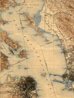
Map, San Francisco 15-minute Quadrangle, 1895
Annotation

Provides historical United States Geological Survey maps of the San Francisco Bay area, from Point Reyes in the north to Half Moon Bay, and east to San Jose. Includes maps from different time periods—the earliest is from 1895, the latest 1997—covering each 7.5-minute and 15-minute quadrangle of the area. Users may zoom in to see minute details. Searchable by quadrangle or place name. Of value for those studying change over time in the development of the Bay Area during the 20th century.

Map Collections: 1500-2003

Image
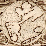
Image, Historia general..., Antonio de Herrera y Tordesillas, c. 1601-1615, LoC.
Annotation

This large collection of maps from the 16th century to the present day focuses on Americana and cartographic treasures.

Materials are organized into seven thematic categories—Cities and Towns, Conservation and Environment, Discovery and Exploration, Cultural Landscapes, Military Battles and Campaigns, Transportation and Communication, and General Maps. Sections include five special presentations.

Users may download maps or zoom in to view details. Seventeen specific map collections contained within this larger site that are of particular importance for the study of American history include "Discovery and Exploration," "The American Revolution and Its Era," "Railroad Maps, 1828–1900," "American Colonization Society Collection: Maps of Liberia, 1830–1870," "Panoramic Maps, 1847–1929," "Civil War Maps," and "Mapping the National Parks."

National Museum of Natural History

Article Body

The National Museum of Natural History, as stated on its website, "inspire[s] curiosity, discovery, and learning about nature and culture through outstanding research, collections, exhibitions, and education."

Natural history. That probably doesn't sound particularly useful to a teacher of history, which is so often centered on humanity, rather than the earth. That said, don't write the NMNH off without giving it some thought. True, many of the offerings are decidedly scientific. However, the museum includes anthropology alongside biology and geology.

Be sure to take a look at the virtual exhibits. More than 30 topics are presented, with highlights including Alaska Native Collections: Sharing Knowledge, Camping With the Sioux: Fieldwork Diary of Alice Cunningham Fletcher, Lakota Winter Counts, and Lewis and Clark: Mapping the West.

The museum also provides a variety of lesson plans, for use in the classroom and during field trips. Also, consider looking into the teacher and classroom resources under "Human Culture and Diversity." Resources range from bi-annual anthropological research publications (including teaching activities and methods) to the National Museum of Natural History's anthropological collections.

Speaking of anthropology, the department provides 24 online exhibits and three databases, including the museum collections.

Workshops provide an opportunity for educators to focus on specific topics of interest.

If you live in the DC area, consider planning a field trip. Hands-on learning opportunities are in no short supply!

U.S. Geological Survey

Article Body

The U.S. Geological Survey exists as a federal organization created to study the nation's flora, fauna, biology, geography, bodies of water, geology, and geospatial information.

The USGS provides access to their entire photographic collection, which is sub-divided into portraiture, photographers, "pioneer photographers," and images of earthquakes; mines, mills, and quarries; national parks; and Mt. St. Helens.

In addition, educators can access nine sub-sites and resources optimal for K-6 education, covering land use and exploration. Sample topics include "A Satellite View of the Journey of Lewis and Clark" and "Urban Growth in American Cities." Twelve resources, also addressing land use and exploration, are available for grades 7-12.

Available teacher packets, like the majority of the site, will primarily be of use to science educators. However, the three packets on maps could be used in conjunction with units on westward expansion or exploration.

National Oceanic and Atmospheric Administration

Article Body

The National Oceanic and Atmospheric Administration (NOAA) provides online exhibits, video clips, photographs, artifacts, interviews, and essays to provide a glimpse into maritime history, the history of science and technology, and its pivotal role in peace and war.

Hurricane History tracks the path of selected notable hurricanes since 1900; each description includes an interactive map.

NOAA administers the Monitor National Marine Sanctuary, preserving the wreck of the Civil War ironclad USS Monitor at Hampton Roads, VA.

Other historical resources are scattered around the NOAA site, retrievable through the search feature using the basic keyword, "history."

Sakura: Cherry Blossoms as Living Symbols of Friendship

Image
Annotation

In 1912, Japan presented Washington, DC, with 3,000 cherry trees as a gift. This Library of Congress exhibit uses primary sources to explore the history of the trees, the National Cherry Blossom Festival that grew up around them, and Japan/U.S. relations.

Primary sources are divided up by four themes. "Art and Documentation" includes three sources: a letter from Tokyo mayor Yei Theodora Ozaki to First Lady Helen Taft on the gift of the trees, a memo on artwork acquired by botanist Walter Tennyson Swingle in Japan, and a photograph of Swingle and Seisaku Funatsu, one of the group of Japanese experts who cultivated the trees gifted to the U.S.

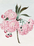
In "A Special Gift to Washington from the City of Tokyo," visitors can view Swingle's collection of 11 Japanese watercolors depicting different types of cherry trees.

"Cherry Blossoms in Japanese Cultural History" collects 15 pieces of Japanese artwork depicting traditional hanami (flower viewing), as well as two pieces of Western artwork showing Japanese influence. Also included in this section are 12 stereographs of Japan during cherry blossom time, created between 1904 and 1908 for Western audiences.

"Enduring Symbols of Friendship" includes nine sources exploring the place of the cherry trees in Japan/U.S. relations. A 1938 Japanese magazine cover, notes for a 1934 speech by Japanese ambassador Hiroshi Satou, and a photo of children from the Japanese Embassy at the Tidal Basin show pre-World War II peace. Two political cartoons show how quickly the trees became a symbol of DC, and a photograph shows U.S. cherry blossom viewers during World War II. The section also features three photographs from a 2011 photography contest associated with the National Cherry Blossom Festival.

Visitors can also click on "Exhibition Items" to view all 55 primary sources, sortable alphabetically or by theme.

Some sources lack annotations, and existing annotations are sparse. However, this is a unique collection of sources that could be used as jumping-off points for exploring cultural exchange, international relations over time, and DC history.