The History Box

Image
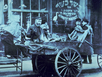
Photo, Pushcart peddler in Lower East Side, NY, early 1900s, The History Box
Annotation

A gateway and an archive of numerous articles on New York history, this site "focuses a particularly long lens on the early history of political and economic events, panics, riots and other related matters affecting or contributing to New York City's development and growth." Its main feature is the New York state and New York City directories. (The U.S. directory is currently unavailable.) The New York state directory offers more than 700 links and more than 60 articles organized under 21 topics that include the arts, cities and counties, ethnic groups, military, societies and associations, transportation, women and their professions, and worship.

The New York City directory offers more than 5,200 links and more than 700 articles organized under 58 topics that include architecture, the arts, business matters, city government, clubs and societies, crime and punishment, education, ethnic groups, 5th Avenue, Harlem, immigration, New York City panics, real estate, temperance and prohibition, and Wall Street. The visitor can search the entire site or each directory by keyword. This site is a good starting point for researching the history of New York. It should also be useful for literary scholars, writers, and historical societies.

Columbia River Basin Ethnic History Archive

Image
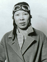
Photo, Leah Hing, ca. 1934, Pilot and WWII instrument mechanic, c. 1934, WSU
Annotation

This site offers a large archive of selected documents, reports, records, maps, photographs, newspapers, artifacts, and oral history interviews. Items are searchable by ethnic group, keyword, archive, type of material, date, or subject. Brief historical overviews and bibliographies for each ethnic group profiled are also available in the archive section. Another section has lessons plans for teachers on African Americans, immigration and settlement, migration, and ethnic culture and identity, 1850-1950. It also offers tutorials on using the archive, using history databases on the web, interpreting photographs, interpreting documents, and interpreting oral history. Historical overviews are provided on the various ethnic groups that settled the Columbia River Basin.

A discussion forum offers a place to talk about discoveries in the archive or questions. Topics currently include ethnic groups, ethnicity and race, work and labor, immigration and migration, family life, religion, social conditions, discrimination, and civil rights. A very useful site for researching or teaching the social and cultural history of the Columbia River Basin.

Jim Crow Segregation: The Difficult and Anti-Democratic Work of White Supremacy kmconlin Thu, 05/12/2011 - 17:06
Question

How did segregation shape daily life for generations of African Americans and how do its legacies remain with us today?

Textbook Excerpt

Textbooks locate segregation’s origins in Southern disenfranchisement laws of the 1890s and highlight the Supreme Court's 1896 "separate but equal" ruling in Plessy v. Ferguson. New job opportunities during World War I and the Great Migration are briefly addressed along with "custom and tradition". Textbooks emphasize the National Association for the Advancement of Colored People's legal challenges, and portray the 1954 Brown v. Board decision as the culmination of the fight. Thus, according to the textbooks, from the 1890s to the 1950s, African Americans endured as best they could.

Source Excerpt

Primary sources provide ample evidence of segregation's brutality. They demonstrate the kind of structural inequalities that white supremacist laws and practices institutionalized but also that African Americans embraced a variety of methods to combat Jim Crow's injustices, and that white allies occasionally joined them. Collectively, the primary sources included here reveal how geography, class, gender, and culture have influenced ongoing battles for justice, as have changing national and international contexts.

Historian Excerpt

Historians debate the origins of Jim Crow, but it is important to remember that slavery had mandated the use of laws and practices to govern interracial relations. Separation from whites by choice accompanied freed people's desire for independence from their former white owners even as they expected the full and equal citizenship guaranteed to them by the 14th Amendment.

Abstract

Segregation contradicts what most students have learned about American freedom and democracy. Textbooks discuss de jure [in law] segregation as a great inconvenience that began in the 1890s and soon spread to every aspect of Southern daily life. Most routinely ignore:

  • segregation's economic dimensions and long-term impact;
  • black community activism;
  • interracial efforts to contest the status quo; and
  • the violence and terrorism necessary to uphold it.

Textbooks that portray segregation as a prelude to a more celebratory narrative of the civil rights era collapse the history of earlier generations of African Americans into a monolithic victimhood.

While the South's vicious de jure system stands apart, the rest of the nation's reliance on both informal custom and formal policy means that segregation—as well as the white supremacy and federal complicity that sustained it—cannot be dismissed as a regional aberration in an otherwise democratic nation.

Segregation contradicts what most students have learned about American freedom and democracy. Textbooks locate segregation's origins in southern disenfranchisement laws of the 1890s and highlight the Supreme Court's 1896 "separate but equal" ruling in Plessy v. Ferguson. The majority of African Americans still lived in the south and worked as agricultural laborers for white landowners who denied them an education and exploited them economically. New job opportunities during World War I offered one escape.

Material Culture: More Than Just Artifacts

Article Body

Coca-Cola ads used to say “Can’t beat the real thing.” At the Jewish Historical Society of Greater Washington, the real thing is our historic synagogue, and indeed, nothing can beat it for educating students about immigrant and neighborhood history in the nation’s capital city.

Originally built by Adas Israel Congregation in 1876, the 25-foot by 60-foot synagogue was a simple house of worship that served German and Eastern European Jewish immigrants in downtown Washington. President Ulysses S. Grant attended its dedication. Because of the building’s significance, the Society moved it three blocks in 1969 to save it from the wrecker’s ball. Today we run the Lillian & Albert Small Museum there.

Among our primary visitors are school groups, mainly from Jewish congregational schools and day schools, but private and public schools visit as well. The building is the focal point of all youth programs.

. . . 3rd–7th graders look for clues about the building's function in its architecture.

In Synagogue Story, K–2nd graders compare the restored 19th-century sanctuary with the 21st-century sanctuaries (or even theaters!) they know—and then make a model of the building to take home with them. In Building Detective, 3rd–7th graders look for clues about the building's function in its architecture. A separate balcony for women teaches them about gender roles in 19th-century American Judaism. A cobalt blue window and a photo of a crucifix in the sanctuary offer a glimpse into the synagogue's later life as a Greek Orthodox Church. Walking by the front façade, then seeing a photo of it with a pork barbecue sign, conveys the story of a continually changing urban neighborhood.

While we could just lecture about late 19th- and early 20th-century Jewish life in Washington, having students physically present in the space, sitting on wooden pews similar to those used over a century ago, seeing photos of how the same space once looked, walking on the old, creaking floors, and studying artifacts used in the space—nothing can top that experience, those sensations, that visceral connection to the past, and the power of the authentic. One teacher said her students will "remember the pews and the bench for President Grant and that he stayed for the entire three-hour service and wore a hat the entire time."

Using material culture—whether a building, a historic artifact, or even a photograph—engages the senses and thus enhances learning.

On walking tours, middle and high school students travel the same streets where Jewish, Italian, German, and Chinese immigrants lived, worked, and worshiped. They traverse blocks of modern office buildings and courthouses, then react with surprise to photos of brick row houses, the four surviving former synagogues, and other physical remnants of the past. Out-of-town students connect with Washington as a city, beyond the monuments and museums on the National Mall.

This is the educational theory of constructivism at work. Using material culture—whether a building, a historic artifact, or even a photograph—engages the senses and thus enhances learning. As we've seen by watching students beholding the synagogue's original ark and simple woodwork, they gain an emotional connection to the history. Another teacher told us that his students, spurred by the experience, asked "great follow-up questions" on the ride home.

So for teachers, we strongly recommend bringing students to historic sites—particularly those off the beaten path—and taking them on walking tours. We know that's not always possible, with school budgets being what they are. Alternatively, many teachers make effective use of "treasure boxes" sent out by museums. These include replica artifacts and photos, which still accomplish the most important goal: helping students connect to the past in a tangible way.
Teaser

Using material culture—whether a building, a historic artifact, or even a photograph—engages the senses and enhances learning.

The High Line

Description

From the Bowery Boys website:

"The High Line, which snakes up New York's west side, is an ambitious park project refitting abandoned elevated train lines into a breathtaking contemporary park. This is the remnant of a raised freight-delivery track system that supported New York's thriving meat, produce and refrigeration industries that have defined the city's western edges.

You can trace the footprints of this area back almost 200 years, to the introduction of the Hudson River Railroad and Cornelius Vanderbilt, who transformed the streets along the Hudson River into 'the lifeline of New York', filled with warehouses, marketplaces and abattoirs. And, of course, lots of traffic, turning 10th Avenue and 11th Avenue into 'death avenues', requiring New York's first 'urban cowboys'.

The West Side Elevated Freight Railroad was meant to relieve some of trauma on the street. That's not exactly how it worked out. We'll tell you about its downfall, its transformation during the 70s as a haven for counter-culture, and its reinterpretation as an innovative urban playground. "

Evolution of the Conservation Movement, 1850-1920 Anonymous (not verified) Mon, 04/14/2008 - 11:31
Image
Image for Evolution of the Conservation Movement, 1850-1920
Annotation

These published works, manuscripts, images, and motion picture footage address the formation of the movement to conserve and protect America's natural heritage. Materials include 62 books and pamphlets, 140 Federal statutes and Congressional resolutions, 34 additional legislative documents, and excerpts from the Congressional Globe and the Congressional Record. An additional 360 presidential proclamations, 170 prints and photographs, two historic manuscripts, and two motion pictures are available.

Materials include Alfred Bierstadt paintings, period travel literature, a photographic record of Yosemite, and Congressional acts regarding conservation and the establishment of national parks. An annotated chronology discusses events in the development of the conservation movement with links to pertinent documents and images.

History: The National Park Service

Image
Logo, NPS History and Culture website
Annotation

Historical aspects of many of the 384 areas under the National Park Service's stewardship are presented in this expansive site. A "Links to the Past" section contains more than 25 text and picture presentations on such diverse history-related topics as archeology, architecture, cultural groups and landscapes, historic buildings, and military history. Of particular interest to teachers, a section entitled "Teaching with Historic Places" features more than 60 lesson plans designed "to enliven the teaching of history, social studies, geography, civics, and other subjects" by incorporating National Register of Historic Places into educational explorations of historic subjects. Examples include an early rice plantation in South Carolina; the lives of turn-of-the-century immigrant cigar makers near Tampa, Florida; a contrast between the Indianapolis headquarters of African-American businesswoman Madam C. J. Walker and a small store in Kemmerer, Wyoming, that grew into the J. C. Penney Company, the first nationwide department store chain; the Civil War Andersonville prisoner of war camp; President John F. Kennedy's birthplace; the Liberty Bell; Finnish log cabins in Iowa; and the Massachusetts Bay Colony's Saugus Iron Works. Especially useful for teachers interested in connecting the study of history with historic sites.

Harvesting the River

Image
Color offset lithograph, "Whistling In," Bartlett Kassabaum, 1980
Annotation

Presents a narrative in exhibit format—with hyperlinks to archival documents and photographs—on the cultural and economic life of the people who came to the Central Illinois River region from 1875 to 1950. Organized into three sections on the harvesting of fish, waterfowl, mussels, and natural ice; transportation by boat, railroad, and plank roads; and the settlement and development of six area river towns. The site delivers oral histories (audio and video), as well as illustrations and photographs. It may serve as a useful introduction to those studying this particular region and regional history in general.

American Notes: Travels in America, 1750-1920

Image
Title graphic, American Notes: Travels in America, 1750-1920
Annotation

This site is a collection of 253 travel narratives written between 1750 and 1920. The narratives were written by American citizens and foreign visitors about their travels in America. Some of the accounts were written by famous Americans (James Fenimore Cooper and Washington Irving, for example), but most of the authors were not famous. The narratives include their observations and opinions about American people, places, and society; and are valuable sources for the study of early American attitudes. Most accounts are viewable either as scanned images or as transcribed texts. Also included is the 32-volume set of manuscript sources entitled Early Western Travels, 1748-1846. The collection is searchable by keyword, and may be browsed by subject, author, and title. Students and teachers will find these primary sources invaluable for research and study of the late 18th and 19th centuries.

Historic USGS Maps of New England

Image
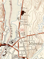
Map, "Mystic, CT-NY-RI Quadrangle," 1944
Annotation

A collection of more than 1,100 topographical maps created by the United States Geological Survey from the 1890s to the 1950s covering all of New England—Maine, New Hampshire, Vermont, Rhode Island, Massachusetts, and Connecticut—and selected areas of New York. The maps—which reveal roads, buildings, rail lines, bodies of water, and elevations—occur in 15-minute and 7.5-minute quadrangle series (a minute is one-sixtieth of a degree of latitude or longitude). In addition, the collection includes six maps with 30-minute quadrangles.

For states other than New York, users can view a state image map and select a point within a grid marked off in 15-minute increments to find listings for available images accompanied by dates the maps were surveyed, created, and revised. Towns within each quadrangle are also listed along with names of adjacent areas. Users also may search an alphabetical list of towns within each state. For New York, only an index of quadrangles names is available. Maps are presented in JPEG format. According to the site, "Each image is typically 2 megabytes, so download times are likely to be slow." A useful site for those studying changes in the New England landscape during the first half of the 20th century.