Selected Historical Decennial Census Population and Housing Counts

Image
Annotation

More than 40 historical census reports, including decennial reports dating back to 1790, are available for download on this website as PDFs. Historical statistics address topics such as population totals by race, urban or rural status, educational attainment, and means of transportation to work, among others.

There are also histories of the 21 U.S. census questionnaires produced from 1790 to 2000, including instructions to census marshals dating back to 1820. Comparative tables show which censuses included specific questions on subjects, such as ancestry and mental disabilities, and whether respondents were deaf, blind, insane, feeble-minded, paupers, literate, or convicts. Additional information includes state and territorial censuses, mortality schedules produced for a number of 19th-century censuses, population at the time of each census, and supplemental censuses taken at various times on free and slave inhabitants, Indian populations, unemployment, and housing.

Because of the PDF format, the reports take a number of minutes to download. These materials are useful for those needing demographic information or researching the history of census taking and the development of census categories.

Physical Sciences Collection: Surveying and Geodesy

Image
Annotation

Provides historical information and photographs pertaining to more than 300 surveying instruments used in America to delimit land and transport boundaries "since the first European colonists settled here some 400 years ago and turned the American landscape into property." Visitors may browse by 23 types of instruments—from alidades to zenith telescopes—and by 117 names of instrument makers. Informative texts on makers, types of instruments, and specific instruments run from one sentence to 300 words in length. Entries include bibliographic references. Of value for those studying the history of science and technology.

The Hartford Black History Project

Image
Annotation

Provides two exhibits on black history in Hartford, CT. "A Struggle from the Start" charts stages in the life of the Hartford African-American community from 1638 to 1920. Structured in five chronological sections, each with three-to-four thematic subsections, a text of 21,000 words is punctuated with approximately 60 images of documents, photographs, illustrations, newspaper clippings, tables, paintings, and maps. This exhibit covers slavery, black codes, free blacks, Black governors in the early Republic period, black soldiers, the black bourgeoisie, the formation of the black community, black labor, black society, black churches, the "Talented Tenth" in Hartford, black painters Charles Ethan Porter and Holdridge Primus, black migration from the South, mass politics, and black community institutions. A second exhibit presents approximately 80 photographs from Hartford's African-American community covering the years 1870 to the 1970s. Valuable for those interested in studying African-American history from a community perspective.

Thomas Jefferson Papers

Image
Annotation

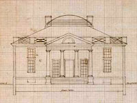
This focused site presents page images and some transcriptions of Jefferson's catalogs of books (1783 and 1789), farm book, garden book, draft of the Declaration of Independence, and some architectural documents. Visitors can browse the page images and search (where transcriptions are available) all the works. Summary descriptions are also available for each document or document type. The catalogs are Jefferson's working lists of books in his personal library. The manuscript copy of Jefferson's draft of the Declaration of Independence is not complete. The Farm Book contains Jefferson's records about his farm holdings and activities on his farms, spanning from 1774 to 1824. The Garden Book contains Jefferson's records about his gardens at Monticello and Shadwell spanning from 1766 to 1824. The architectural documents section offers more than 600 architectural drawings, sketches, and notes relating to buildings designed by Jefferson, such as Monticello and the Virginia Capitol, organized into 26 subjects.

Visitors can choose to view documents in the primary window as transcriptions (if available), as a large image, or as a small image. The search feature allows keyword search of available transcriptions. Though limited in scope, this site is useful for those interested in specific Jefferson documents.

Lift Every Voice: Music in American Life

Image
Annotation

An exhibit of music and documents that "commemorates and celebrates a variety of songs that were a part of everyday American life through the centuries." Includes 18 audio excerpts lasting approximately one minute each of representative ballads, hymns and spirituals, patriotic odes, minstrel tunes, songs from musicals, protest songs, and songs about the state of Virginia. Clips include performances by Woody Guthrie, Paul Robeson, Lead Belly, Kate and Anna McGarrigle, Bob Dylan, and the Beatles. Accompanied by a 10,500-word essay arranged by types of music and interspersed with more than 100 historical documents, including manuscripts, illustrations, photographs, hymn books, songsters, portraits, posters, sheet music covers, album covers, and record labels. A "Virginiana" section provides material from Thomas Jefferson's library to illustrate his interest in music. The site is a good introduction for those interested in understanding historical roles, functions, and uses of music by various American groups.

The Luso-Hispanic World in Maps

Image
Annotation

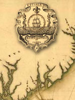
Provides approximately 50 maps and paragraph-long descriptions of more than 1,000 maps in the Library of Congress' collections pertaining to exploration, colonization, and military efforts and concerns by Spain and Portugal from the mid-16th century to 1900. Includes approximately 10 maps of Mexico and southwest U.S. made during the U.S.-Mexican War of 1846-1848; and five pertaining to Spanish claims in North America. An 8,700-word informative guide provides historical background. While the site will be useful to those planning to visit the Library's extensive map collection, online visitors may be frustrated by the lack of search capabilities. Maps included in the site are not indexed, and users can access them only by paging through the entire catalog.

The Yale Map Collection: Online Maps

Image
Annotation

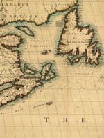
A selection of approximately 200 historical maps covering all parts of the world and ranging in time from the early 16th to the late 19th centuries. Provides more than 50 maps of the Americas, with 16 of American cities. Includes a 1641 map showing the layout of the New Haven community and a 1770 "New Map of the Cherokee Nation." Links to five previous exhibitions with 60 maps and explanatory texts of between 1,600 and 2,800 words each on road maps, three-dimensional maps, and fanciful maps. The site also includes listings for 19 reference sources and links to 48 other sites for maps and cartographic studies. A modest, but useful collection for those studying the history of cartography and exploration, and those needing cartographic aids for other historical subjects.

Historical Map and Chart Collection

Image
Annotation

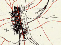
Provides more than 1,000 historical maps and nautical charts—mostly from the 19th century—produced or acquired by the Office of Coast Survey. Includes a Civil War collection of approximately 500 maps; a 90-sheet 1888 topological survey of the Washington, D.C. area; a 48-sheet topological survey of Cincinnati made in 1912; and 16 facsimiles of explorer George Vancouver's charts of the Pacific Northwest made between 1791 and 1798. Additional resources include 27 maps of the Erie Barge Canal made between 1917 and 1923; a 43-sheet survey of the Mississippi River made between 1868 and 1880; and approximately 50 sketches of landscape areas along both coasts. Maps can be viewed at 100 dpi or downloaded at 300 dpi. Organized by region and type of map. Valuable for those studying the Civil War, Washington, D.C., history, and various water-related government projects of the 19th century.

Today in History Web Resources

Image
Annotation

Gateway to more than 100 links, most of which provide visitors with the capability to search for events that occurred on specific days. "Specialty sites" link to resources dealing with specific ethnic groups, entertainment forms, politics, professions, regions, and countries. Users can find hundreds of holidays, birthdays of famous people, and calendar-related quotations, as well as links to events involving African Americans, American Indians, popular culture, sports, radical history, psychology, health, and the literary world. No depth, mostly trivia, but still of use to students and teachers who need to check a date.

Virginia Historical Inventory (VHI)

Image
Annotation

Furnishes more than 19,000 survey reports, more than 6,200 photographs, and 103 annotated county and city maps that document the history of thousands of structures built in Virginia prior to the Civil War. Original research was gathered in the late 1930s by the Virginia Writers's Project, a branch of the Works Progress Administration (WPA), and includes information compiled by field workers through onsite investigations—including interviews with residents—and by using court records and other local resources. Provides descriptions of architectural details, histories of buildings, lists of owners, and in many cases photographs and sketches. The project was "specifically charged with describing the vernacular architecture and history of everyday buildings built before 1860: homes, workplaces, churches, public buildings." Also includes materials on cemeteries, tombstones, antiques, historical events, personages, land grants, wills, deeds, diaries, and correspondence.

Provides a 5,600-word essay on the project's history. Users may search reports, maps, and photographs by keywords; includes specific instructions for genealogical research and for finding documents dealing with the Civil War and African American history. Site creators note that many of the structures documented by the project "no longer exist, and the VHI photographs may be the only extant visual records of them." A valuable resource for those studying the material culture of Virginia's past.