History: The National Park Service jmccartney Thu, 09/10/2009 - 08:02
Image
Logo, NPS History and Culture website
Annotation

Historical aspects of many of the 384 areas under the National Park Service's stewardship are presented in this expansive site. A "Links to the Past" section contains more than 25 text and picture presentations on such diverse history-related topics as archeology, architecture, cultural groups and landscapes, historic buildings, and military history. Of particular interest to teachers, a section entitled "Teaching with Historic Places" features more than 60 lesson plans designed "to enliven the teaching of history, social studies, geography, civics, and other subjects" by incorporating National Register of Historic Places into educational explorations of historic subjects. Examples include an early rice plantation in South Carolina; the lives of turn-of-the-century immigrant cigar makers near Tampa, Florida; a contrast between the Indianapolis headquarters of African-American businesswoman Madam C. J. Walker and a small store in Kemmerer, Wyoming, that grew into the J. C. Penney Company, the first nationwide department store chain; the Civil War Andersonville prisoner of war camp; President John F. Kennedy's birthplace; the Liberty Bell; Finnish log cabins in Iowa; and the Massachusetts Bay Colony's Saugus Iron Works. Especially useful for teachers interested in connecting the study of history with historic sites.

Harvesting the River jmccartney Wed, 10/07/2009 - 15:06
Image
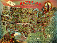
Color offset lithograph, "Whistling In," Bartlett Kassabaum, 1980
Annotation

Presents a narrative in exhibit format—with hyperlinks to archival documents and photographs—on the cultural and economic life of the people who came to the Central Illinois River region from 1875 to 1950. Organized into three sections on the harvesting of fish, waterfowl, mussels, and natural ice; transportation by boat, railroad, and plank roads; and the settlement and development of six area river towns. The site delivers oral histories (audio and video), as well as illustrations and photographs. It may serve as a useful introduction to those studying this particular region and regional history in general.

David Rumsey Map Collection

Image
Image for David Rumsey Historical Map Collection
Annotation

This private collection presents more than 15,800 rare historical maps with a focus on North and South America. The collection is accessible via several formats. A standard browser (the "directory") is designed for use by the general public. In addition to two browsers and a "collections ticker" requiring Insight software (available for free download), a GIS browser shows detailed overlays of maps and geospatial data for the more serious researcher.

Many of the U.S. maps are from the late 19th and early 20th centuries and are often notable for their craftsmanship. Materials include atlases, globes, books, maritime charts, pocket and wall maps, and children's maps. Users can zoom in to view details. Overlay capabilities make this site valuable for its ability to convey how locations have changed over time.

Osher Map Library

Image
Image for Osher Map Library
Annotation

These 14 exhibitions include more than 600 maps and related documents on aspects of history revealed through the study of maps. The website provides well-integrated essays of up to 8,000 words for each exhibit and some annotated bibliographies.

Exhibits focusing on American history include "Mapping the Republic," on conflicting conceptualizations of the U.S. from 1790 to 1900; "Exodus and Exiles," on Diaspora experiences of Jews and African Americans; "The American Way," a collection of 20th-century road maps and guidebooks; "Carto-Maine-ia," on popular uses of maps; and "Maine Wilderness Transformed," that examines "the creation of a landscape of exploitation."

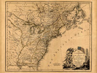
In addition, "The Cartographic Creation of New England," addresses European exploration and settlement, "The 'Percy Map,'" presents a significant Revolutionary War map; and "John Mitchell's Map" offers insight into diplomatic disputes. These maps are especially valuable for studying exploration and cartography in American history.

Envisaging the West: Thomas Jefferson and the Roots of Lewis and Clark

Image
Image for Envisaging the West: Thomas Jefferson and the Roots of Lewis and Clark
Annotation

By the time Thomas Jefferson became the third President of the United States in 1801, interest in exploring the West had begun to shape U.S. policy. This chronological narrative traces Jefferson's life, participation in politics, and accumulation of scientific geographical knowledge from 1735 to 1804. There are four main sections: "The Jeffersons and Their Frontier Virginia Neighborhood," "From Colony to Commonwealth," "Science and Statecraft at Home and Abroad," and "Public Servant to the Early Republic."

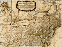
This narrative is accompanied by an archive of 169 letters, statues, books, treaties, maps, and journals providing primary source insight into Jefferson's thoughts about the West and the Lewis and Clark expedition in particular. Three interactive maps from the 1700s, overlaid with historical data about cities, private dwellings, natural features, courthouses, and waterways, provide important insight into the geographic and social environment at the time.

Conservation and Environmental Maps

Image
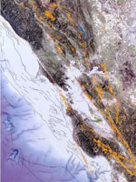
Map, Earthquakes and faults in the San Francisco Bay Area (1970-2003)
Annotation

A collection of historical and modern maps, this site features more than 150 maps showing early exploration and subsequent land use. The maps show a variety of information, including landscape changes over time, natural and man-made features, recreation and wilderness areas, geologic features, topography, wetlands, vegetation, and wildlife. A series of conservation maps focuses especially on the growth and development of national parks.

The maps have been categorized by purpose, and fit into one of seven categories: Conservation and Environment, Discovery and Exploration, Immigration and Settlement, Military Battles and Campaigns, Transportation and Communication, Cities and Towns, and General Maps.

Historical Maps Online

Image
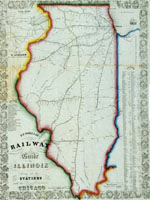
Map, D.B. Cooke & Co.'s railway guide for Illinois...
Annotation

This website offers more than 400 images of historic maps charting 400 years of development in Illinois and the northwest territory. The collection of maps can be browsed by state or geographic area or by categories such as early maps, topographic maps of Illinois, Indians of North America, waterways, and transportation. Types of maps include maps showing roads and canals, topographical maps, French and Spanish colonial maps, maps of railways, city maps, county and township maps, maps showing regions of settlement, and sectional state maps.

A zoom and pan feature allows the map images to be examined in detail and bibliographic information is provided with each map image. A keyword search is available. An excellent source of historic maps.

Map Collections: 1500-2003

Image
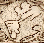
Image, Historia general..., Antonio de Herrera y Tordesillas, c. 1601-1615, LoC.
Annotation

This large collection of maps from the 16th century to the present day focuses on Americana and cartographic treasures.

Materials are organized into seven thematic categories—Cities and Towns, Conservation and Environment, Discovery and Exploration, Cultural Landscapes, Military Battles and Campaigns, Transportation and Communication, and General Maps. Sections include five special presentations.

Users may download maps or zoom in to view details. Seventeen specific map collections contained within this larger site that are of particular importance for the study of American history include "Discovery and Exploration," "The American Revolution and Its Era," "Railroad Maps, 1828–1900," "American Colonization Society Collection: Maps of Liberia, 1830–1870," "Panoramic Maps, 1847–1929," "Civil War Maps," and "Mapping the National Parks."

National Museum of Natural History

Article Body

The National Museum of Natural History, as stated on its website, "inspire[s] curiosity, discovery, and learning about nature and culture through outstanding research, collections, exhibitions, and education."

Natural history. That probably doesn't sound particularly useful to a teacher of history, which is so often centered on humanity, rather than the earth. That said, don't write the NMNH off without giving it some thought. True, many of the offerings are decidedly scientific. However, the museum includes anthropology alongside biology and geology.

Be sure to take a look at the virtual exhibits. More than 30 topics are presented, with highlights including Alaska Native Collections: Sharing Knowledge, Camping With the Sioux: Fieldwork Diary of Alice Cunningham Fletcher, Lakota Winter Counts, and Lewis and Clark: Mapping the West.

The museum also provides a variety of lesson plans, for use in the classroom and during field trips. Also, consider looking into the teacher and classroom resources under "Human Culture and Diversity." Resources range from bi-annual anthropological research publications (including teaching activities and methods) to the National Museum of Natural History's anthropological collections.

Speaking of anthropology, the department provides 24 online exhibits and three databases, including the museum collections.

Workshops provide an opportunity for educators to focus on specific topics of interest.

If you live in the DC area, consider planning a field trip. Hands-on learning opportunities are in no short supply!

U.S. Geological Survey

Article Body

The U.S. Geological Survey exists as a federal organization created to study the nation's flora, fauna, biology, geography, bodies of water, geology, and geospatial information.

The USGS provides access to their entire photographic collection, which is sub-divided into portraiture, photographers, "pioneer photographers," and images of earthquakes; mines, mills, and quarries; national parks; and Mt. St. Helens.

In addition, educators can access nine sub-sites and resources optimal for K-6 education, covering land use and exploration. Sample topics include "A Satellite View of the Journey of Lewis and Clark" and "Urban Growth in American Cities." Twelve resources, also addressing land use and exploration, are available for grades 7-12.

Available teacher packets, like the majority of the site, will primarily be of use to science educators. However, the three packets on maps could be used in conjunction with units on westward expansion or exploration.