Harvesting the River

Image
Color offset lithograph, "Whistling In," Bartlett Kassabaum, 1980
Annotation

Presents a narrative in exhibit format—with hyperlinks to archival documents and photographs—on the cultural and economic life of the people who came to the Central Illinois River region from 1875 to 1950. Organized into three sections on the harvesting of fish, waterfowl, mussels, and natural ice; transportation by boat, railroad, and plank roads; and the settlement and development of six area river towns. The site delivers oral histories (audio and video), as well as illustrations and photographs. It may serve as a useful introduction to those studying this particular region and regional history in general.

American Notes: Travels in America, 1750-1920

Image
Title graphic, American Notes: Travels in America, 1750-1920
Annotation

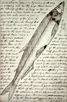
This site is a collection of 253 travel narratives written between 1750 and 1920. The narratives were written by American citizens and foreign visitors about their travels in America. Some of the accounts were written by famous Americans (James Fenimore Cooper and Washington Irving, for example), but most of the authors were not famous. The narratives include their observations and opinions about American people, places, and society; and are valuable sources for the study of early American attitudes. Most accounts are viewable either as scanned images or as transcribed texts. Also included is the 32-volume set of manuscript sources entitled Early Western Travels, 1748-1846. The collection is searchable by keyword, and may be browsed by subject, author, and title. Students and teachers will find these primary sources invaluable for research and study of the late 18th and 19th centuries.

National Park Service: Links to the Past

Image
Image, History & Culture, http://www.nps.gov/history/.
Annotation

Visitors to this site are invited to explore historical aspects of the roughly 200 National Park Service locations designated important to U.S. history and prehistory. Materials are organized by "cultural resource subjects," including archeology, architecture and engineers, cultural groups, cultural landscapes, historic buildings, mapping, maritime and military history, and "cultural resource programs," such as the American Indian Liaison Program and Heritage Preservation Services.

Visitors can search for information on more than 2.5 million Civil War soldiers and sailors; more than 71,000 properties listed in the National Register of Historic Places; and approximately 240,000 reports on federal archaeological projects in the National Archaeological Database. National Register Travel Itineraries provide historic guides to 18 cities and communities. The National Underground Railroad Network to Freedom contains information on 51 sites of importance and on slavery and antislavery efforts.

Also of interest are bibliographies on the African American west and public history, and full-text publications on the Antiquities Act of 1906 and the promotion of the city of Seattle during the gold rush era. The homepage—"History and Culture"—presents several topical, comprehensive historical exhibits including the "Eisenhower Virtual Museum."

Lewis and Clark: Maps of Exploration 1507-1814

Image
Logo, Lewis & Clark, The Maps of Exploration
Annotation

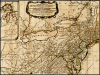
This 1995 exhibition presents approximately 70 maps designed to help "understand [Thomas] Jefferson's views of the West and the nature of the quest to the Pacific," and to "show the evolution of cartographic knowledge of North America up to the time that [Meriwether] Lewis and [William] Clark set out."

Arranged into five sections, it treats the period from the arrival of Columbus in North America to Lewis and Clark's 1803 voyage.

Well-written background essays describe relevant monographs and journals, explain the role of technology in mapmaking, and elucidate the social and intellectual contexts of Western exploration.

The site, which offers both European and American perspectives, also furnishes eight related links and a 31-title bibliography.

Particularly useful for understanding the evolution of geographic knowledge about North America and for tracing the history of cartography during this period.

Envisaging the West: Thomas Jefferson and the Roots of Lewis and Clark

Image
Image for Envisaging the West: Thomas Jefferson and the Roots of Lewis and Clark
Annotation

By the time Thomas Jefferson became the third President of the United States in 1801, interest in exploring the West had begun to shape U.S. policy. This chronological narrative traces Jefferson's life, participation in politics, and accumulation of scientific geographical knowledge from 1735 to 1804. There are four main sections: "The Jeffersons and Their Frontier Virginia Neighborhood," "From Colony to Commonwealth," "Science and Statecraft at Home and Abroad," and "Public Servant to the Early Republic."

This narrative is accompanied by an archive of 169 letters, statues, books, treaties, maps, and journals providing primary source insight into Jefferson's thoughts about the West and the Lewis and Clark expedition in particular. Three interactive maps from the 1700s, overlaid with historical data about cities, private dwellings, natural features, courthouses, and waterways, provide important insight into the geographic and social environment at the time.

Map Collections: 1500-2003

Image
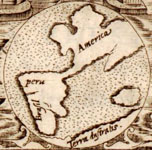
Image, Historia general..., Antonio de Herrera y Tordesillas, c. 1601-1615, LoC.
Annotation

This large collection of maps from the 16th century to the present day focuses on Americana and cartographic treasures.

Materials are organized into seven thematic categories—Cities and Towns, Conservation and Environment, Discovery and Exploration, Cultural Landscapes, Military Battles and Campaigns, Transportation and Communication, and General Maps. Sections include five special presentations.

Users may download maps or zoom in to view details. Seventeen specific map collections contained within this larger site that are of particular importance for the study of American history include "Discovery and Exploration," "The American Revolution and Its Era," "Railroad Maps, 1828–1900," "American Colonization Society Collection: Maps of Liberia, 1830–1870," "Panoramic Maps, 1847–1929," "Civil War Maps," and "Mapping the National Parks."

Hannah Arendt Papers

Image
Graphic, The Hannah Arendt Papers
Annotation

Due to copyright restrictions, only a small portion of the more than 25,000 digitized items from the Hannah Arendt papers can be viewed outside of three locations. Visitors who are not at the Library of Congress, New School University in New York City, or Carl von Ossietzky University in Oldenburg, Germany, may, however, view almost all of the collection's documents relating to the Adolph Eichmann trial and Arendt's book, Eichmann in Jerusalem. Material in this collection includes correspondence with holocaust survivors, minutes of the trial, Arendt's notes, and positive and negative reviews of the book. About one quarter of Arendt's general correspondence from 1938 to 1975, arranged alphabetically by correspondent, is available. Visitors may access eight folders of notes, lectures, fiction, and poetry from the 1920s and 1940s and all of Arendt's appointment books from 1972 to 1975. All material is in facsimile, much of it in German. Most of a collection of lecture notes, correspondence with students, and royalty statements for Arendt's books from 1949 to 1975 is available offline. Nearly half of a collection of drafts of Arendt's books, On Revolution and Between Past and Future may also be accessed from any location. Although limited, the site will be interesting for research on Arendt, modern Europe, and philosophy.

From Haven to Home: 350 Years of Jewish Life in America

Image
Postcard, A Happy New Year, 1910-1920, Hebrew Publishing Company, LoC
Annotation

An exhibition on Jewish life in America emphasizing the themes of accommodation, assertion, adaptation, and acculturation. The website features more than 200 illustrations, portraits, and images of books and documents from Library of Congress collections. The website offers an explanatory overview of the exhibition and four brief electronic exhibits focused that help to tell a part of the Jewish story in America from 1654 to the present. Some of the items highlighted by the exhibition include the first book printed in the English settlements of America, The Bay Psalm Book printed in 1640, the first published American Jewish sermon, and a hand-drawn plaque from c. 1942 with dual Hebrew prayers for Winston Churchill and Franklin Roosevelt. A small bibliography lists 10 books plus six books for children. The site provides an introduction to the Library of Congress collections and is useful for teaching about the history of Jewish life in America.

Jews in America: Our Story

Image
Image, Announcement for a Purim Ball..., New York, 1881, Jews in America
Annotation

The history of Jews in America from the 17th century to the present is explored in this website through essays, images, video presentations, and interactive timelines. Eight sections focus on particular time periods: 1654–1776; 1777–1829; 1830–1880; 1881–1919; 1920–1939; 1940–1948; 1949–1967; and 1968–present. Each section has short topical essays discussing the world events, politics, and daily life of the period, video and audio presentations, an image gallery, and books for further reading.

A number of sections also have "featured artifacts" that examine a particular cultural artifact, such as a Colonial-era book of prayers or a Civil War photo album, in greater detail. Each thumbnail is accompanied by a description and a full-sized image. The 590 images in the collection can also be viewed in a separate gallery.

Jewish American History on the Web

Image
Portrait, Israel Baer Kursheedt
Annotation

This privately maintained site offers a wide range of material on 19th-century Jewish history, including articles, documents, and religious essays. It makes available the text of The Occident and American Jewish Advocate from 1843 to 1850. The articles are searchable and visitors can browse the article indexes for each year. "Library" contains more than 60 essays and documents on Jews and Judaism, including an 1863 Catechism for Jewish Children. Additionally, the site offers the complete text of the 1845 Descriptive Geography and Brief Historical Sketch of Palestine; more than 50 articles on Jews in the Civil War, including some first-hand accounts of events and extracts from personal diaries; and several articles on Jews in the Old West. There are more than 450 links to other sites on Jewish history, Jews, and Judaism. A site of interest to those studying the history of Judaism and the Jewish people in 19th-century America.