Early American Imprints, Series I: Evans, 1639-1800
Image
Annotation

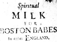
This subscription-only website presents an extensive archive of U.S. history documents, offering more than 36,000 items and 2.3 million pages on all aspects of 17th- and 18th-century American life. It is comprised of a range of publications helpful for researching social, cultural, intellectual, and religious history, as well as political and military history, including advertisements, almanacs, bibles, charters and by-laws, cookbooks, maps, narratives, novels, plays, poems, sermons, songs, textbooks, and travelogues. It is especially useful for the history of printing, as it contains an exhaustive list of printers, booksellers, and publishers active in this time period as well as images and the full-text of most of the books, pamphlets, and broadsides they helped create.

Users can browse the imprints by category: Genre, Subjects, Author, History of Printing, Place of Publication, and Language. Simple and advanced searches are available, enabling easy access into this large collection of documents. For those with access, this site provides an extensive resource for researching all aspects of 17th- and 18th-century North America.
Spain, The United States, and The American Frontier: Historias Paralelas

Image
Annotation

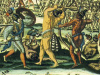
This collection of primary and secondary sources explores the history of Spanish expansion into North America from Florida, Georgia, and the Carolinas; across the modern-day American West; and north to Alaska. There are more than 200 primary sources, including numerous texts, 118 maps, manuscripts, and first-hand accounts, all written between 1492 and 1898. Some of the highlights include La Florida del Inca, an account of the Hernando de Soto expedition through Florida and the southeastern part of North America, along with the Notes of a Military Reconnaissance from Fort Leavenworth to San Diego, published in 1848 as a special report to the United States Congress. All documents are available in English and many of the documents are available in Spanish, as well. The collection is searchable by keyword and title and can be browsed. These documents are valuable for understanding Spanish-North American interaction.

National Postal Museum

Image
Annotation

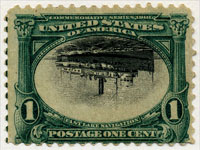
Divided into six galleries, this website features 21 online exhibits. The first gallery, Binding the Nation, includes six exhibits such as "The Post and the Press" and "Moving West" which explains how the postal service contracted with stagecoach lines to transport mail across the frontier. The second gallery, Customers and Communities, uses a series of exhibits to examine the development of mail delivery to the growing urban and rural populations in the 20th century. For example, through a virtual tour of the "Mail by Rail," visitors learn about the revolutionary Railway Mail Service. Moving the Mail is the third gallery, with three exhibits, and Art of Cards and Letters, the fourth gallery, spotlights the important role mail has held as a medium for personal communications, including "Undercover: The Evolution of the American Envelope." The fifth gallery, Artistic License comprises six exhibits; and the last, the Philatelic Gallery, includes exhibits entitled "Rarities Vault" and "Inverts." This gallery also features changing exhibits featuring special objects from both the Museum and private collections, including an online version of "Mail to the Chief," a collection of original drawings by Franklin Roosevelt of the many stamps he designed.

There are also two research guides online for the Benjamin B. Lipsner Airmail Collection and for the 1847 Federal Postage Stamp Correspondence. An Activity Zone offers materials for young students and free downloadable curriculum guides (grades K through college level) are available for teachers. The 24 online articles from EnRoute, the National Postal Museum's membership magazine, complete this rich site.

University of Missouri-Columbia: Digital Library Collections

Image
Annotation

This archive makes available varied material on English, American, and Missouri history, including speeches, pamphlets, plat books, and government documents. The collection of Daniel Webster speeches offers more than 100 items that, in addition to his addresses and speeches in Congress, include sermons, addresses, orations, and speeches in his honor, as well as some correspondence. The Fourth of July orations collection contains more than 100 items, including orations by John Quincy Adams, Charles F. Adams, and Daniel Webster. The site also offers a collection of more than 110 Missouri county plat books published in 1930, a collection of various items of Missouriana, and a group of four miscellaneous texts that includes an 80-page text on the liberty of the press published in London in 1812. The collection of 17th- to 19th-century British religious, political, and legal tracts contains more than 400 documents and pamphlets published primarily during the English Civil War. Each collection can be individually searched. For anyone researching 17th- and 18th-century transatlantic history, the political history of New England, or the history of Missouri, this is a collection worth consulting.

The Pilgrims in American Culture: Thanksgiving

Image
Annotation

Documenting the colonial experience of settlers in Plimoth, MA, this site contains several brief articles on Puritanism, traditional thanking for harvest, the Wampanoag, the formation of Thanksgiving as a national holiday, Thanksgiving menu regionalism and commonality, and primary source quotations. A major focus of the site is New England Thanksgiving. A somewhat longer article focuses on the menu of the original Thanksgiving. Explore the online activity about What really happened at the First Thanksgiving? that invites you to be the historian and explore multiple perspectives.

A virtual tour of the Plimoth Plantation, which requires a free browser plug-in, allows visitors to observe the grounds as well as historical re-enactors and interpreters. Although the site has relatively few primary sources, the exhibit is useful as an introduction to New England studies.

Physical Sciences Collection: Surveying and Geodesy

Image
Annotation

Provides historical information and photographs pertaining to more than 300 surveying instruments used in America to delimit land and transport boundaries "since the first European colonists settled here some 400 years ago and turned the American landscape into property." Visitors may browse by 23 types of instruments—from alidades to zenith telescopes—and by 117 names of instrument makers. Informative texts on makers, types of instruments, and specific instruments run from one sentence to 300 words in length. Entries include bibliographic references. Of value for those studying the history of science and technology.

The Hartford Black History Project

Image
Annotation

Provides two exhibits on black history in Hartford, CT. "A Struggle from the Start" charts stages in the life of the Hartford African-American community from 1638 to 1920. Structured in five chronological sections, each with three-to-four thematic subsections, a text of 21,000 words is punctuated with approximately 60 images of documents, photographs, illustrations, newspaper clippings, tables, paintings, and maps. This exhibit covers slavery, black codes, free blacks, Black governors in the early Republic period, black soldiers, the black bourgeoisie, the formation of the black community, black labor, black society, black churches, the "Talented Tenth" in Hartford, black painters Charles Ethan Porter and Holdridge Primus, black migration from the South, mass politics, and black community institutions. A second exhibit presents approximately 80 photographs from Hartford's African-American community covering the years 1870 to the 1970s. Valuable for those interested in studying African-American history from a community perspective.

Thomas Jefferson Papers

Image
Annotation

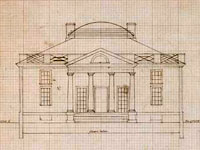
This focused site presents page images and some transcriptions of Jefferson's catalogs of books (1783 and 1789), farm book, garden book, draft of the Declaration of Independence, and some architectural documents. Visitors can browse the page images and search (where transcriptions are available) all the works. Summary descriptions are also available for each document or document type. The catalogs are Jefferson's working lists of books in his personal library. The manuscript copy of Jefferson's draft of the Declaration of Independence is not complete. The Farm Book contains Jefferson's records about his farm holdings and activities on his farms, spanning from 1774 to 1824. The Garden Book contains Jefferson's records about his gardens at Monticello and Shadwell spanning from 1766 to 1824. The architectural documents section offers more than 600 architectural drawings, sketches, and notes relating to buildings designed by Jefferson, such as Monticello and the Virginia Capitol, organized into 26 subjects.

Visitors can choose to view documents in the primary window as transcriptions (if available), as a large image, or as a small image. The search feature allows keyword search of available transcriptions. Though limited in scope, this site is useful for those interested in specific Jefferson documents.

The Luso-Hispanic World in Maps

Image
Annotation

Provides approximately 50 maps and paragraph-long descriptions of more than 1,000 maps in the Library of Congress' collections pertaining to exploration, colonization, and military efforts and concerns by Spain and Portugal from the mid-16th century to 1900. Includes approximately 10 maps of Mexico and southwest U.S. made during the U.S.-Mexican War of 1846-1848; and five pertaining to Spanish claims in North America. An 8,700-word informative guide provides historical background. While the site will be useful to those planning to visit the Library's extensive map collection, online visitors may be frustrated by the lack of search capabilities. Maps included in the site are not indexed, and users can access them only by paging through the entire catalog.

The Yale Map Collection: Online Maps

Image
Annotation

A selection of approximately 200 historical maps covering all parts of the world and ranging in time from the early 16th to the late 19th centuries. Provides more than 50 maps of the Americas, with 16 of American cities. Includes a 1641 map showing the layout of the New Haven community and a 1770 "New Map of the Cherokee Nation." Links to five previous exhibitions with 60 maps and explanatory texts of between 1,600 and 2,800 words each on road maps, three-dimensional maps, and fanciful maps. The site also includes listings for 19 reference sources and links to 48 other sites for maps and cartographic studies. A modest, but useful collection for those studying the history of cartography and exploration, and those needing cartographic aids for other historical subjects.