Picturing America kschrum Thu, 03/13/2008 - 10:28
Image
Annotation

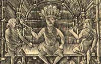
Twenty-seven iconic images in American history are presented here, designed specifically to encourage educators to use images as primary source documents in the classroom. The images range in time from 17th-century depictions of the Catholic mission in San Antonio to the contemporary art of Washington, DC native Martin Puryear.

Also included are the Lansdowne portrait of George Washington, "Washington Crossing the Delaware," and Hiram Powers's statue of Benjamin Franklin, as well as works by artists such as Grant Wood, George Catlin, Winslow Homer, John Singer Sargent, Mary Cassatt, and Edward Hopper, and by photographers Walker Evans and Dorothea Lange. All images are accompanied by a brief annotation providing historical context, a biography of the artist, and a list of online resources offering further contextual information, lesson plans, and classroom activities. Images enlarge to fullscreen and are searchable by artist and by theme: Leadership, Freedom & Equality, Democracy, Courage, Landscapes, and Creativity & Ingenuity.

Using Maps as Primary Sources

Image
Article Body

This website shows a 4th-grade teacher in northern Virginia teaching a lesson focused on a map drawn by John Smith that was published in 1612. Source Analysis, a feature created for the Loudoun County (Virginia) (TAH) website, has three sections focused on this primary source: scholar analysis, teacher analysis, and classroom practice. The latter two sections show a standards-based lesson that asks students to answer the question: What is important to John Smith? The teacher carefully plans activities so students look closely at the map and consider how this primary source helps them answer the central question. The site provides examples of two promising practices:

  • Engaging young students in close, careful observation and reading of a primary source document (using student pairs and a comparative document); and
  • Using students' observations to inform and guide analysis and connect the source to larger questions and topics in the curriculum.
The Lesson in Action

In the Classroom Practice section, we see the lesson in action. The teacher introduces the lesson question and then takes time to ensure that students understand the question by introducing synonyms for "important" and reviewing word meanings. She passes out the maps to assigned student pairs and asks them, "What do you see?" Students have time to look carefully at the map and notice words (e.g., "Jamestown" and "Powhatan"), the Chesapeake Bay and its tributaries, living structures, trees, how particular words vary in size and spacing, and so on. The teacher further facilitates the students' observation by juxtaposing the 1612 map with a contemporary textbook map of the same region. This juxtaposition helps students see the choices John Smith made in drawing this map that they might have missed without the comparative source. The teacher then uses what students notice about these maps to help them think about what the details and differences mean. Students start to identify what was important to John Smith and subsequently to the Virginia Company, given the evidence in front of them. Throughout this instruction, the teacher uses feedback, a logical sequencing of activities, and clear and accessible questions to ensure access to the learning activities for all of her students.

Thinking Like Historians

This teacher shows how carefully structured lessons that use primary sources can engage students in the process of thinking like historians. Students slow down and carefully read and look at the map, noticing things that they might otherwise have missed. They then consider what the contents of the map mean and what the map tells us about John Smith and the Virginia Company's worldview. The 1612 map becomes a window into the past that only reveals its slice of the landscape with close reading. Also on this site is a Teacher Analysis section in which the teacher explains some of what preceded this lesson and her instructional choices—a useful complement to the classroom videos. Each of these sections presents information in a set of videos that are clearly titled and visually interesting.

American Shores: Maps of the Middle Atlantic Region to 1850

Image
Annotation

This attractive site explores the mid-Atlantic region and history with maps created before 1850. An extensive collection offers more than 1,852 historical maps of many different types. In addition to numerous regional and state maps, these include land surveys, coast surveys, nautical charts, military maps, ornamental maps, and city maps.

An overview provides historical context for reading the maps of the geographic regions. In addition, the site offers several special features. "Basics of Maps" explains such cartographic terms and features as orientation, scale, and the cartouche. "Maps Through History" highlights particular maps and map genres from the collection, including a look at New York Harbor, the Hudson River, nautical charts, maps revealing early transportation routes, and maps of American Revolution battle sites. "Geographical Areas" highlights many kinds of maps and what information they offer. Visitors can click on thumbnail images to view enlarged maps and pan and zoom the maps.

Plymouth Colony Archive Project

Image
Annotation

A wealth of documents and analytical essays emphasize the social history of Plymouth Colony from 1620 to 1691. This website also offers a tribute to the scholarly work of the late James Deetz, professor of historical archaeology. Documents include 135 probates, 24 wills, and 14 texts containing laws and court cases on land division, master-servant relations, sexual misconduct, and disputes involving Native Americans.

The site also provides more than 90 biographical studies, research papers, and topical articles that analyze "life ways" of 395 individuals who lived in the colony and offer theoretical views on the colony's legal structure, gender roles, vernacular house forms, and domestic violence. There are 25 maps or plans, approximately 50 photographs, and excerpts from Deetz's books on the history and myths of Plymouth Colony and on Anglo-American gravestone styles.

Raid on Deerfield: The Many Stories of 1704

Image
Annotation

This website documents the 1704 raid on Deerfield, MA, by 300 French and their Native American allies. Visitors are introduced to the raid by a multimedia exhibit that describes white settlement patterns that led to profound cross-cultural tensions.

Explanations includes 15 short essays that provide historical background. "Voices and Songs" provides audio commentary for the 300th anniversary of the raid, three audio versions of Native American creation stories, and 17th- and 18th-century music. Meet the Five Cultures includes brief introductions to the English, French, Mohawk, Huron, and Wobanaki.

Twenty-eight individual biographies include Native Americans, French, and English settlers. Fourteen maps depict Native American territories and the areas involved. After viewing the evidence, visitors are asked to decide whether the raid was part of a larger pattern of cross-cultural violence or an aberration.

Religion and the Founding of the American Republic

Image
Annotation

This exhibition of 212 written documents and visual images explores the significance of religion in early American history and its relationship with the establishment of republican institutions. Materials include manuscripts, letters, books, prints, paintings, sermons, pamphlets, artifacts, and music.

There are seven sections, each with a 500-word essay and item annotations. Topics include religious persecution in Europe that led to emigration, including woodcuts depicting religious violence; religious experience in 18th-century America, including the Great Awakening; the influence of religious leaders and ideas on the War of Independence; and evangelical movements of the early 19th century. Additional topics include policies toward religion of the Continental Confederation Congress, state governments, and the new federal government, including sermons and appeals arguing for and against tax-supported religion.

Virtual Jamestown

Image
Annotation

This is a good place to begin exploring the history of Jamestown. The site includes over 60 letters and firsthand accounts from 1570 to 1720 on voyages, settlements, Bacon's Rebellion, and early history. More than 100 public records, such as census data and laws; 55 maps and images; and a registry of servants sent to plantations from 1654 to 1686 complete the site.

Virtual Jamestown also includes records from 1607 to 1815 of Christ's Hospital in England, where orphans were trained to apprentice in the colonies. There are four interactive virtual recreations. The reference section includes a timeline from 1502 to the present, narratives by prominent historians, links to 20 related sites, a bibliography of primary and secondary sources. The Complete Works of John Smith and John Smith's Map of Virginia have recently been added to the site, while 3D recreations of Jamestown's Statehouse and Meetinghouse as well as an archive of Virginia's first Africans are being added.

Atlantic Slave Trade and Slave Life in the Americas: A Visual Record

Image
Annotation

This collection of more than 1,230 images depicts the enslavement of Africans, the Atlantic Slave Trade, and slave life in the New World. Images are arranged in 18 categories, including pre-Colonial Africa, capture of slaves, maps, slave ships, plantation scenes, physical punishment, music, free people of color, family life, religion, marketing, and emancipation.

Many of the images are from 17th- and 18th-century books and travel accounts, but some are taken from sketches within slave narratives, Harper's Weekly, and Monthly Magazine. Reference information and brief comments, often an excerpt from original captions, accompany each image. Although there is no interpretation or discussion of historical relevance, these images are valuable for learning about representations of slavery in American slave societies, especially in the Caribbean and Latin America.