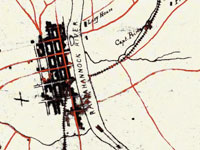
Worthington Memory, Online Scrapbook
Image
Annotation

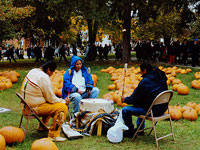
Currently provides more than 122 images of objects, documents, and photographs pertaining to the history of the town of Worthington, OH, founded in 1803 by a group of families migrating from western Connecticut and Massachusetts. The site creators plan to add more materials in the future, including digitized versions of 19th- and 20th-century newspapers and oral histories. Users may search by subject, title, or keyword in bibliographic records—which include abstracts of up to 100 words for each item—or browse the collection by decade or 27 categories covering aspects of the social, economic, cultural, civic, and environmental history of the town. Includes links to 22 related sites. Useful for those studying local history.
Kiowa Drawings

Image
Annotation

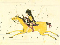
Presents more than 600 drawings by Kiowa Indians—a tribe originally from the Southern Plains—from the 19th and 20th centuries. While many are on traditional buffalo hide, more recent drawings are on paper. These drawings illustrate "tribal social and artistic traditions" as well as the history of contact and conflict. The first of five sections includes 45 drawings created by Kiowa, Cheyenne, and Arapahoe warriors imprisoned in the 1870s. The largest section offers more than 400 images commissioned by anthropologist James Mooney in the late 19th century as illustrations for his field notes. Additional sections include the Silver Horn pictorial calendar, composed of images used to track time and illustrate stories, and Silver Horn Target Record Book, with images of "warfare, courting, personal dress, the Sun Dance, and stories of the mythical trickster figure, Saynday." The final section offers material by the "Kiowa Five," artists who studied at the University of Oklahoma in the late 1920s and helped establish contemporary Indian painting. Useful for those studying American Indian history, culture, life, and art.

Physical Sciences Collection: Surveying and Geodesy

Image
Annotation

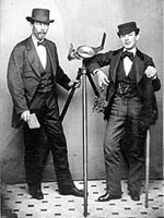
Provides historical information and photographs pertaining to more than 300 surveying instruments used in America to delimit land and transport boundaries "since the first European colonists settled here some 400 years ago and turned the American landscape into property." Visitors may browse by 23 types of instruments—from alidades to zenith telescopes—and by 117 names of instrument makers. Informative texts on makers, types of instruments, and specific instruments run from one sentence to 300 words in length. Entries include bibliographic references. Of value for those studying the history of science and technology.

WPA Life Histories, Virginia Interviews

Image
Annotation

Provides approximately 1,350 life histories and youth studies created by the Virginia Writers' Project (VWP)—part of the Works Progress Administration's Federal Writers' Project—between October 1938 and May 1941. In addition, the site offers more than 50 interviews with ex-slaves conducted by the VWP's all-black Virginia Negro Studies unit in 1936 and 1937 and six VWP folklore studies produced between 1937 and 1942. The life histories—ranging between two and 16 pages in length—offer information on rural and urban occupational groups and experiences of individuals during the Depression, in addition to remembrances of late 19th-century and early 20th-century life. The youth studies investigate experiences of young people between the ages of 16 and 24 who left school and include a survey of urban black youth. The ex-slave narratives, selected from more than 300 that were conducted for the project—of which only one-half have survived—provided research for the 1940 WPA publication The Negro in Virginia.

Interviews and studies were edited—sometimes extensively—at the Richmond home office. Each study includes a bibliographic record with notes searchable by keyword; for many records, notes are structured to include searchable data on age, gender, race, nationality, industrial classification, and occupation. The site includes a 2,300-word overview of the project. Valuable for those studying social, economic, and cultural life in Virginia during the Depression, in addition to early periods, youth culture, and the history of slavery.

The Hartford Black History Project

Image
Annotation

Provides two exhibits on black history in Hartford, CT. "A Struggle from the Start" charts stages in the life of the Hartford African-American community from 1638 to 1920. Structured in five chronological sections, each with three-to-four thematic subsections, a text of 21,000 words is punctuated with approximately 60 images of documents, photographs, illustrations, newspaper clippings, tables, paintings, and maps. This exhibit covers slavery, black codes, free blacks, Black governors in the early Republic period, black soldiers, the black bourgeoisie, the formation of the black community, black labor, black society, black churches, the "Talented Tenth" in Hartford, black painters Charles Ethan Porter and Holdridge Primus, black migration from the South, mass politics, and black community institutions. A second exhibit presents approximately 80 photographs from Hartford's African-American community covering the years 1870 to the 1970s. Valuable for those interested in studying African-American history from a community perspective.

Lift Every Voice: Music in American Life

Image
Annotation

An exhibit of music and documents that "commemorates and celebrates a variety of songs that were a part of everyday American life through the centuries." Includes 18 audio excerpts lasting approximately one minute each of representative ballads, hymns and spirituals, patriotic odes, minstrel tunes, songs from musicals, protest songs, and songs about the state of Virginia. Clips include performances by Woody Guthrie, Paul Robeson, Lead Belly, Kate and Anna McGarrigle, Bob Dylan, and the Beatles. Accompanied by a 10,500-word essay arranged by types of music and interspersed with more than 100 historical documents, including manuscripts, illustrations, photographs, hymn books, songsters, portraits, posters, sheet music covers, album covers, and record labels. A "Virginiana" section provides material from Thomas Jefferson's library to illustrate his interest in music. The site is a good introduction for those interested in understanding historical roles, functions, and uses of music by various American groups.

The Luso-Hispanic World in Maps

Image
Annotation

Provides approximately 50 maps and paragraph-long descriptions of more than 1,000 maps in the Library of Congress' collections pertaining to exploration, colonization, and military efforts and concerns by Spain and Portugal from the mid-16th century to 1900. Includes approximately 10 maps of Mexico and southwest U.S. made during the U.S.-Mexican War of 1846-1848; and five pertaining to Spanish claims in North America. An 8,700-word informative guide provides historical background. While the site will be useful to those planning to visit the Library's extensive map collection, online visitors may be frustrated by the lack of search capabilities. Maps included in the site are not indexed, and users can access them only by paging through the entire catalog.

The Yale Map Collection: Online Maps

Image
Annotation

A selection of approximately 200 historical maps covering all parts of the world and ranging in time from the early 16th to the late 19th centuries. Provides more than 50 maps of the Americas, with 16 of American cities. Includes a 1641 map showing the layout of the New Haven community and a 1770 "New Map of the Cherokee Nation." Links to five previous exhibitions with 60 maps and explanatory texts of between 1,600 and 2,800 words each on road maps, three-dimensional maps, and fanciful maps. The site also includes listings for 19 reference sources and links to 48 other sites for maps and cartographic studies. A modest, but useful collection for those studying the history of cartography and exploration, and those needing cartographic aids for other historical subjects.

History Through Deaf Eyes

Image
Annotation

An exhibit of 60 images, mostly photographs, and a 2,500-word essay that presents a social history of deaf community life in the U.S. from the early 19th century to the present. Covers education, the development of American Sign Language, the "silent press," deaf people in the workplace, media portrayals, deaf clubs, activism, and technological developments. Also includes material on a few historical figures such as the Reverend Thomas Hopkins Gallaudet and Alexander Graham Bell. Hosted by the National Deaf Life Museum, the website also has links to educational resources and the Through Deaf Eyes documentary film produced by Florentine Films/Hott Productions and WETA, Washington, DC, in association with Gallaudet University. A solid introduction to the history of deaf people in America.

Historical Map and Chart Collection

Image
Annotation

Provides more than 1,000 historical maps and nautical charts—mostly from the 19th century—produced or acquired by the Office of Coast Survey. Includes a Civil War collection of approximately 500 maps; a 90-sheet 1888 topological survey of the Washington, D.C. area; a 48-sheet topological survey of Cincinnati made in 1912; and 16 facsimiles of explorer George Vancouver's charts of the Pacific Northwest made between 1791 and 1798. Additional resources include 27 maps of the Erie Barge Canal made between 1917 and 1923; a 43-sheet survey of the Mississippi River made between 1868 and 1880; and approximately 50 sketches of landscape areas along both coasts. Maps can be viewed at 100 dpi or downloaded at 300 dpi. Organized by region and type of map. Valuable for those studying the Civil War, Washington, D.C., history, and various water-related government projects of the 19th century.