The Luso-Hispanic World in Maps

Image
Annotation

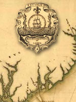
Provides approximately 50 maps and paragraph-long descriptions of more than 1,000 maps in the Library of Congress' collections pertaining to exploration, colonization, and military efforts and concerns by Spain and Portugal from the mid-16th century to 1900. Includes approximately 10 maps of Mexico and southwest U.S. made during the U.S.-Mexican War of 1846-1848; and five pertaining to Spanish claims in North America. An 8,700-word informative guide provides historical background. While the site will be useful to those planning to visit the Library's extensive map collection, online visitors may be frustrated by the lack of search capabilities. Maps included in the site are not indexed, and users can access them only by paging through the entire catalog.

The Yale Map Collection: Online Maps

Image
Annotation

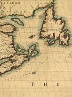
A selection of approximately 200 historical maps covering all parts of the world and ranging in time from the early 16th to the late 19th centuries. Provides more than 50 maps of the Americas, with 16 of American cities. Includes a 1641 map showing the layout of the New Haven community and a 1770 "New Map of the Cherokee Nation." Links to five previous exhibitions with 60 maps and explanatory texts of between 1,600 and 2,800 words each on road maps, three-dimensional maps, and fanciful maps. The site also includes listings for 19 reference sources and links to 48 other sites for maps and cartographic studies. A modest, but useful collection for those studying the history of cartography and exploration, and those needing cartographic aids for other historical subjects.

Woody Guthrie and the Archive of American Folk Song: 1940-1950

Image
Annotation

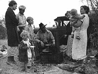
A selection of 53 items of correspondence between folksinger and songwriter Woody Guthrie (1912-1967) and members of the staff of the Library of Congress' Archive of American Folk Song. Consists mostly of letters from the early 1940s between Guthrie and Alan Lomax, at that time in charge of the Archive and who, like Guthrie, was an important force in the movement to document, record, and publicize vernacular American music. Includes scanned images of documents and transcriptions, allowing keyword searching. Also offers a 2,400-word biographical essay; a timeline of Guthrie's life; 14 photographs; a finding aid for the complete Woody Guthrie Manuscript Collection; a 21-title bibliography; and a 15-title discography. Valuable for those studying the histories of American music, radio broadcasting, and government efforts during the Roosevelt era to document American culture.

History Through Deaf Eyes

Image
Annotation

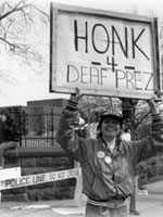
An exhibit of 60 images, mostly photographs, and a 2,500-word essay that presents a social history of deaf community life in the U.S. from the early 19th century to the present. Covers education, the development of American Sign Language, the "silent press," deaf people in the workplace, media portrayals, deaf clubs, activism, and technological developments. Also includes material on a few historical figures such as the Reverend Thomas Hopkins Gallaudet and Alexander Graham Bell. Hosted by the National Deaf Life Museum, the website also has links to educational resources and the Through Deaf Eyes documentary film produced by Florentine Films/Hott Productions and WETA, Washington, DC, in association with Gallaudet University. A solid introduction to the history of deaf people in America.

Voices of the Colorado Plateau

Image
Annotation

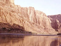
Offers more than 40 multimedia presentations featuring oral history excerpts and photographs that document aspects of life in the Colorado Plateau--encompassing parts of Utah, Arizona, New Mexico, and Colorado--during the past half century. Also presents audio files of 10 complete oral histories and transcripts of the interviews ranging from 2,200 to 19,000 words in length. A joint project of eight libraries and museums in the four Colorado Plateau states and Nevada, the site is organized into three sections--People, Places, and Topics--with subheadings that allow visitors to access the audio excerpts, many of which are accompanied by slide shows of photographs. The people interviewed include a Navajo language interpreter, the son of homesteaders, a schoolteacher, a pioneer in commercial river running, and an administrative officer for a town built for dam workers. Topics range from sociocultural concerns, such as growing up, education, families, food, and leisure, to work- and environment-related subjects, including ranching, timber, and tourism. Valuable for those studying the American West and the use of oral history for exhibit presentations.

Historical Map and Chart Collection

Image
Annotation

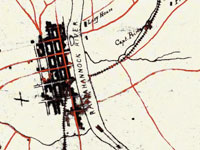
Provides more than 1,000 historical maps and nautical charts—mostly from the 19th century—produced or acquired by the Office of Coast Survey. Includes a Civil War collection of approximately 500 maps; a 90-sheet 1888 topological survey of the Washington, D.C. area; a 48-sheet topological survey of Cincinnati made in 1912; and 16 facsimiles of explorer George Vancouver's charts of the Pacific Northwest made between 1791 and 1798. Additional resources include 27 maps of the Erie Barge Canal made between 1917 and 1923; a 43-sheet survey of the Mississippi River made between 1868 and 1880; and approximately 50 sketches of landscape areas along both coasts. Maps can be viewed at 100 dpi or downloaded at 300 dpi. Organized by region and type of map. Valuable for those studying the Civil War, Washington, D.C., history, and various water-related government projects of the 19th century.

We Shall Overcome: Historic Places of the Civil Rights Movement

Image
Annotation

A "National Registry of Historic Places Travel Itinerary" covering 42 places of significance with regard to the postwar African-American civil rights movement. Churches, colleges, private homes, places of business, neighborhoods, and government offices, primarily located in the South, are each described in 300-word entries illustrated with one or two photographs. An introductory 5,000-word essay offers a narrative history of the movement with annotations to specific sites. Focuses on the 1950s and 1960s, with no attempt to cover civil rights struggles of groups other than African Americans. A few sites cover events and persons active prior to the 1950s, such as Ida B. Wells's home in Chicago and the W. E. B. Du Bois Homesite in Great Barrington, MA.

Users can access sites from a map of the U.S. or by a list organized by states. Information for visiting each site is also provided, as is a list of 39 related websites and a 34-title bibliography. The site's creators note that the places were nominated by states and thus "do not represent a systematic effort to survey, identify, and list all important civil rights sites in the National Register." A useful way to introduce students to civil rights history.

Virginia Historical Inventory (VHI)

Image
Annotation

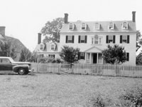
Furnishes more than 19,000 survey reports, more than 6,200 photographs, and 103 annotated county and city maps that document the history of thousands of structures built in Virginia prior to the Civil War. Original research was gathered in the late 1930s by the Virginia Writers's Project, a branch of the Works Progress Administration (WPA), and includes information compiled by field workers through onsite investigations—including interviews with residents—and by using court records and other local resources. Provides descriptions of architectural details, histories of buildings, lists of owners, and in many cases photographs and sketches. The project was "specifically charged with describing the vernacular architecture and history of everyday buildings built before 1860: homes, workplaces, churches, public buildings." Also includes materials on cemeteries, tombstones, antiques, historical events, personages, land grants, wills, deeds, diaries, and correspondence.

Provides a 5,600-word essay on the project's history. Users may search reports, maps, and photographs by keywords; includes specific instructions for genealogical research and for finding documents dealing with the Civil War and African American history. Site creators note that many of the structures documented by the project "no longer exist, and the VHI photographs may be the only extant visual records of them." A valuable resource for those studying the material culture of Virginia's past.

The Capital and the Bay, ca. 1600-1925

Image
Annotation

This site offers published books selected from the Library of Congress' general and rare book collections in an "attempt to capture in words and pictures a distinctive region as it developed between the onset of European settlement and the first quarter of the twentieth century." Contains 139 books, a few by well-known figures, such as Edwin Booth, Frederick Douglass, and Thomas Jefferson, but most by little-known residents and visitors to the region. Includes memoirs, autobiographies, biographies, books of letters, journals, poems, addresses, reports, speeches, travel books, sermons, books of photographs, and promotional brochures. In addition to Washington, D.C., the cities of Baltimore, MD, and Richmond, VA, are featured.

A special presentation entitled "Pictures of People and Places from the Collection" consists of selected illustrations organized in three sections of 10 images each on Maryland, the District of Columbia, and Virginia. The site includes 10 works dealing with slavery—a number of which were written by former slaves—and approximately 10 works dealing with encounters between whites and Native Americans. Includes links to 22 related sites. A valuable collection for those studying ways that Washington, D.C., and neighboring regions have been described in print over several centuries.

Spy Letters of the American Revolution

Image
Annotation

This site exhibits 12 facsimiles and transcriptions of spy letters from the American Revolution housed in the Sir Henry Clinton collection. Three inter-linked sections, "People," "Stories," and "Methods" provide context for each letter. A gallery of 19 men and three women, writers, readers, and subjects of the letters, includes 200-word biographical essays for each person and eight portraits. In "Stories," visitors will find 350-word descriptions of the significance of each letter. Methods of spying are described in six 150-word essays. A timeline coveres 1763 to 1783. The timeline is illustrated with 19 prints of people and places important in the revolution, and the site provides route maps for 11 of the letters.

The site's bibliography lists 25 books and one digital exhibit about the revolution and espionage. A "Teachers' Lounge" provides six assignments, 700 words on use of primary sources, 250 words on curricular themes that may be addressed using the site, and 25 study questions for students. The site is easy to navigate.