Illinois Digital Archives
Image
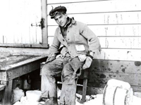
Photo, Gordon Ray on the farm, Gordon Ray, 1915, Digital Past
Annotation

This website offers an archive of more than 35,000 items from 75 individual collections at nearly 30 institutions in Illinois. Items include black-and-white and color photographs, post cards, audio recordings, maps, books, newspaper articles, newsletters and bulletins, handbills, and film clips. The focus of all the collections is the history of Illinois, its places, and people. A strength of the collections is the large number of photographs of residential and commercial buildings from cities and towns throughout Illinois.

Visitors can browse the contents of all collections by city, organization, or proper name. Once in a collection, other collections can be individually browsed by selecting from the collections dropdown menu. All collections are searchable by such fields as subject, description, creator, publisher, contributors, date, type, or format. Clicking on the thumbnail image brings up a new window with a large image and descriptive data. There are also 14 exhibits on various topics such as "History of Park Ridge, 1841-1926" and "Brides of Yesteryear." This is a useful collection of primary source material on the social and cultural history of Illinois.

Archival Research Catalog (ARC)

Image
Annotation

ARC offers more than 78,000 digital government resources. Materials include textual records, photographs, maps, architectural drawings, artifacts, sound recordings, and motion pictures dating from the colonial period to the recent past. ARC includes items on presidents, the military, war, immigration, Japanese-American internment, slavery, science, prisons, federal programs, the environment, the National Park Service, foreign affairs, civil rights, African Americans, and American Indians.

To begin a search, click on the yellow "search" button near the top left of the ARC webpage. The search engine is clearly organized and invites queries on specific historical materials or general themes. To access digitized materials only, check the box marked "Descriptions of Archival Materials linked to digital copies." The site continues to expand, though, as it stands, it provides an exceptional collection of government material.

Campaign Atlases

Image
Image for Campaign Atlases
Annotation

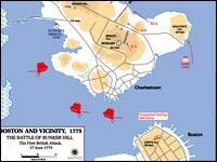
These 400 20th-century color maps of military campaigns cover a broad range of conflicts, from American colonial wars to U.S. involvement in Somalia in 1992—1993. Most of the maps represent conflicts in which the U.S. played a role, such as the "Battle of Bunker Hill" or the "Allied Landing in Normandy," although the collection also includes maps of the Napoleonic Wars, the Chinese Civil War, the Falkland Islands War, and Arab-Israeli conflicts.

Maps are indexed by war and may be enlarged, but are not annotated. The site is easy to navigate, although large maps may be slow to download. A bibliography lists eight atlases, published between 1959 and 1987, from which many of the maps were taken. The site is particularly useful for studying cartography and military history.

Indiana's Storyteller: Connecting People to the Past

Image
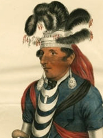
Image, Brewett, Chief of the Miami, James Otto Lewis, 1827, Indiana's. . . site
Annotation

The Indiana Historical Society's main digital archive site contains more than 34,000 images, most of which are directly related to Indiana's past, grouped into almost 30 themed collections that include photographs, prints, sheet music, manuscripts, old court documents, letters, Indiana ephemera, and maps. Also collected here are images from the Jack Smith Lincoln Graphics Collection (containing photographs, lithographs, and engravings of Abraham Lincoln) and the Daniel Weinberg Lincoln Conspirators Collection (containing newspaper clippings, manuscripts, and other material pertaining to the Lincoln assassination). A sampler of the other collections: digitized images of the Indianapolis Recorder; manuscripts and images of James Whitcomb Riley; a collection of 900 postcards of scenes from Indiana from the first two decades of the 20th century; and fascinating panoramic photographs from the early part of the 20th century, showing church groups, picnics, army recruits, and conventioneers.

Early Washington Maps: A Digital Collection

Image
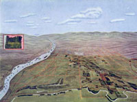
Map, "Hermiston Oregon," Umatilla Project Development League, 1910
Annotation

The nearly 1,000 maps available on this site document the conflict between Great Britain and America for ownership of the region. They also illustrate the transformation of the physical boundaries of the Pacific region and the efforts of its inhabitants to control the land. The site includes a valuable interactive timeline that presents the maps in historical perspective. The collection contains large-scale geographic maps of the land and sea and small hand-drawn sketches of settlements. The maps are very detailed and most were created in the late-19th- and early-20th-century. Maps are primarily concerned with geography, transportation, climate, population, culture, politics, and tourism and there is a searchable index that is organized according to 21 themes, such as forests, Puget Sound, railroads, Seattle, Washington State University, and Native American reservations.

A drop-down menu allows users to examine and enlarge thumbnail images of each map. Biographical and detailed descriptive text (most between 20 and 500 words) is presented with each image, and the text is searchable by keyword. Created as a resource to help students, teachers and researchers understand the history and development of the state of Washington, this site will appeal to those interested in Washington, historical geography, and the development of cartography.

Tennessee Electronic Atlas

Image
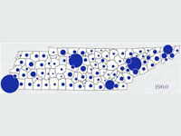
Map graphic, Tennessee Electric Atlas
Annotation

This site provides information about the state of Tennessee and offers a gateway for learning more about the state. One of the main goals is to disseminate data through thematic maps and interactive mapping (which contains tutorial exercises that introduce the basic concepts involved in geographic information systems). For those interested in utilizing the full capabilities of the site, the Metro GIS service area of the site allows users to look at the main metropolitan regions in the state and to customize the themes (such as churches, golf courses, and hospitals) to their preferences. Included are data concerning agriculture, education, physical landscape, economics, and society. The site includes information from the 2000 national census, as well as state legislative districts. There is also detailed information about education in Tennessee. Visitors can check out the school system report cards to see results of standardized tests, both in raw numbers and in comparative terms versus other districts. Although the site contains no historical maps, the site allows visitors to compare some change over time, and visitors can use the site to compare the size and shape of the 106th and 108th Congressional districts.

Colonial Williamsburg

Image
Photo, Asynchronous Fashion Photography Interactive, Colonial Williamsburg.
Annotation

Intended to promote tourism to Colonial Williamsburg, this website is also rich in educational resources. Visitors may "Experience the Life" by selecting one of 12 categories, ranging from animals to food to the African-American Experience; and will find information and resources about each topic. For example, visitors can learn about colonial clothing for men, women, and children. There is a paper doll game where players must assemble the various layers of colonial clothing in the proper order. Selecting the link "See the Places" allows users to virtually visit 27 buildings, including the prison (Public Gaol), the Capitol, and eight colonial sites, including Market Square and Duke of Gloucester Street. "Meet the People" allows visitors to learn about prominent Williamsburg natives, such as the Randolph family, Thomas Jefferson, and Patrick Henry; or meet more diverse groups, like African Americans or colonial children.

The "Teacher Resource" section allows educators to virtually tour Colonial Williamsburg or learn about the science of mapping colonial America. It also provides 18 lesson plans for exploring such topics as the colonial reaction to the Stamp Act or the murder trial of Abigail Briggs. Listen to the audio review:.

Bisbee Deportation of 1917

Image
Logo, Bisbee Deportation of 1917
Annotation

In 1917, a labor dispute between copper mining companies and workers in Bisbee, Arizona, escalated into vigilante action against suspected members of the Industrial Workers of the World (IWW). This site provides primary and secondary sources on the strike and subsequent deportation of over 1000 striking miners from Bisbee. It offers a roughly 500-word essay on the incident's historical context, and provides online access to materials such as personal narratives, witness interviews, government reports, newspaper articles, correspondence, and images selected from the University of Arizona Library, the Arizona Historical Society, and the Sharlot Hall Museum in Prescott, Arizona. There are 26 mining and deportation photographs, three maps, 19 IWW publications with color images of the covers, and six images of IWW stickers on the site, along with a bibliography of 34 scholarly works, 11 of which offer links to online, full-text versions. The site provides a partial finding aid that lists items with links to the document texts featured on the site. The site is ideal for studying labor action and labor/management relations in the early 20th century.

History Now: American History Online

Image
Logo, <em>History Now</em>
Annotation

A quarterly journal inaugurated in September 2004 designed to "promote the study of American history" with articles by historians and teaching resources. Past issues on elections, primary sources on slavery, immigration, and American national holidays are also available on the site.

Each issue has six main features. "In This Issue" provides an introduction and overview. "The Historian's Perspective" offers four to six scholarly essays by noted historians on the issue's topic. "From the Teacher's Desk" has lesson plans for high school, middle school, and elementary school levels with links to related websites. "Interactive History" provides either timelines, quizzes, or interactive maps. The "Digital Drop Box" allows site visitors to post comments, suggestions, sample lesson plans, or stories from the classroom. "Ask the Archivist" has suggested sources and a section for questions and answers.

Africans in America Anonymous (not verified) Mon, 04/14/2008 - 11:31
Image
Image for Africans in America
Annotation

Created as a companion to the PBS series of the same name, this well-produced site traces the history of Africans in America through Reconstruction in four chronological parts. The site provides 245 documents, images, and maps linked to a narrative essay.

"The Terrible Transformation" (1450–1750) deals with the beginning of the slave trade and slavery's growth. "Revolution" (1750–1805) discusses the justifications for slavery in the new nation. "Brotherly Love" (1791–1831) traces the development of the abolition movement. "Judgment Day" (1831–1865) describes debates over slavery, strengthening of sectionalism, and the Civil War. In addition to the documents, images, maps, and essay (approximately 1,500 words per section), the site presents 153 brief (150-word) descriptions by historians of specific aspects on the history of slavery, abolition, and war in America. The site provides a valuable introduction to the study of African-American history through the Civil War.