Civics Online

Image
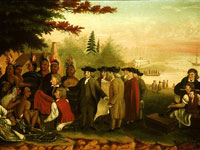
Painting, "Penn's Treaty with the Indians," Edward Hicks, c.1840-1844
Annotation

This site was designed as a resource for teachers and students of Civics, grades K-12, in Michigan public schools. The site provides access to 118 primary source documents and links to 71 related sites. Of these documents, 22 are speeches, 34 are photographs or paintings, and five are maps. The site is indexed by subject and "core democratic values" as determined by Michigan Curriculum Framework. A section for teachers includes one syllabi each for primary, middle, and high school courses. The syllabi are accompanied by interviews with the teacher who developed the assignments and by a student who participated in the curriculum, as well as by examples of student work. "Adventures in Civics" presents student visitors with a 178-word essay on Elian Gonzalez and an essay assignment for each grade level on what it means to be an American. The site links to six articles and 17 sites about Gonzalez.

Students may use a multimedia library, simultaneously searchable by era, grade-level, and core democratic value. The site also provides a timeline of American history with 163 entries (five to 500-words). The site provides a 1,000-word explanation of core democratic values and links to 41 other government and university sites about American history and civics. This site will probably be most interesting and useful for teachers looking for curriculum ideas.

Maine Memory Network jmccartney Wed, 10/07/2009 - 14:29
Image
Photo, Percival Procter Baxter, Age 10, 1886
Annotation

This site has two primary goals: to serve as a resource center for Maine history, and to assist classroom teachers as they teach American and Maine history. The site provides a search engine for its 5,700 primary sources (photographs, artwork, and documents), while the 34 online exhibits cover subjects including the 20th Maine regiment in the Civil War, Irish immigration, and Maine during the Revolutionary War.

Particularly interesting is My Album, where visitors can select, save, and arrange photographs and add text. Albums can be viewed in a slideshow or shared with other visitors through email or by storing them in a publicly accessible folder (users must register and give personal information to use this feature).

In addition to the nine lesson plans for teachers, there is a Community Gallery, where visitors can view 15 exhibits created by elementary, middle, and high school students posted for public viewing.

Columbia River Basin Ethnic History Archive

Image
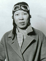
Photo, Leah Hing, ca. 1934, Pilot and WWII instrument mechanic, c. 1934, WSU
Annotation

This site offers a large archive of selected documents, reports, records, maps, photographs, newspapers, artifacts, and oral history interviews. Items are searchable by ethnic group, keyword, archive, type of material, date, or subject. Brief historical overviews and bibliographies for each ethnic group profiled are also available in the archive section. Another section has lessons plans for teachers on African Americans, immigration and settlement, migration, and ethnic culture and identity, 1850-1950. It also offers tutorials on using the archive, using history databases on the web, interpreting photographs, interpreting documents, and interpreting oral history. Historical overviews are provided on the various ethnic groups that settled the Columbia River Basin.

A discussion forum offers a place to talk about discoveries in the archive or questions. Topics currently include ethnic groups, ethnicity and race, work and labor, immigration and migration, family life, religion, social conditions, discrimination, and civil rights. A very useful site for researching or teaching the social and cultural history of the Columbia River Basin.

Journals of the Lewis and Clark Expedition Anonymous (not verified) Fri, 01/25/2008 - 22:21
Image
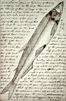
Image, Page from the journals, Journals of the Lewis and Clark Expedition
Annotation

This well-designed site presents the Nebraska edition of the Lewis and Clark journals, edited by Gary E. Moulton. The site provides the complete text of all the journals from the 1803–1806 expedition, as well as introductions, prefaces, and sources. The material is searchable by keyword and phrase.

There are 29 scholarly essays about the expedition. An image gallery offers 124 images of pages from the journals, 95 images of people and places, and 50 images of plants and animals encountered on the expedition. The maps section includes 12 explanatory maps and nine images of maps from the journals. Additionally, there are 27 audio excerpts of journal readings and eight video interviews with the editor of the project. The website stands as an outstanding resource for researching the history of the Lewis and Clark expedition.

Historic USGS Maps of New England jmccartney Wed, 10/07/2009 - 15:00
Image
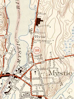
Map, "Mystic, CT-NY-RI Quadrangle," 1944
Annotation

A collection of more than 1,100 topographical maps created by the United States Geological Survey from the 1890s to the 1950s covering all of New England—Maine, New Hampshire, Vermont, Rhode Island, Massachusetts, and Connecticut—and selected areas of New York. The maps—which reveal roads, buildings, rail lines, bodies of water, and elevations—occur in 15-minute and 7.5-minute quadrangle series (a minute is one-sixtieth of a degree of latitude or longitude). In addition, the collection includes six maps with 30-minute quadrangles.

For states other than New York, users can view a state image map and select a point within a grid marked off in 15-minute increments to find listings for available images accompanied by dates the maps were surveyed, created, and revised. Towns within each quadrangle are also listed along with names of adjacent areas. Users also may search an alphabetical list of towns within each state. For New York, only an index of quadrangles names is available. Maps are presented in JPEG format. According to the site, "Each image is typically 2 megabytes, so download times are likely to be slow." A useful site for those studying changes in the New England landscape during the first half of the 20th century.

David Rumsey Map Collection Anonymous (not verified) Mon, 04/14/2008 - 11:31
Image
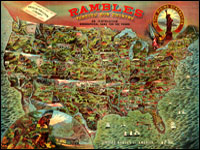
Image for David Rumsey Historical Map Collection
Annotation

This private collection presents more than 15,800 rare historical maps with a focus on North and South America. The collection is accessible via several formats. A standard browser (the "directory") is designed for use by the general public. In addition to two browsers and a "collections ticker" requiring Insight software (available for free download), a GIS browser shows detailed overlays of maps and geospatial data for the more serious researcher.

Many of the U.S. maps are from the late 19th and early 20th centuries and are often notable for their craftsmanship. Materials include atlases, globes, books, maritime charts, pocket and wall maps, and children's maps. Users can zoom in to view details. Overlay capabilities make this site valuable for its ability to convey how locations have changed over time.

Osher Map Library

Image
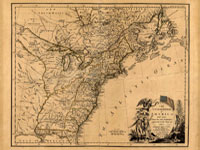
Image for Osher Map Library
Annotation

These 14 exhibitions include more than 600 maps and related documents on aspects of history revealed through the study of maps. The website provides well-integrated essays of up to 8,000 words for each exhibit and some annotated bibliographies.

Exhibits focusing on American history include "Mapping the Republic," on conflicting conceptualizations of the U.S. from 1790 to 1900; "Exodus and Exiles," on Diaspora experiences of Jews and African Americans; "The American Way," a collection of 20th-century road maps and guidebooks; "Carto-Maine-ia," on popular uses of maps; and "Maine Wilderness Transformed," that examines "the creation of a landscape of exploitation."

In addition, "The Cartographic Creation of New England," addresses European exploration and settlement, "The 'Percy Map,'" presents a significant Revolutionary War map; and "John Mitchell's Map" offers insight into diplomatic disputes. These maps are especially valuable for studying exploration and cartography in American history.

Digital Map Collection

Image
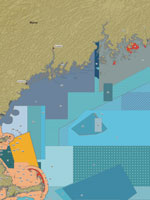
Map, Marine protected areas in the Gulf of Maine...
Annotation

This specialized site contains more than 6,000 digitized maps. Almost 700 are maps of California, most drawn in the mid-19th century. California map results can be sorted according to users' needs. More than 5,330 maps (primarily from the 19th and 20th centuries) cover other parts of the world, including Portugal, Kenya, Hong Kong, Iraq, and hundreds of other nations or territories. Non-California search results cannot be sorted. Many of the maps are archived by the University of California, Berkeley, but some are accessible by links to other sites.

The maps are extremely high quality, so loading the images may take some time, especially with slower connections. The maps include information about the date and author. The site is difficult to navigate and the search engine is finicky, but the site should be useful to those interested in high-quality maps, especially older ones. This site will be most useful for those who are looking for specific maps.

Historical Maps of the United States

Image
Map, Exploration Before 1675
Annotation

This division of the Perry-Castaneda Map Collection provides access to 500 historical maps of the U.S. Maps are sorted thematically and include three maps of early inhabitants, 11 of exploration and early settlement from 1675 to 1854, and 15 of territorial growth from 1775 to 1970. Of the 95 military history maps covering engagements from 1763 to 1967, 50 are about World War II alone.

Among 183 late 19th- and 20th-century maps, there are 146 of U.S. cities produced around 1920. Historic sites, memorials, and battlefields are represented in 191 maps of sites such as Aztec ruins in New Mexico, the Bering land bridge in Alaska, and the Vicksburg battle site in Mississippi. Most of the maps are excerpted from 20th-century historical atlases. The site will be particularly useful for research in military history and early 20th-century urban history.