Lewis and Clark: Maps of Exploration 1507-1814
Image
Logo, Lewis & Clark, The Maps of Exploration
Annotation

This 1995 exhibition presents approximately 70 maps designed to help "understand [Thomas] Jefferson's views of the West and the nature of the quest to the Pacific," and to "show the evolution of cartographic knowledge of North America up to the time that [Meriwether] Lewis and [William] Clark set out."

Arranged into five sections, it treats the period from the arrival of Columbus in North America to Lewis and Clark's 1803 voyage.

Well-written background essays describe relevant monographs and journals, explain the role of technology in mapmaking, and elucidate the social and intellectual contexts of Western exploration.

The site, which offers both European and American perspectives, also furnishes eight related links and a 31-title bibliography.

Particularly useful for understanding the evolution of geographic knowledge about North America and for tracing the history of cartography during this period.
Envisaging the West: Thomas Jefferson and the Roots of Lewis and Clark

Image
Image for Envisaging the West: Thomas Jefferson and the Roots of Lewis and Clark
Annotation

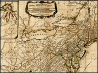
By the time Thomas Jefferson became the third President of the United States in 1801, interest in exploring the West had begun to shape U.S. policy. This chronological narrative traces Jefferson's life, participation in politics, and accumulation of scientific geographical knowledge from 1735 to 1804. There are four main sections: "The Jeffersons and Their Frontier Virginia Neighborhood," "From Colony to Commonwealth," "Science and Statecraft at Home and Abroad," and "Public Servant to the Early Republic."

This narrative is accompanied by an archive of 169 letters, statues, books, treaties, maps, and journals providing primary source insight into Jefferson's thoughts about the West and the Lewis and Clark expedition in particular. Three interactive maps from the 1700s, overlaid with historical data about cities, private dwellings, natural features, courthouses, and waterways, provide important insight into the geographic and social environment at the time.

Historic Topographic Maps of California

Image
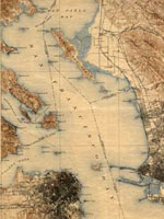
Map, San Francisco 15-minute Quadrangle, 1895
Annotation

Provides historical United States Geological Survey maps of the San Francisco Bay area, from Point Reyes in the north to Half Moon Bay, and east to San Jose. Includes maps from different time periods—the earliest is from 1895, the latest 1997—covering each 7.5-minute and 15-minute quadrangle of the area. Users may zoom in to see minute details. Searchable by quadrangle or place name. Of value for those studying change over time in the development of the Bay Area during the 20th century.

Conservation and Environmental Maps

Image
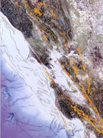
Map, Earthquakes and faults in the San Francisco Bay Area (1970-2003)
Annotation

A collection of historical and modern maps, this site features more than 150 maps showing early exploration and subsequent land use. The maps show a variety of information, including landscape changes over time, natural and man-made features, recreation and wilderness areas, geologic features, topography, wetlands, vegetation, and wildlife. A series of conservation maps focuses especially on the growth and development of national parks.

The maps have been categorized by purpose, and fit into one of seven categories: Conservation and Environment, Discovery and Exploration, Immigration and Settlement, Military Battles and Campaigns, Transportation and Communication, Cities and Towns, and General Maps.

Historical Maps Online

Image
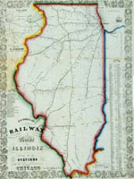
Map, D.B. Cooke & Co.'s railway guide for Illinois...
Annotation

This website offers more than 400 images of historic maps charting 400 years of development in Illinois and the northwest territory. The collection of maps can be browsed by state or geographic area or by categories such as early maps, topographic maps of Illinois, Indians of North America, waterways, and transportation. Types of maps include maps showing roads and canals, topographical maps, French and Spanish colonial maps, maps of railways, city maps, county and township maps, maps showing regions of settlement, and sectional state maps.

A zoom and pan feature allows the map images to be examined in detail and bibliographic information is provided with each map image. A keyword search is available. An excellent source of historic maps.

Map Collections: 1500-2003

Image
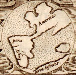
Image, Historia general..., Antonio de Herrera y Tordesillas, c. 1601-1615, LoC.
Annotation

This large collection of maps from the 16th century to the present day focuses on Americana and cartographic treasures.

Materials are organized into seven thematic categories—Cities and Towns, Conservation and Environment, Discovery and Exploration, Cultural Landscapes, Military Battles and Campaigns, Transportation and Communication, and General Maps. Sections include five special presentations.

Users may download maps or zoom in to view details. Seventeen specific map collections contained within this larger site that are of particular importance for the study of American history include "Discovery and Exploration," "The American Revolution and Its Era," "Railroad Maps, 1828–1900," "American Colonization Society Collection: Maps of Liberia, 1830–1870," "Panoramic Maps, 1847–1929," "Civil War Maps," and "Mapping the National Parks."

A Portion of the People: Three Hundred Years of Southern Jewish Life

Image
Oil on canvas, Mary Olivia Lucas Harby. . . , c. 1830, A Portion of the People
Annotation

This exhibit tells "the story of Southern Jewish settlers and their descendants from the late 1600s through the 21st century." It currently consists of two presentations, each with more than 50 pages presenting an image from the exhibit's collection with accompanying explanatory text. Images include portraits, maps, historical documents, photographs of Jewish ritual books and religious and cultural objects, paintings and photographs of synagogues, and photographs of Jewish businesses. "First Families" explores the period from the 1600s to the 1820s through more than 50 images and "This Happy Land" explores the antebellum and Civil War years through more than 90 images. (The presentation "Pledging Allegiance," recounting the story of Jewish migration to the South in the first half of the 20th century, is under construction.) Visitors can listen to six interviews featuring voices from the past (transcripts are available). Additionally, a photographic essay with more than 40 photographs, "Palmetto Jews" by Bill Aron, examines Jewish life in South Carolina over the past 50 years. There is no site search capability.

Diary of a Civil War Nurse

Image
Photo, Armory Square Nurses, National Library of Medicine
Annotation

As men flocked to join the Union and Confederate armies, so, too, many women left their homes to serve as nurses in the war effort. This website presents the story of one such woman, Amanda Akin, who at 35 years of age left New York to work at Armory Square Hospital in Washington, DC, for one year and three months. During that time, she both kept a journal and wrote letters to her sisters recording her experiences.

The website offers images of Akin's diary, photograph portraits, and choice quotes from her recollections, as well as brief explanations and sources related to Civil War nursing in general—for example, books of orders and photographs. The title is somewhat misleading in that the diary itself is not available on the website. Instead, the interactive document link takes you to a map of Washington, DC, with locations relevant to Akin's story and major events of the time. Each location provides photographs (sometimes with a comparison image of the location today), advertisements, and/or artworks; quotes from Akins and other sources; and a small amount of contextual information.

The site links to a copy of Amanda Akin Stearns's (Akin's married name) The Lady Nurse of Ward E which Akin penned in 1909 as a memoir of her time working in the hospital.

Home Sweet Home: Life in 19th-Century Ohio

Image
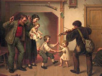
Chromolithograph, Power of Music, James Fuller Queen, c. 1872, Home. . . site
Annotation

19th-century Cincinnati, OH, an economically prosperous city and a "Gateway to the West," was a microcosm of the changes in domestic life occurring throughout the United States. This website uses music, commonly performed and appreciated in family parlors, to help users better understand these changes, as well as common social, economic, and religious values among Cincinnati's majority population of white Protestants. The 21 songs included are divided by theme: Family Life, Singing Schools, Religion, Rural Values, Temperance, Parlor Music, and Minstrel Songs. "You'll Never Miss the Water Till the Well Runs Dry" exemplifies some of the changes in family life, describing the lessons a young man learned from his mother, and then re-learned later for himself, about forging a successful life on his own.

Sheet music and an audio recording are provided for all songs, which are also accompanied by brief annotations. Two substantive, scholarly essays on "Life in 19th Century Cincinnati and "Understanding the Music," provide historical context. A bibliography and list of related Library of Congress websites provide opportunities for further exploration.

Slavery in Canada

Image
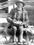
 Photo, William Henson escaped from slavery. . . , Daniel G. Hill, NYPL
Annotation

This website covers a topic that often goes overlooked—that slavery spread as far north as Canada.

Resources include portions of a slave autobiography; slave narratives; Underground Railroad stories and songs; articles from abolitionist newspapers; short timelines (1600-1699, 1700-1799, 1800-1899, and 1900-present); more than 60 biographies of slaves; 10 images, including maps, photographs, artworks, and newspaper scans; radio and documentary links; and a collection of web links relevant to the topic. The included glossary and chapter quizzes are not currently working.

However, the site could prove useful for locating primary sources which attest to the geographical breadth of slavery in North America.