e-WV: The West Virginia Encyclopedia

Image
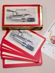
Photo, Deck of playing cards from the S.S. Avalon, Michael Keller, e-WV
Annotation

Take some time on this guide to all things West Virginia. This website offers a plethora of articles from "Abolitionism" to "John Zontini." To aid your search, you can sort through articles by topical category, alphabetical order, selecting "random article," or running a keyword search for specific interests. Your search will return media as well as text results, nicely sorted into separate categories. Articles are brief, but cross-referenced; and they also include citations and images, when available and appropriate.

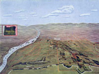
The encyclopedia also includes larger sets of information and images referred to as exhibits. Topics include steamboats, John Henry, the Kanawha County Textbook Controversy, the Hatfield-McCoy Feud, coal mining, historic preservation, the Swiss community of Helvetia, the Greenbrier resort, and labor. A similar feature offers a handful of historical West Virginia maps.

Want something more interactive? Try the thematic 10-question quizzes, forums, or interactive maps and timelines.

California as I Saw It: First-Person Narratives of California, 1849-1900

Image
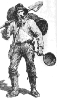
Image, Miner and Pack Burro, unidentified publication, California as I Saw It
Annotation

The 190 works presented on this site—approximately 40,000 written pages and more than 3,000 illustrations—provide eyewitness accounts covering California history from the Gold Rush through the end of the 19th century. Most authors represented are white, educated, male Americans, including reporters detailing Gold Rush incidents and visitors from the 1880s attracted to a highly-publicized romantic vision of California life.

The narratives, in the form of diaries, descriptions, guidebooks, and subsequent reminiscences, portray encounters with those living in California as well as the impact of mining, ranching, and agriculture. Additional topics include urban development, the growth of cities, and California's unique place in American culture. A special presentation recounts early California history, and a discussion of the collection's strengths and weaknesses provides useful context for the first-person accounts.

Ancient Architects of the Mississippi

Image
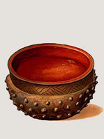
Small bowl, Mississippean, Ancient Architects of the Mississippi
Annotation

This small website uses essays and images to explain the life, art, and engineering of the Native American moundbuilders who inhabited the lower Mississippi River region from c. 8,000 BC to c. 1500 AD.

The main feature is the exhibits. Three exhibits, each centered on a short essay, focus on different aspects of the moundbuilders' life and culture. "Life Along the River" also has six captioned artist's renderings of life in the moundbuilders' cities. "The Moundbuilders" features a detailed description of Emerald Mound. And "Traders and Travelers" also has four images of the moundbuilders' art work, with explanatory text.

In addition to these three descriptive exhibits, "Delta Voices" offers 16 selected quotes about the mounds from both historical and contemporary persons. Additionally, there is a timeline and a short "context" section, with a map, that helps to locate the moundbuilders in place and history.

Search is limited to a search of all National Park Service websites. This website is a useful starting point for those interested in the history and culture of the Native American moundbuilders.

Accessible Archives

Image
Image, Godey's Lady's Book, Accessible Archives
Annotation

These eight databases present more than 176,000 articles from 18th- and 19th-century newspapers, magazines, books, and genealogical records. Much of the material comes from Pennsylvania and other mid-Atlantic states.

Godey’s Lady’s Book (1830–1880), one of the most popular 19th-century publications, furnished middle- and upper-class American women with fiction, fashion illustrations, and editorials. The Pennsylvania Gazette (1728–1800), a Philadelphia newspaper, is described as the New York Times of the 18th century. The Civil War: A Newspaper Perspective includes major articles from the Charleston Mercury, the New York Herald, and the Richmond Enquirer. African-American Newspapers: The 19th Century includes runs from six newspapers published in New York, Washington, DC, and Toronto between 1827 and 1876. American County Histories to 1900 provides 60 volumes covering the local history of New Jersey, Delaware, and Pennsylvania. The Pennsylvania Genealogical Catalogue: Chester County 1809–1870 has been partially digitized, with 25,000 records available. The Pennsylvania Newspaper Record: Delaware County 1819–1870 addresses industrialization in a rural area settled by Quaker farmers.

Curating the City: Wilshire Blvd

Image
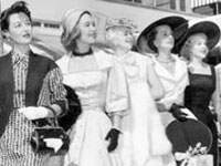
Photo, Prize-winning fashionable women at Beverly Wilshire Easter brunch, 1955
Annotation

Wilshire Boulevard runs for 16 miles in Los Angeles, from Ocean Avenue in Santa Monica to Grand Avenue in Downtown. This website offers an interactive journey down the length of this historic street, with more than 100 stops at parks, buildings, and historic landmarks in Westwood/Brentwood, Beverley Hills, Miracle Mile/Carthay Circle, Windsor Square/Hancock Park, Wilshire Center, and the Parks District.

Virtual visitors to Palisades Park in Santa Monica, for example, can see 14 photographs and drawings of the park, spanning from the early 1900s, through the 1940s, and to contemporary photographs, and read a brief description of the park's history. Those interested in the history of architecture will find useful a website feature that allows users to filter all monuments by architect, style, and function. The website also includes a "Memory Book," allowing users to contribute their stories about Wilshire Boulevard and read the stories of others, as they talk about their favorite pizza restaurant in Westwood or their childhood in Beverly Hills in the early 1960s.

Illinois Digital Archives

Image
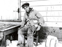
Photo, Gordon Ray on the farm, Gordon Ray, 1915, Digital Past
Annotation

This website offers an archive of more than 35,000 items from 75 individual collections at nearly 30 institutions in Illinois. Items include black-and-white and color photographs, post cards, audio recordings, maps, books, newspaper articles, newsletters and bulletins, handbills, and film clips. The focus of all the collections is the history of Illinois, its places, and people. A strength of the collections is the large number of photographs of residential and commercial buildings from cities and towns throughout Illinois.

Visitors can browse the contents of all collections by city, organization, or proper name. Once in a collection, other collections can be individually browsed by selecting from the collections dropdown menu. All collections are searchable by such fields as subject, description, creator, publisher, contributors, date, type, or format. Clicking on the thumbnail image brings up a new window with a large image and descriptive data. There are also 14 exhibits on various topics such as "History of Park Ridge, 1841-1926" and "Brides of Yesteryear." This is a useful collection of primary source material on the social and cultural history of Illinois.

Early Washington Maps: A Digital Collection jmccartney Wed, 10/07/2009 - 15:07
Image
Map, "Hermiston Oregon," Umatilla Project Development League, 1910
Annotation

The nearly 1,000 maps available on this site document the conflict between Great Britain and America for ownership of the region. They also illustrate the transformation of the physical boundaries of the Pacific region and the efforts of its inhabitants to control the land. The site includes a valuable interactive timeline that presents the maps in historical perspective. The collection contains large-scale geographic maps of the land and sea and small hand-drawn sketches of settlements. The maps are very detailed and most were created in the late-19th- and early-20th-century. Maps are primarily concerned with geography, transportation, climate, population, culture, politics, and tourism and there is a searchable index that is organized according to 21 themes, such as forests, Puget Sound, railroads, Seattle, Washington State University, and Native American reservations.

A drop-down menu allows users to examine and enlarge thumbnail images of each map. Biographical and detailed descriptive text (most between 20 and 500 words) is presented with each image, and the text is searchable by keyword. Created as a resource to help students, teachers and researchers understand the history and development of the state of Washington, this site will appeal to those interested in Washington, historical geography, and the development of cartography.

Tennessee Electronic Atlas jmccartney Wed, 10/07/2009 - 15:12
Image
Map graphic, Tennessee Electric Atlas
Annotation

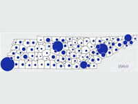
This site provides information about the state of Tennessee and offers a gateway for learning more about the state. One of the main goals is to disseminate data through thematic maps and interactive mapping (which contains tutorial exercises that introduce the basic concepts involved in geographic information systems). For those interested in utilizing the full capabilities of the site, the Metro GIS service area of the site allows users to look at the main metropolitan regions in the state and to customize the themes (such as churches, golf courses, and hospitals) to their preferences. Included are data concerning agriculture, education, physical landscape, economics, and society. The site includes information from the 2000 national census, as well as state legislative districts. There is also detailed information about education in Tennessee. Visitors can check out the school system report cards to see results of standardized tests, both in raw numbers and in comparative terms versus other districts. Although the site contains no historical maps, the site allows visitors to compare some change over time, and visitors can use the site to compare the size and shape of the 106th and 108th Congressional districts.

Colonial Williamsburg

Image
Photo, Asynchronous Fashion Photography Interactive, Colonial Williamsburg.
Annotation

Intended to promote tourism to Colonial Williamsburg, this website is also rich in educational resources. Visitors may "Experience the Life" by selecting one of 12 categories, ranging from animals to food to the African-American Experience; and will find information and resources about each topic. For example, visitors can learn about colonial clothing for men, women, and children. There is a paper doll game where players must assemble the various layers of colonial clothing in the proper order. Selecting the link "See the Places" allows users to virtually visit 27 buildings, including the prison (Public Gaol), the Capitol, and eight colonial sites, including Market Square and Duke of Gloucester Street. "Meet the People" allows visitors to learn about prominent Williamsburg natives, such as the Randolph family, Thomas Jefferson, and Patrick Henry; or meet more diverse groups, like African Americans or colonial children.

The "Teacher Resource" section allows educators to virtually tour Colonial Williamsburg or learn about the science of mapping colonial America. It also provides 18 lesson plans for exploring such topics as the colonial reaction to the Stamp Act or the murder trial of Abigail Briggs. Listen to the audio review:.

20th-century Jewish Immigration

Question

How is Jewish immigration generalized by textbooks?

Textbook Excerpt

Some textbook narratives point out large, well-known anti-Semitic groups but fail to examine in detail acts of violence against religious and cultural minorities or the acts those groups took to combat the virulent, unapologetic anti-Semitism.

Source Excerpt

A shared wellspring of religious and cultural traditions helped keep even the most contentious elements of the American Jewish community intertwined in some ways. For example, the 1910 Protocol of Peace was negotiated and signed by Jewish communal leaders and lawyers who represented both Jewish garment manufacturers and factory owners, and Jewish workers and labor activists.

Historian Excerpt

American Jewish history provides a test case for the question of how different the experiences of the “old” and “new” immigrants actually were, with a growing number of historians convinced that the period between 1820 and 1924 should more properly be seen as a continuous century of American Jewish migration that saw more structural similarities than discontinuities.

Abstract

All textbooks cover the great wave of immigration that brought approximately 25 million people to America from 1880–1924. They provide a standard account of chain migration, ethnic urban neighborhoods, the Americanization movement, and the successful campaigns for restrictive immigration legislation. Eastern European Jews are often cited as examples of the new religious groups entering the U.S., as frequent participants in the labor activism that characterized industrial development, and as significant contributors to popular American culture, especially through music and movies. Several other significant elements of the Jewish immigrant experience receive little attention, but a closer look sheds light on the complicated turn-of-the-century immigration to America.

Jewish Immigration to the United States