Lyndon B. Johnson State Park, Historic Site, and Sauer-Beckmann Farm [TX]

Description

The park's location is historically significant since it is in the heart of the former President's home country. The area has been influenced by three major cultures: Native Americans, Spanish, and German. Indians roamed the Hill Country first, leaving behind artifacts which tell of their nomadic life. The Spanish conquistadors followed, bringing a culture which was to endure to the present. German immigrants settled the Hill Country in the early 1800s and their descendants still call it home. Their culture has had a major impact on the development of the region and the park itself. All of these cultures are represented at the park. The Visitor Center contains memorabilia from President Johnson's presidency and interactive displays about the land and people that shaped a president. Attached to the Visitors Center is the Behrens Cabin, a two-room dogtrot cabin built by German immigrant H. C. Behrens during the 1870s. The furnishings are typical of such homes in that period. Visitors can further explore the history of these immigrants by viewing the 1860s Danz family log cabin located just west of the Visitor Center. Also located in the park is the Sauer-Beckmann Farm, a living history farm. Life on the farmstead is presented as it was in 1918. Park interpreters wear period clothing, do the farm and household chores as they were done at that time, and also conduct tours for the visitors.

The site offers exhibits, tours, demonstrations, and occasional recreational and educational events (including living history events).

What Happened to the Royal Family of Hawaii After the U.S. Took Over?

field_image
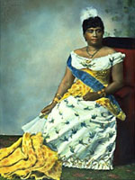
Queen Liliuokalani
Question

What happened to the royal family of Hawaii after the U.S. took over?

Answer

Hawaii's monarchy was limited by the 1887 Constitution of the Kingdom of Hawaii, which King David Kalakaua (1836–1891) signed under threat of force, and which was therefore often known as the Bayonet Constitution. It established a constitutional monarchy much like Britain's, but also transferred power through a redefinition of the electoral franchise to an elite class of American, European, and native Hawaiian landowners.

When Kalakaua died in 1891, his sister Lili'uokalani (1838–1917) succeeded him on the throne. Soon she made plans to restore the monarchy's veto power and other features of the pre-1887 Constitution. A group of American and European residents, in opposition to the Queen, organized themselves and solicited protection from U.S. Marines and sailors, which U.S. Government Minister John Stevens provided. Queen Lili'uokalani was deposed on January 14, 1893, and a provisional government was formed.

On February 1, Stevens proclaimed Hawaii a protectorate of the United States. On July 4, 1894, the Republic of Hawaii was founded and Sanford Dole became its President. A brief effort at the beginning of 1895 to restore the monarchy and Lili'uokalani to the throne was thwarted. Arrested and convicted for playing a part in the failed effort, Lili'uokalani was confined to house arrest in Iolani Palace, where she spent much of her time writing songs. She abdicated her throne eight months later, in return for the commutation of the sentence of her fellow conspirators. Later, she would write that her signature on the abdication agreement, which she signed "Lili'uokalani Domonis" (she had married Robert Domonis), invalidated it because, as a monarch, she had never acted under that name, but only "Lili'uokalani." Be that as it may, the government pensioned her off and she retired to her palatial home, where she died, at age 79.

Hawaii was a united kingdom under a single monarch only for eighty years, from 1810, when Kamehameha I (1738–1819) brought all the islands under his control, to the time when the monarchy became defunct under Lili'uokalani. During that time, the rules of succession evolved, to include not only the members of the families of Kamehameha and Kalakaua, but also adopted sons and daughters (Lili'uokalani had three) and members of a noble class recognized by Kamehameha as eligible to be rulers. Because the kingdom ended more than a century ago and because all these families have continued to proliferate, there are currently a large number of people who might be considered as heirs or pretenders to the Hawaiian throne, were it ever to be revived.
Bibliography

William Adam Russ, The Hawaiian Revolution (1893–94) (Selinsgrove, Pa.: Susquehanna University Press, 1992).

Ralph S. Kuykendall, The Hawaiian Kingdom, 1874–1893 (Honolulu: University of Hawaii Press, 1967).

Gavan Daws, Shoal of Time: A History of the Hawaiian Islands (Honolulu: University of Hawaii Press, 1974).

Norris W. Potter et al, History of the Hawaiian Kingdom (Honolulu: Bess Press, 2003).

George S. Kanahele, Emma: Hawai'i's Remarkable Queen (Honolulu: The Queen Emma Foundation, 1999) Liliuokalani, Hawaii’s Story (Rutland, Vt.: Tuttle, 1964).

Digital Archive Collections at the University of Hawai'i at Manoa Library

Image
Image, Digital Archive Collections at the University of Hawai'i at Manoa Library
Annotation

These 29 collections document the history of Hawaii and Micronesia from 1834 to the 1990s. "Annexation of Hawai'i," for example, contains thousands of pages of documents concerning the U.S. plan to annex Hawaii, realized in 1898. Materials include the 1,437-page Blount Report of 1894–95, initiated by President Grover Cleveland on the history of relations between the U.S. and Hawaii and the planned annexation; Congressional debates on the Hawaii Organic Act, passed in 1900 to establish a territorial government; and Hawaiian anti-annexation petitions and protest documents from 1897–98.

"Hawaii War Records" presents 880 photographs documenting the impact of World War II on Hawaii and its people. The "Trust Territories of the Pacific Islands" photo archive provides 52,000 photographs on programs in education, health, and political and economic development in the 2,100 islands of Micronesia administered by the U.S. from 1947 to 1994. The website also includes a collection of 16 Hawaiian-language newspapers.

Ansel Adams's Photographs of Japanese-American Internment at Manzanar

Image
Photo, Tsutomu Fuhunago, Ansel Adams
Annotation

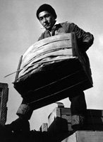
During World War II, the U.S. Government forced more than 100,000 Japanese Americans to leave their homes and businesses, relocating them to internment camps from California to Arkansas. Well-known photographer Ansel Adams documented the lives of Japanese Americans at the Manzanar War Relocation Center in California—from portraits to daily life, including agriculture and leisure.

This site presents 242 original negatives and 209 photographic prints, often displayed together to show Adams's developing and cropping techniques. His 1944 book on Manzanar, Born Free and Equal is also reproduced. Adams donated the collection to the Library of Congress in 1965, writing, "The purpose of my work was to show how these people, suffering under a great injustice . . . had overcome the sense of defeat and dispair [sic] by building for themselves a vital community in an arid (but magnificent) environment."

The Indian War of 1812

Description

Professor David Henkin examines the ongoing war between Native American nations and the United States in 1812 and prior to and following 1812. He also considers popular memory of Native American history and failure to integrate it into U.S. history as a whole.

Journals of the Lewis and Clark Expedition

Image
Image, Page from the journals, Journals of the Lewis and Clark Expedition
Annotation

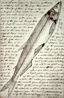
This well-designed site presents the Nebraska edition of the Lewis and Clark journals, edited by Gary E. Moulton. The site provides the complete text of all the journals from the 1803–1806 expedition, as well as introductions, prefaces, and sources. The material is searchable by keyword and phrase.

There are 29 scholarly essays about the expedition. An image gallery offers 124 images of pages from the journals, 95 images of people and places, and 50 images of plants and animals encountered on the expedition. The maps section includes 12 explanatory maps and nine images of maps from the journals. Additionally, there are 27 audio excerpts of journal readings and eight video interviews with the editor of the project. The website stands as an outstanding resource for researching the history of the Lewis and Clark expedition.

David Rumsey Map Collection

Image
Image for David Rumsey Historical Map Collection
Annotation

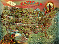
This private collection presents more than 15,800 rare historical maps with a focus on North and South America. The collection is accessible via several formats. A standard browser (the "directory") is designed for use by the general public. In addition to two browsers and a "collections ticker" requiring Insight software (available for free download), a GIS browser shows detailed overlays of maps and geospatial data for the more serious researcher.

Many of the U.S. maps are from the late 19th and early 20th centuries and are often notable for their craftsmanship. Materials include atlases, globes, books, maritime charts, pocket and wall maps, and children's maps. Users can zoom in to view details. Overlay capabilities make this site valuable for its ability to convey how locations have changed over time.

Osher Map Library

Image
Image for Osher Map Library
Annotation

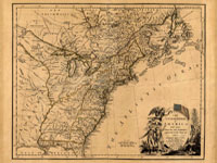
These 14 exhibitions include more than 600 maps and related documents on aspects of history revealed through the study of maps. The website provides well-integrated essays of up to 8,000 words for each exhibit and some annotated bibliographies.

Exhibits focusing on American history include "Mapping the Republic," on conflicting conceptualizations of the U.S. from 1790 to 1900; "Exodus and Exiles," on Diaspora experiences of Jews and African Americans; "The American Way," a collection of 20th-century road maps and guidebooks; "Carto-Maine-ia," on popular uses of maps; and "Maine Wilderness Transformed," that examines "the creation of a landscape of exploitation."

In addition, "The Cartographic Creation of New England," addresses European exploration and settlement, "The 'Percy Map,'" presents a significant Revolutionary War map; and "John Mitchell's Map" offers insight into diplomatic disputes. These maps are especially valuable for studying exploration and cartography in American history.

Envisaging the West: Thomas Jefferson and the Roots of Lewis and Clark

Image
Image for Envisaging the West: Thomas Jefferson and the Roots of Lewis and Clark
Annotation

By the time Thomas Jefferson became the third President of the United States in 1801, interest in exploring the West had begun to shape U.S. policy. This chronological narrative traces Jefferson's life, participation in politics, and accumulation of scientific geographical knowledge from 1735 to 1804. There are four main sections: "The Jeffersons and Their Frontier Virginia Neighborhood," "From Colony to Commonwealth," "Science and Statecraft at Home and Abroad," and "Public Servant to the Early Republic."

This narrative is accompanied by an archive of 169 letters, statues, books, treaties, maps, and journals providing primary source insight into Jefferson's thoughts about the West and the Lewis and Clark expedition in particular. Three interactive maps from the 1700s, overlaid with historical data about cities, private dwellings, natural features, courthouses, and waterways, provide important insight into the geographic and social environment at the time.