Milwaukee Neighborhoods: Photos and Maps, 1885-1992

Image
Annotation

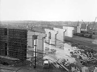
This website presents 638 images of the buildings and neighborhoods of Milwaukee that together document the development of the city of Milwaukee from the mid-1880s to the early 1990s. The collection brings together images from two rare books, the photograph collections of the American Geographical Society Library and the Archives Department at the University of Wisconsin, Milwaukee, Libraries, and two extensive photograph collections. Image subjects include residential and industrial facilities, local businesses, historic buildings, churches, and numerous Milwaukee parks.

An essay by professor Judith Kenny entitled Picturing Milwaukee makes use of images from the collection to examine the growth and development of Milwaukee and its 75 neighborhoods in the larger context of economic and social change. Topics addressed include early commercial development, industrialization, suburban development, and the post-World War II city. Additionally, there are 12 maps of Milwaukee that can be browsed separately. Each is accompanied by a descriptive record and a link to a larger image.

The collection can be searched by neighborhood, subject terms, or place/businesses. In addition to those interested in the history of Milwaukee, this site will be of interest to those studying urban development or historical architecture.

The New Georgia Encyclopedia

Image
Annotation

A web-based reference work, this site provides authoritative and accurate information on people, places, institutions, and events for many aspects of Georgia's life, history, and culture. The encyclopedia offers close to 2,000 articles and 8,000 multimedia files on a range of categories, including art, business, education, politics, history, religion, and sports with specific articles on topics such as architecture: building types (houses, public schools, roadside, and vernacular), military bases, folklife projects, and gymnastics at the University of Georgia.

Within the essays, there are links to related essays and external websites. There are also video and audio clips as well as images and some maps. New material is added regularly and the site also offers basic stats on the state, features and destinations, and galleries.

The United States and Brazil: Expanding Frontiers, Comparing Cultures

Image
Annotation

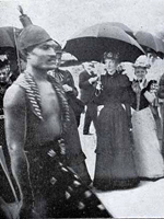
Designed to explore the historical similarities and contrasts, ethnic diversity, and interactions between Brazil and the United States, this site contains almost 1,000 images from the rare book, manuscript, map, print, and photographic collections of the Library of Congress and the National Library of Brazil.

The site includes letters (including letters from Thomas Jefferson concerning the independence of Brazil), illustrations, 18th-century maps, and other textual items, including poetry.

The sources are available in five categories: "Historical Foundations," "Ethnic Diversity," "Culture and Literature," "Mutual Impressions," and "Biodiversity" (right now, only the Historical Foundations section is completed). The site is viewable in both English and Portuguese, and is appropriate for high school and college students, as well as teachers and researchers.

What Exit? New Jersey and Its Turnpike

Image
Annotation

This site uses about 45 sources to document the planning and construction of the New Jersey Turnpike, opened after two years of construction in 1952.

Building It contains a 1,000-word history of the turnpike's construction, as well as eight primary documents from the planning stages of the highway, including an early map of the proposed route. A dozen promotional documents (pamphlets, public announcements, bond solicitations) and newspaper coverage are also available as is a narrative account of tensions in Elizabeth, NJ, where more than 200 citizens were displaced to build the highway.

Driving It includes 10 accounts from many of the first to drive along the turnpike, advertisements from Howard Johnson's and other turnpike concessionaires, and an excerpt from a 1950s film on highway safety.

Telling It features 16 primary sources, 10 driver stories, and accounts from toll collectors, as well as the story of the first highway worker to lose his life on duty in 1967.

Three Detour sections allow visitors a little diversion with short activities: visitors can match up song lyrics that mention the turnpike with the artists who wrote them (Bruce Springsteen and Simon and Garfunkel are included).

For teachers, the site includes an annotated bibliography of works for various age groups.

Rare Map Collection

Image
Annotation

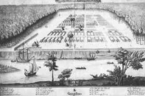
A collection of more than 800 maps dating from 1544 to 1939 of mostly North American locations, with an emphasis on 19th-century Georgia. Organized into nine chronological and topical divisions—New World; Colonial America; Revolutionary America; Revolutionary Georgia; Union and Expansion; American Civil War; Frontier to New South; Savannah and the Coast; and Transportation.

Includes maps of battles, American Indian nations, railroads, and roads. Useful especially for those studying military history and the development of the South.

Seneca Village

Image
Annotation

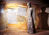
An introduction to Seneca Village, a multi-ethnic community of African Americans and Irish and German immigrants destroyed by New York city officials in 1857 to clear land for Central Park.

Through a selection of materials, currently limited to maps, images, and secondary essays, the site furnishes background on both Seneca Village and Central Park more generally. Also suggests "classroom activities" and provides a list of 63 related titles.

Based on The Park and the People—an award-winning history of Central Park by Roy Rosenzweig and Elizabeth Blackmar—the site promises to expand significantly (but, as of October 2000 had not changed significantly from when it was launched a few years earlier). "Primary documents will include the New York State Manuscript Census for 1855; birth and death records; church registers and records; newspaper articles; political cartoons, drawings, illustrations, photographs, and maps. Many of these will be interactive, so that students can query the data directly. "

Illinois During the Gilded Age

Image
Annotation

Focused on the Gilded Age in Illinois, this website offers 287 primary source documents. These include political speeches, pamphlets, songs, audio recordings, and maps that deal with such issues as politics, farming, law, labor, religion, and economic development. Visitors can browse all 287 items or search by author, title, date, theme, or genre. Visitors can search text documents, images, or audio files separately. The site also offers 26 video lectures from college professors interpreting the major issues of the period. Lecture topics include John Dewey, Dwight Moody, Chicago Gilded Age culture, women's suffrage, government and reform, the People's Party, William Jennings Bryan, William Mckinley, and the election of 1896.

The site can also be explored through eight historical themes, each with an interpretive essay, a bibliography, a search feature for related primary documents, and a list of related video lectures. The themes are: economic development and labor, labor, law and society, political development, race and ethnicity, religion and culture, settlement and immigration, and women's experience and gender roles. In addition, eight essays cover important periods: 1866-1868 (war's aftermath), 1869-1872 (the Chicago Fire), 1873-1876 (the Panic of 1873), 1877 (The Great Strike), 1878-1884 (Immigration, Labor, and Politics), 1884-1891 (Haymarket and Hull House), 1892-1895 (1893 Chicago's World Fair), and 1896 (The Cross of Gold). The "Teacher's Parlor" has nine lesson plans, including the WCTU and the lynching controversy, civil service reform, bimetallism, and free trade.

Gilmer Civil War Maps Collection

Image
Annotation

This collection of 161 maps represents the work of Jeremy Francis Gilmer, an engineer in the U.S. Army from 1839 to 1961 and a Confederate States of America Army officer during the Civil War. These hand-drawn maps represent the entire South, but Virginia and North Carolina are particularly well-represented. General maps of the eastern, central, and valley regions of Virginia are included, as are maps of the battlefields in Hanover County and at Manassas. Several drawings of rivers in Virginia suggest their importance in the War. Drawings of forts and fortifications, entrenchments, and defensive works also feature prominently, such as Forts Debray, Velasco, Quintana and Sabine in Texas, Forts Boykin, Magruder, and Monroe in Virginia, and defensive works around Weldon, Wilmington, and Halifax, North Carolina. Maps can be browsed by state or searched by keyword, and can be enlarged and zoomed in, making them useful for those interested in detailed viewing or projection in the classroom.

Getting the Message Out! National Political Campaign Materials, 1840-1860

Image
Annotation

After property qualifications for voting were eliminated in the 1830s, the American electorate expanded from 1.5 million to 2.4 million. As abolition, the extension of slavery, the Mexican War, and the Dred Scott decision dominated the national debate, songs, parades, and barbecues became increasingly important campaign tools to reach out to new voters. This type of political material culture is highlighted through this website, presenting 1,200 documents, more than 650 images, 100 songs, and interactive country-wide Presidential election maps for all six Presidential elections between 1840 and 1860. Detailed contextual information is available on a wide range of subjects, such as political campaigns, political parties, and major national events. Five short videos by well-known scholars address political culture, the second party system, politics as popular entertainment, and women's roles in antebellum politics. The detailed lesson plan in the "Teacher's Podium" challenges students to assess changing campaign strategies through song lyrics.

Early American Imprints, Series II: Shaw-Shoemaker, 1801-1819

Image
Annotation

This database is the most essential collection of written materials for historical research in American history from 1801-1819. It provides full-text access to nearly 4.5 million pages of 36,000 books, pamphlets, broadsides and other imprints published in the U.S. during this period. Gazetteers, almanacs, juvenile literature, chapbooks, hymnals, campaign literature, novels, slave narratives, spelling books, school readers, treaties, maps, atlases, advertisements, diaries, autobiographies, and much more are all included. Most of these materials were originally detailed in the bibliography compiled by Ralph Shaw and Richard Shoemaker. This collection, long available on microfiche, is made available here as a digital, fully searchable online database. It complements Readex's other Early American Imprints series of material from the period of 1639-1800.