Historical Map and Chart Collection
Image
Annotation

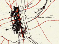
Provides more than 1,000 historical maps and nautical charts—mostly from the 19th century—produced or acquired by the Office of Coast Survey. Includes a Civil War collection of approximately 500 maps; a 90-sheet 1888 topological survey of the Washington, D.C. area; a 48-sheet topological survey of Cincinnati made in 1912; and 16 facsimiles of explorer George Vancouver's charts of the Pacific Northwest made between 1791 and 1798. Additional resources include 27 maps of the Erie Barge Canal made between 1917 and 1923; a 43-sheet survey of the Mississippi River made between 1868 and 1880; and approximately 50 sketches of landscape areas along both coasts. Maps can be viewed at 100 dpi or downloaded at 300 dpi. Organized by region and type of map. Valuable for those studying the Civil War, Washington, D.C., history, and various water-related government projects of the 19th century.
Virginia Historical Inventory (VHI)

Image
Annotation

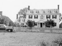
Furnishes more than 19,000 survey reports, more than 6,200 photographs, and 103 annotated county and city maps that document the history of thousands of structures built in Virginia prior to the Civil War. Original research was gathered in the late 1930s by the Virginia Writers's Project, a branch of the Works Progress Administration (WPA), and includes information compiled by field workers through onsite investigations—including interviews with residents—and by using court records and other local resources. Provides descriptions of architectural details, histories of buildings, lists of owners, and in many cases photographs and sketches. The project was "specifically charged with describing the vernacular architecture and history of everyday buildings built before 1860: homes, workplaces, churches, public buildings." Also includes materials on cemeteries, tombstones, antiques, historical events, personages, land grants, wills, deeds, diaries, and correspondence.

Provides a 5,600-word essay on the project's history. Users may search reports, maps, and photographs by keywords; includes specific instructions for genealogical research and for finding documents dealing with the Civil War and African American history. Site creators note that many of the structures documented by the project "no longer exist, and the VHI photographs may be the only extant visual records of them." A valuable resource for those studying the material culture of Virginia's past.

Heading West and Touring West

Image
Annotation

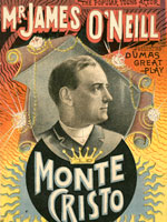
This site is home to two related exhibits about the exploration and settlement of the American West. "Heading West" is a collection of 15 maps produced between 1540 and 1900 and divided into five categories: imagining, exploring, settling, mining, and traveling. A 700-word essay introduces the exhibit and each image is accompanied by 50-400 words of explanation. The site links to 16 other sites about exploration and maps of the West. "Touring West" is a collection of materials about performers who toured the west in the 19th century. It is divided into five sections: travel, abolitionists, railroads, recitals, and heroics. Visitors will find 3 images in each section and 50-400 words of explanation. The images include prints and photographs of performers, programs, and promotional posters. An introductory essay of 500-words describes the collection. The site offers 15 links to sites about performance. Both exhibits will be useful to those interested in the West, performance, or search of illustrations.

Private Passions, Public Legacy: Paul Mellon's Personal Library

Image
Annotation

This exhibit presents 60 items from Paul Mellon's private collection of material relating to the history of Virginia. The entire collection, 447 items, is housed at the University of Virginia. A 600-word essay provides biographical information on Mellon and his bequest. The exhibit is arranged in six sections, from "Exploring the New World" through "Slavery and the Civil War" to "Opening New Vistas". "Acquiring Virginia's Legacy" presents six highlights of the collection and a 1,400-word essay explaining its significance. A 150-word explanatory essay accompanies each image. The exhibit includes facsimiles of 11 books, seven prints, seven letters, five objects of ephemera, and five maps. Among the ephemera is a myriopticon, a rolled painting that viewers can "unroll" to view scenes from the Civil War. The site is primarily interesting as an exhibit and may not be particularly useful for researchers except as an introduction to the Mellon collection.

A Maritime Perspective on American Expansion, 1820-1890

Image
Annotation

Focusing on 19th-century American maritime history and westward expansion, this collection of more than 160 documents from the Mystic Seaport Museum and Library provides diverse materials to explore themes such as the California Gold Rush, whaling, maritime business, migration and immigration, women's role in the West, and interactions between European migrants and native inhabitants. This Ameritech Award-winning site includes more than 25 photographs, more than 20 letters, logbooks from ships, published travel narratives, paintings, maps, and nautical charts. Provides four essays published previously in a Mystic Seaport publication, including an 1866 newspaper essay assessing Honolulu as a whaling port by youthful journalist Mark Twain.

The site is searchable by subject, name, title, and keyword, and includes an annotated bibliography of hundreds of documents in the Seaport's collections, and of 65 secondary sources. Valuable for those studying the American West, maritime history, business history, and the history of coastal and island localities.

The American Revolution and Its Era: Maps and Charts

Image
Annotation

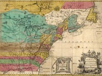
This American Memory site records the mapping of North America and the Caribbean from 1750 to 1789 through images of maps in the Geography and Map Division of the Library of Congress. Most items on the site are also included among the 2,000 images in Maps and Charts of North America and the West Indies, 1750-1789: A Guide to the Collections of the Library of Congress, compiled by John R. Sellers and Patricia Molen van Ee (1981).

Currently the site contains roughly 500 images. Maps and charts will be added to the online exhibit gradually. Selected images include original manuscript drawings by famous mapmakers like Samuel Holland, John Hills, and John Montresor; maps from the personal collections of men like Admiral Richard Howe and the Comte de Rochambeau; and large groups of maps by three major 18th-century London publishers: Thomas Jeffreys, William Faden, and Joseph Frederick Wallet des Barres.

The online collection allows visitors to compare editions, styles, and techniques of mapmakers from Great Britain, France, Germany, Spain, Holland, Italy, and the United States; and to follow the development of specific maps from the manuscript sketch to the finished, printed version. Each image is accompanied by descriptive notes (100–150 words) and a list of the medium, date and place of publication, condition, call number, and repository. The site also includes a 1,500-word essay on mapmaking during the American Revolutionary era and links to 12 other American Memory sites containing related materials.

Visitors can browse this site by geographic location, subject, creator, and title, and can search the site by keyword. This site is ideal for students and teachers interested in mapmaking in the 18th century and in exploring how maps helped to illustrate American culture.

Railroad Maps, 1828-1900

Image
Annotation

This Library of Congress American Memory site features images and descriptions of 623 railroad maps selected from more than 3,000 regional, state, and county maps in the Library's Geography and Map Division. The selected items represent the variety of cartographic styles and techniques used in maps created for a range of purposes, including railroad surveys, U.S. General Land Office maps, surveys for rights of way, general surveys for railroad company reports, maps used by commercial publications, ticket agents and the public, and route guides to encourage commerce and travel by rail.

The maps on this site were featured in the cartobibliography Railroad Maps of the United States: A Selective Annotated Bibliography of Original 19th Century Maps in the Geography and Map Division of the Library of Congress, compiled by Andrew M. Modelski (1975). A descriptive summary of 50–100 words and notes on the scale, publication place and date, medium, call numbers, and repository accompany each image.

The site also includes a lengthy (3,000-word) essay outlining the history of railroads and maps, a bibliography of eight related works, and links to 15 American Memory sites containing related materials. The site can be searched by keyword and browsed by geographic location, subject, map creator, title, and railroad lines. This site is ideal for students and teachers interested in the history of railroads, cartography, and transportation in the United States.

Samuel F. B. Morse Papers, 1793-1919

Image
Annotation

Offers approximately 50,000 images of 6,500 items from the papers of 19th-century American scientist and painter Samuel F. B. Morse (1791–1872), inventor of the electromagnetic telegraph. In addition to science and art-related papers, the materials in the collection document Morse's interest in photography and religion, as well as his involvement with the American nativist movement. Includes correspondence, diaries, notebooks, scrapbooks, newspaper clippings, books, pamphlets, broadsides, maps, drawings, and other materials, primarily produced during between 1807 and 1872.

The site provides a timeline supplemented with 15 documents; a family tree; two essays of approximately 1,000 words each (entitled "The Invention of the Telegraph" and "The Lesser-Known Morse: Artist, Politician, Photographer"); a bibliography of 22 titles; and links to 16 additional sites.

Searching capabilities leave much to be desired. Keyword searching applies only to titles assigned to documents by the Library of Congress. Thus even though the finding aid lists "Nativism" as a subject, a keyword search turns up nothing. The site unfortunately is of limited use because of this shortcoming.

Reston Collection Images

Image
Annotation

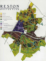
This collection of more than 160 texts, maps, photographs, and sketches is focused on the people, themes, and organizations important to Reston's history as a planned community. Textual materials include deeds, certificates, promotional brochures, studies, reports, and correspondence. Maps include Reston's Master Plan, major road systems, educational facilities, and recreational areas. Photographs include Lake Anne, various physical structures, and people significant to Reston's history. Sketches are mostly of building and community plans. Subject areas include health care, education, public services, parks, recreation, transportation, and population.

The collection can be browsed by title, subject, people, or organization and it can also be searched by subject, personal name, corporate name, or title. This is a website of interest to those researching the history of Reston or of planned communities.

Washington History

Image
Annotation

This website offers resources in Washington history through three main sections: historical records research, historical newspapers and classics in Washington history, and presentations. Historical records offers county census records, naturalization records, other miscellaneous records, and genealogical research resources, as well as searches of the state archive records and the state library catalog. The newspapers and classics feature allows visitors to search and view articles from four state newspapers dating back to 1852. Users can search the newspapers by keyword, topic, or personal name. This section also has 91 classic works on Washington history, searchable by keyword, grouped under topics of county and regional history, exploration and early travel, Native Americans, pioneer life, special collections, territorial government, and wagon trails and the Oregon Trail. Individual works can also be searched. (Newspaper articles and classics must be viewed using the DJVU plugin software, available for free download on the site.)

Additionally there is a Corps 33 bibliography of more than 35 works on the Lewis and Clark expedition. There are six presentations that allow visitors to explore Washington's territorial history through an interactive timeline featuring photographs and documents, view documents relating to World War I and profiles of Washington's soldiers, read the history and view historical photographs of cities, counties and corporations, browse a collection of historical maps of the state and the Pacific Northwest, view all 78 pages of the original Washington State Constitution and learn the history surrounding it, and explore the history of elections and voting in the state. The site also offers a collection of 96 images showing the construction and early history of the state's Legislative Building.