Harrisburg's Old 8th Ward
Image
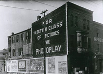
Photo, 418 Walnut Street
Annotation

This website is devoted solely to the study of 8th Ward from Harrisburg, PA, in the 19th century, with essays, images, maps, and directory lists. A virtual walking tour offers more than 70 pictures of 8th Ward buildings and a Then and Now tour pairs views of streets and buildings in the 19th century with views of the same areas today.

The site has three informational directories on businesses, institutions, and residents. The business directory lists businesses found in the Old 8th Ward organized by goods or services and provides the owner's name, dates of operation, and links to photographs. The institutions directory lists charitable organizations, churches, fire companies, market houses, and schools with links to photographs and a brief description. The extensive resident directory is organized by streets and lists residents with their occupation, ethnicity, years of residence, and other available information.

A guide to student research on the Old 8th Ward includes 16 scholarly essays on such topics as business and industry, churches and synagogues, newspaper accounts, politics, residents, and saloons. Additionally, there are six period maps and a miscellanea section with advertisements, newspaper articles, postcards, and real estate listings. There is no search capability. In addition to those interested in Harrisburg itself, the site is of interest to anyone studying urban development in the 19th century.
Connecticut History Online

Image
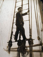
Photo, Captain George Comer of East Haddam in rigging..., 1907
Annotation

This site is a collaborative effort between the Connecticut Historical Society, the Thomas H. Dodd Research Center at the University of Connecticut, and the Mystic Seaport Museum, funded by a National Leadership Grant from the Institute of Museum and Library Services. It offers approximately 14,000 images depicting Connecticut's history from the beginning of the 19th century to the middle of the 20th century.

The images are divided into categories: "Artifacts," "Manuscripts and Documents," Maps, Charts, and Bird's-eye Views," "Newspapers and Magazines," "Photographs, Prints, and Drawings," "Posters/Broadsides," and "Sound Recordings and Transcripts." Each image includes notes on the creator, date, and place created, medium, repository information, and a brief (40-word) description of the subject. Visitors can search the site by keyword, subject, creator, title, and date.

The site also includes four sample lesson plans for middle school classes comparing and contrasting two Connecticut families and the roles of men and women through exercises interpreting the site's images, a list of ideas for future topics, and themes for secondary-level classrooms. This site is ideal for teachers and students interested in the history of Connecticut and its communities.

Bethlehem Digital History Project

Image
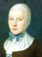
Oil on canvas, Johannetta Ettwein, John Valentine Haidt, 1754
Annotation

This collection of materials addresses the Moravian community of Bethlehem, PA, from its founding in 1741 to 1844, when the community first opened to non-Moravians. Most documents are available in three formats: facsimile of original in German type, transcription, and translation into English. All documents may be read in English.

A 650-word essay introduces visitors to Bethlehem history. The community kept a diary that visitors may read for the years 1742 to 1745. The Journal of the Commission of the Brethren of Bethlehem, from 1752 to 1760, allows further access to the inner workings of the community. The death register currently lists 400-word obituaries for five women and six men. Birth and marriage registers are to be added to the site.

Moravians of this era read memoirs (2,000–3,000 words) at the funerals of community members, sometimes incorporating autobiographical writing. Visitors may read 34 of these memoirs.

The records of the community also include four maps, a survey, and the ledgers of the town finances from 1747 to 1765. Inventories of four shops may also be examined.

Other material includes a 32-page 1876 historical sketch of the Bethlehem Seminary for Young Ladies, a 19-page scholarly essay on the Moravian approach to business, and a 1762 discussion of how to finance the Single Sisters' Choir. Visitors may search the site by subject. The site will be very interesting for research in colonial history and the history of religion in America.

Madison: Celebrating 150 Years

Image
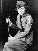
Photo, Irene Castle in Uniform, WWI or later, Madison: Celebrating 150 Years
Annotation

In 2006, Madison, WI, celebrated the 150th anniversary of its incorporation as a city. To mark the occasion, this website features 6,952 images, several articles and documents, maps and information on Madison's buildings, and links to virtual exhibits, entreating users to investigate Madison's past. This diverse collection of materials highlights both the experiences of the American Indian groups that had lived in the Madison area for many thousands of years, as well as those of the Yankee, English, Irish, German and Scandinavian settlers who began to arrive in 1837.

Visitors can view a map of American Indian village and mound sites, built for burial and ceremonial purposes, which are still visible around the city today. Also available are the recollections of George W. Stoner, one of the first settlers to arrive in Madison, through which one can learn about the construction of the city's first buildings and businesses, its first election, and its first suicide. Moving into the 20th century, visitors can also learn of the Federal Government's attempts to enforce Prohibition in Madison, which one official described as "queen of the bootleggers." This website is useful for those interested not only in Wisconsin history, but also in the history of urbanization in the United States more generally.

New York Public Library Picture Collection Online

Image
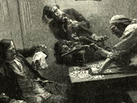
Engraving, "Capture of the Galleon," Howard Pyle, 1887
Annotation

This image resource site contains 30,000 digitized images from books and periodicals, as well as original photographs, prints, and postcards, mostly dated before 1923. There are cartoons and illustrations from the well known Harper's Weekly and Century Magazine, as well as images from the Library of Congress Prints and Photograph division. In addition many of the vibrant images of Native Americans were collected from the Department of War Indian Gallery. Covering more than 12,000 subjects, the site features images of Jamestown settlers, Pocahontas and John Smith, American presidents, 19th-century New York architecture, slave life, American and European women's costumes, streetcars and trains, and even insects and snakes.

Bibliographical information accompanies each image, and users may also save images of interest in their own "gallery" for viewing or purchase. Thumbnail sketches enlarge for full-page viewing. Searchable by keyword or by browsing a variety of indexes, the collection is a useful visual resource for teachers and researchers.

First Century of the First State University: The Creation of UNC

Image
Image, Original Seal of the University of North Carolina, 1893-94
Annotation

The University of North Carolina at Chapel Hill opened its doors to students in 1789, becoming the first public university in the U.S. Part of the larger Documenting the American South website, this collection illuminates the first century of UNC's operation. Close to 500 primary source documents—letters, speeches, architectural drawings, account ledgers, meeting minutes, sermons, and General Assembly acts—are available, including previously unpublished materials. Topics include: Buildings, Campus, Creation and Governance, Curriculum, Faculty, Student Life, Town and Gown, The University During the Civil War and Reconstruction, and The University in the Life of the State. These broad topics, in turn, shed light on smaller dramas within the history of the university, such as the 1856 dismissal of a professor for expressing anti-slavery views to students. Contextual essays and an extensive timeline accompany these materials, rendering them accessible to specialists and generalists alike interested in the histories of the Civil War, North Carolina, and higher education in the United States.

France in America

Image
Image for France in America
Annotation

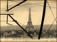
This bilingual website (English and French) explores the history of the French presence in North America from the early 16th century to the end of the 19th century through more than 360 manuscripts, books, maps, and other documents. Each thematic presentation—"Exploration and Knowledge," "The Colonies," "Franco-Indian Alliances," "Imperial Struggles," and "The French and North America after the Treaty of Paris"—includes a title exhibit and additional exhibits that highlight particular items in the collection. Materials can also be browsed in the collections section.

A timeline (1515–1804) organizes events in French America by explorations, colonization and development, and conflicts and diplomacy, and places them in the context of events in France. Additionally, there are eight descriptive maps that show various Indian groups in contact with the French and the changes in political boundaries in North America from before 1763 to the era of the Louisiana Purchase.

Built in America: Historic American Buildings Survey and Engineering

Image
Image for Built in America:
Annotation

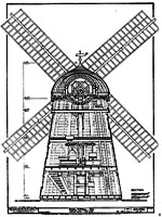
These facsimile images of measured drawings, photographs, and written documentation cover 35,000 significant historic sites dating from the 17th to the 20th century. The Historic American Buildings Survey (HABS) started in 1933 as a work relief program and became a permanent part of the National Park Service the following year to document "our architectural heritage of buildings," in the words of project founder Charles E. Peterson. The Historic American Engineering Record (HAER) was established in 1969 to similarly survey engineering works and industrial sites.

For each structure, the site provides from one to ten drawings, from one to 30 photographs, and from one to 50 pages of HABS text detailing the structure's history, significance, and current physical condition. The collection displays building types and engineering technologies from a farmhouse to a pickle factory, from churches to the Golden Gate Bridge.

Living New Deal Project

Image
Annotation

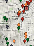
The Living New Deal project essentially creates a Google map of projects completed within the United States as part of the economic and social revival measure, the New Deal. These maps can be sorted by the type of project you are interested in locating, such as education, parks, art, or flood erosion measures. You can also find the portion of the nation of interest to you, and use the maps to locate nearby New Deal examples. Time for a field trip, perhaps?

In addition to providing the name, address, and website link for each location, the Living New Deal project also includes numerous other resources—such as detailed project descriptions, names of contributors and/or artists, project dates, photographs, and many other helpful and informative tid bits of information. The site also offers a plethora of other resources, so be sure to search around for teaching resources centered on the New Deal, news updates about existing New Deal projects, and coverage of the current economic crisis.

Although the website asks for contributions on the main page, users are under no financial obligations whatsoever. Contributions of information (to be verified by UC Berkeley) are also welcome, and likely more professionally appropriate.

National Park Service History E-Library

Image
Annotation

This website gathers together documents concerning the history of National Park Service properties.

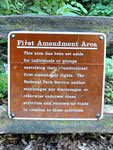
Navigation is simple. Just select your park of interest from the drop-down list, and you will be brought to a list of all of the available documents for that particular location. Documents include structure reports, administrative histories, physical and cultural landscape reports, studies of historic resources available, management regulations, conference proceedings, notes, and more.

Note that these resources largely explore the history of preserving a historical site, rather than the importance of the site itself. This is the history of making history public. The documents are most likely to be of use in the later grades, as they lean towards official language. However, there are also images such as floor plans and photographs within documents which may be of use when introducing a park into your discussions.