Historic USGS Maps of New England

Image
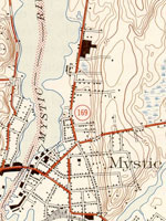
Map, "Mystic, CT-NY-RI Quadrangle," 1944
Annotation

A collection of more than 1,100 topographical maps created by the United States Geological Survey from the 1890s to the 1950s covering all of New England—Maine, New Hampshire, Vermont, Rhode Island, Massachusetts, and Connecticut—and selected areas of New York. The maps—which reveal roads, buildings, rail lines, bodies of water, and elevations—occur in 15-minute and 7.5-minute quadrangle series (a minute is one-sixtieth of a degree of latitude or longitude). In addition, the collection includes six maps with 30-minute quadrangles.

For states other than New York, users can view a state image map and select a point within a grid marked off in 15-minute increments to find listings for available images accompanied by dates the maps were surveyed, created, and revised. Towns within each quadrangle are also listed along with names of adjacent areas. Users also may search an alphabetical list of towns within each state. For New York, only an index of quadrangles names is available. Maps are presented in JPEG format. According to the site, "Each image is typically 2 megabytes, so download times are likely to be slow." A useful site for those studying changes in the New England landscape during the first half of the 20th century.

David Rumsey Map Collection

Image
Image for David Rumsey Historical Map Collection
Annotation

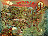
This private collection presents more than 15,800 rare historical maps with a focus on North and South America. The collection is accessible via several formats. A standard browser (the "directory") is designed for use by the general public. In addition to two browsers and a "collections ticker" requiring Insight software (available for free download), a GIS browser shows detailed overlays of maps and geospatial data for the more serious researcher.

Many of the U.S. maps are from the late 19th and early 20th centuries and are often notable for their craftsmanship. Materials include atlases, globes, books, maritime charts, pocket and wall maps, and children's maps. Users can zoom in to view details. Overlay capabilities make this site valuable for its ability to convey how locations have changed over time.

Historical Maps of the United States

Image
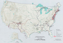
Map, Exploration Before 1675
Annotation

This division of the Perry-Castaneda Map Collection provides access to 500 historical maps of the U.S. Maps are sorted thematically and include three maps of early inhabitants, 11 of exploration and early settlement from 1675 to 1854, and 15 of territorial growth from 1775 to 1970. Of the 95 military history maps covering engagements from 1763 to 1967, 50 are about World War II alone.

Among 183 late 19th- and 20th-century maps, there are 146 of U.S. cities produced around 1920. Historic sites, memorials, and battlefields are represented in 191 maps of sites such as Aztec ruins in New Mexico, the Bering land bridge in Alaska, and the Vicksburg battle site in Mississippi. Most of the maps are excerpted from 20th-century historical atlases. The site will be particularly useful for research in military history and early 20th-century urban history.

Historic Topographic Maps of California

Image
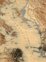
Map, San Francisco 15-minute Quadrangle, 1895
Annotation

Provides historical United States Geological Survey maps of the San Francisco Bay area, from Point Reyes in the north to Half Moon Bay, and east to San Jose. Includes maps from different time periods—the earliest is from 1895, the latest 1997—covering each 7.5-minute and 15-minute quadrangle of the area. Users may zoom in to see minute details. Searchable by quadrangle or place name. Of value for those studying change over time in the development of the Bay Area during the 20th century.

Historical Maps Online

Image
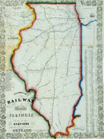
Map, D.B. Cooke & Co.'s railway guide for Illinois...
Annotation

This website offers more than 400 images of historic maps charting 400 years of development in Illinois and the northwest territory. The collection of maps can be browsed by state or geographic area or by categories such as early maps, topographic maps of Illinois, Indians of North America, waterways, and transportation. Types of maps include maps showing roads and canals, topographical maps, French and Spanish colonial maps, maps of railways, city maps, county and township maps, maps showing regions of settlement, and sectional state maps.

A zoom and pan feature allows the map images to be examined in detail and bibliographic information is provided with each map image. A keyword search is available. An excellent source of historic maps.

Map Collections: 1500-2003

Image
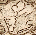
Image, Historia general..., Antonio de Herrera y Tordesillas, c. 1601-1615, LoC.
Annotation

This large collection of maps from the 16th century to the present day focuses on Americana and cartographic treasures.

Materials are organized into seven thematic categories—Cities and Towns, Conservation and Environment, Discovery and Exploration, Cultural Landscapes, Military Battles and Campaigns, Transportation and Communication, and General Maps. Sections include five special presentations.

Users may download maps or zoom in to view details. Seventeen specific map collections contained within this larger site that are of particular importance for the study of American history include "Discovery and Exploration," "The American Revolution and Its Era," "Railroad Maps, 1828–1900," "American Colonization Society Collection: Maps of Liberia, 1830–1870," "Panoramic Maps, 1847–1929," "Civil War Maps," and "Mapping the National Parks."

Odden's Bookmarks: The Fascinating World of Maps and Mapping

Image
Logo, Universiteit Utrecht
Annotation

A gateway to more than 14,000 sites on and about cartography and geography. Allows searching by keyword and browsing by countries and categories—including maps and atlases, collections, societies, departments, government cartography, libraries, and literature. Provides links to 585 sites that offer historical maps and atlases. Valuable for those studying cartography and geography, and useful for others as an easy-to-use reference source.

Hannah Arendt Papers

Image
Graphic, The Hannah Arendt Papers
Annotation

Due to copyright restrictions, only a small portion of the more than 25,000 digitized items from the Hannah Arendt papers can be viewed outside of three locations. Visitors who are not at the Library of Congress, New School University in New York City, or Carl von Ossietzky University in Oldenburg, Germany, may, however, view almost all of the collection's documents relating to the Adolph Eichmann trial and Arendt's book, Eichmann in Jerusalem. Material in this collection includes correspondence with holocaust survivors, minutes of the trial, Arendt's notes, and positive and negative reviews of the book. About one quarter of Arendt's general correspondence from 1938 to 1975, arranged alphabetically by correspondent, is available. Visitors may access eight folders of notes, lectures, fiction, and poetry from the 1920s and 1940s and all of Arendt's appointment books from 1972 to 1975. All material is in facsimile, much of it in German. Most of a collection of lecture notes, correspondence with students, and royalty statements for Arendt's books from 1949 to 1975 is available offline. Nearly half of a collection of drafts of Arendt's books, On Revolution and Between Past and Future may also be accessed from any location. Although limited, the site will be interesting for research on Arendt, modern Europe, and philosophy.

From Haven to Home: 350 Years of Jewish Life in America

Image
Postcard, A Happy New Year, 1910-1920, Hebrew Publishing Company, LoC
Annotation

An exhibition on Jewish life in America emphasizing the themes of accommodation, assertion, adaptation, and acculturation. The website features more than 200 illustrations, portraits, and images of books and documents from Library of Congress collections. The website offers an explanatory overview of the exhibition and four brief electronic exhibits focused that help to tell a part of the Jewish story in America from 1654 to the present. Some of the items highlighted by the exhibition include the first book printed in the English settlements of America, The Bay Psalm Book printed in 1640, the first published American Jewish sermon, and a hand-drawn plaque from c. 1942 with dual Hebrew prayers for Winston Churchill and Franklin Roosevelt. A small bibliography lists 10 books plus six books for children. The site provides an introduction to the Library of Congress collections and is useful for teaching about the history of Jewish life in America.

A Portion of the People: Three Hundred Years of Southern Jewish Life

Image
Oil on canvas, Mary Olivia Lucas Harby. . . , c. 1830, A Portion of the People
Annotation

This exhibit tells "the story of Southern Jewish settlers and their descendants from the late 1600s through the 21st century." It currently consists of two presentations, each with more than 50 pages presenting an image from the exhibit's collection with accompanying explanatory text. Images include portraits, maps, historical documents, photographs of Jewish ritual books and religious and cultural objects, paintings and photographs of synagogues, and photographs of Jewish businesses. "First Families" explores the period from the 1600s to the 1820s through more than 50 images and "This Happy Land" explores the antebellum and Civil War years through more than 90 images. (The presentation "Pledging Allegiance," recounting the story of Jewish migration to the South in the first half of the 20th century, is under construction.) Visitors can listen to six interviews featuring voices from the past (transcripts are available). Additionally, a photographic essay with more than 40 photographs, "Palmetto Jews" by Bill Aron, examines Jewish life in South Carolina over the past 50 years. There is no site search capability.