The Pill

Image
Annotation

Designed as a companion to the PBS film, this site documents the development of the birth control pill and its effect on women's health. The site offers a synopsis of the film (approximately 1,000 words) and about a dozen primary sources, including letters between birth control pill researchers. The site also includes a timeline that documents references to birth control as far back in history as Biblical Genesis.

A Gallery showcases approximately 15 birth control pill package designs. People and Events introduces visitors to the researchers (including Margaret Sanger) who dedicated years to the project, as well as milestones in the pill's development. Special Features uses a Flash presentation to demonstrate how the pill works to prevent pregnancy, explores the many shifts in sexual attitudes that have been attributed to the pill, and asks viewers to participate in an online poll.

A Teacher's Guide features lesson plans in geography, civics, history, and society, and presents challenging exercises for students. For example, one exercise asks students to survey the effect geography had on sexual attitudes by comparing laws about contraception from state to state in 1960.

Although the site is not a comprehensive archive, the primary sources and multimedia exhibits make it valuable, especially for research into birth control and women's issues.

The Story of Virginia

Image
Annotation

This attractive website offers a presentation on the history of Virginia from prehistoric times to the present with essays, images, and teaching resources. There are 10 chapters: the first Virginians; the settlement of colonial Virginia; Virginia's society before 1775; Virginians in the American Revolution; Virginians as Southerners, Confederates, and New Southerners; Virginians in the 20th century; the struggles of African American and female Virginians for equality; and a final chapter on images of Virginia in popular culture. Each chapter has an essay featuring images of relevant items in the collections of the Virginia Historical Society.

The "resource bank" collects all 95 images from the chapters of people, documents, places, and objects. Additionally, the site offers a teacher's guide for each chapter listing the standards of learning, a summary of key points, classroom activities and lesson plans, links to related websites, and information on tours, outreach programs, and hands-on-history programs.

An excellent introduction to the history of Virginia and its people with useful resources for class projects and classroom instruction.

Roy Rosenzweig Center for History and New Media

Image
Annotation

In the past decade new media and new technologies have begun to transform even the ancient discipline of history. CD-ROMs and the World Wide Web challenge historians to rethink the ways that they research, write, present, and teach about the past. The Center for History and New Media (CHNM) was established in the fall of 1994 to contribute to and reflect upon this transformation and challenge. The Center produces historical works in new media, tests the effectiveness of these products in the classroom, and reflects critically on the promises and pitfalls of new media in historical practice. The Center's resources are designed to benefit professional historians, high school teachers, and students of history.

Includes links to more than 1,000 history departments around the world; and a wide variety of teaching, scholarly, and exhibition resources—online databases, informative sites, and software. For example, Declaration: Interpreting the Declaration of Independence by Translation provides translations of the American Declaration of Independence into French, German, Polish, Russian, and Spanish, along with commentaries on the practice and problems of translating documents.

With the American Social History Project/Center for Media and Learning at the City University of New York (ASHP/CML), CHNM produces History Matters, a resource site for teachers and students of American history.

Rare Map Collection

Image
Annotation

A collection of more than 800 maps dating from 1544 to 1939 of mostly North American locations, with an emphasis on 19th-century Georgia. Organized into nine chronological and topical divisions—New World; Colonial America; Revolutionary America; Revolutionary Georgia; Union and Expansion; American Civil War; Frontier to New South; Savannah and the Coast; and Transportation.

Includes maps of battles, American Indian nations, railroads, and roads. Useful especially for those studying military history and the development of the South.

WWW-Virtual Library, History Central Catalogue

Image
Annotation

Created by an international group of volunteer institutions, this site offers a gateway with thousands of links to general history resources and seeks to provide "effective tools for practicing historians wishing to work online." Links are presented for the following categories: "Research: Methods and Materials"; "Eras and Epochs"; "Historical Topics"; and "By Countries and Regions."

1492: An Ongoing Voyage

Image
Annotation

This exhibit "examines the first sustained contacts between American people and European explorers, conquerors, and settlers from 1492 to 1600." Divided into six sections--"What Came To Be Called 'America'," "The Mediterranean World," "Christopher Columbus: Man and Myth," "Inventing America," "Europe Claims America," and "Epilogue"--the materials include background essays, illustrations of objects such as Columbus' Coat of Arms, and a 15-title bibliography. An interesting exhibition that consists mostly of secondary text.

Evaluating the Validity of Information

Teaser

Did the Chinese discover America before Columbus? How would or does this impact our understanding of European explorers and exploration?

lesson_image
Description

Students learn to assess the validity of a historical argument as they evaluate the implausible theory that the Chinese discovered America in 1421.

Article Body

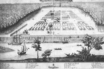
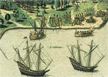
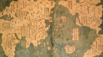
TV presents a great deal of historical information these days, but not all of it is valid or trustworthy. Unfortunately, many students lack the tools needed to assess historical information they see on television. This skill-building lesson presents students with some of the tools needed to assess the validity of an argument made through a persuasive, high-quality visual medium. In this two-day lesson, students assess the validity of a claim integral to the argument that the Chinese discovered America in 1421. Retired submarine commander Gavin Menzies presents this argument and the evidence to students in two short video clips highlighting the resources available to ancient Chinese sailors to make seven epic ocean voyages during the Ming dynasty. The lesson is clearly structured and guides students through steps they should take to evaluate historical claims. Helpfully, it includes a student handout that clearly explains the criteria for assessing the evidence of a historical argument. For example students are prompted to look at the qualifications of the person making a claim and to evaluate the persuasive techniques being used. A second handout has a worksheet to help students use the criteria to evaluate specific aspects of Menzies's argument. Student learning is assessed both through classroom discussion and a culminating essay that prompts students to provide a reasoned evaluation of the claim that the Chinese had the naval capacity to travel to America in the 15th century. The lesson includes a detailed rubric to assist your evaluation of these essays.

Topic
Exploration; Evaluating Historical Evidence
Time Estimate
2 class periods
flexibility_scale
4
Rubric_Content_Accurate_Scholarship

Yes The process of examining historical evidence is presented accurately. However, other websites present additional information and arguments disputing Menzies' thesis.

Rubric_Content_Historical_Background

No The lesson provides clear criteria for assessing historical accuracy but provides little historical background about the specific time period under investigation.

Rubric_Content_Read_Write

Yes Students write a final essay, but the lesson does not require significant reading.

Rubric_Analytical_Construct_Interpretations

Yes Lesson requires students to analyze the evidence.

Rubric_Analytical_Close_Reading_Sourcing

Yes Requires close attention to the arguments made in a historical video. Attention to the source of a historical argument is an integral part of the lesson.

Rubric_Scaffolding_Appropriate

Yes Appropriate for grades 6-8. Could easily be adapted for grades 9-12.

Rubric_Scaffolding_Supports_Historical_Thinking

Yes Provides a well-written student handout of criteria for assessing the validity of a historical argument. A table to help students apply these criteria to Menzies's theory is also provided.

Rubric_Structure_Assessment

Yes The lesson provides a solid essay prompt and a clear rubric for assessing the essay.

Rubric_Structure_Realistic

Yes Directions are clear and procedures are realistic in most settings.

Rubric_Structure_Learning_Goals

Yes The lesson progresses logically toward the goal of making students think about historical evidence.

A Look at Slavery through Posters and Broadsides

Teaser

How to identify the author, audience, date, and message of historical posters.

lesson_image
Description

Using historic posters, this lesson engages students in analyzing primary sources by identifying their author, intended audience, date, and message.

Article Body

This well-planned lesson, which uses posters on slavery and abolition, teaches students to ask important questions as they read a primary source. First, the teacher models the task by analyzing a representative poster in front of the classroom. In small groups, students then analyze additional posters, locating such information as author, audience, purpose, and message. They use this information to consider the attitudes towards slavery that the posters convey.

One strength of the lesson is that the primary sources are given in two formats: students receive historically evocative reproductions of the original posters along with easy-to-read typed transcriptions. Some teachers may choose to highlight important text, particularly for beginning readers; other teachers will want to leave it up to students to locate and identify this crucial information.

This lesson appears in the December 2004 issue of History Now, a quarterly journal of the Gilder Lehrman Institute of American History.

Topic
Slavery and Abolition
Time Estimate
1 day
flexibility_scale
2
Rubric_Content_Accurate_Scholarship

Yes Lesson is accurate and up-to-date.

Rubric_Content_Historical_Background

No The lesson plan's Teacher Resources section includes links to information about historical context. It's up to teachers, however, to decide how much background students will need.

Rubric_Content_Read_Write

Yes In class, all students read, and one student per group records information on a Poster Inquiry Sheet. In the suggested homework assignment, students each write a news story about their assigned poster.

Rubric_Analytical_Construct_Interpretations

Yes The Poster Inquiry Sheet provides students with a method for identifying and interpreting historical facts.

Rubric_Analytical_Close_Reading_Sourcing

Yes During the modeling and the group work, students learn and practice how to read primary sources.

Rubric_Scaffolding_Appropriate

Yes Some language in the posters may be difficult, but teachers can choose to highlight sections of text to reduce the amount or difficulty of necessary reading.

Rubric_Scaffolding_Supports_Historical_Thinking

Yes The teacher's modeling step provides a helpful scaffold, as does the Poster Inquiry Sheet.

Rubric_Structure_Assessment

No Although the lesson plan does not include an assessment rubric, teachers can check in with small groups to assess student learning.

Rubric_Structure_Realistic

Yes The modeling provided in Steps One, Two, and Three is pedagogically useful. However, reading every single poster before the class may be excessively time-consuming. Teachers may want to discuss just one poster and then go around the classroom to check in with small groups as needed.

Rubric_Structure_Learning_Goals

Yes The lesson plan helps students to learn about slavery and abolition while providing a method for analyzing primary sources.

Using Maps as Primary Sources

Image
Article Body

This website shows a 4th-grade teacher in northern Virginia teaching a lesson focused on a map drawn by John Smith that was published in 1612. Source Analysis, a feature created for the Loudoun County (Virginia) (TAH) website, has three sections focused on this primary source: scholar analysis, teacher analysis, and classroom practice. The latter two sections show a standards-based lesson that asks students to answer the question: What is important to John Smith? The teacher carefully plans activities so students look closely at the map and consider how this primary source helps them answer the central question. The site provides examples of two promising practices:

  • Engaging young students in close, careful observation and reading of a primary source document (using student pairs and a comparative document); and
  • Using students' observations to inform and guide analysis and connect the source to larger questions and topics in the curriculum.
The Lesson in Action

In the Classroom Practice section, we see the lesson in action. The teacher introduces the lesson question and then takes time to ensure that students understand the question by introducing synonyms for "important" and reviewing word meanings. She passes out the maps to assigned student pairs and asks them, "What do you see?" Students have time to look carefully at the map and notice words (e.g., "Jamestown" and "Powhatan"), the Chesapeake Bay and its tributaries, living structures, trees, how particular words vary in size and spacing, and so on. The teacher further facilitates the students' observation by juxtaposing the 1612 map with a contemporary textbook map of the same region. This juxtaposition helps students see the choices John Smith made in drawing this map that they might have missed without the comparative source. The teacher then uses what students notice about these maps to help them think about what the details and differences mean. Students start to identify what was important to John Smith and subsequently to the Virginia Company, given the evidence in front of them. Throughout this instruction, the teacher uses feedback, a logical sequencing of activities, and clear and accessible questions to ensure access to the learning activities for all of her students.

Thinking Like Historians

This teacher shows how carefully structured lessons that use primary sources can engage students in the process of thinking like historians. Students slow down and carefully read and look at the map, noticing things that they might otherwise have missed. They then consider what the contents of the map mean and what the map tells us about John Smith and the Virginia Company's worldview. The 1612 map becomes a window into the past that only reveals its slice of the landscape with close reading. Also on this site is a Teacher Analysis section in which the teacher explains some of what preceded this lesson and her instructional choices—a useful complement to the classroom videos. Each of these sections presents information in a set of videos that are clearly titled and visually interesting.

American Shores: Maps of the Middle Atlantic Region to 1850

Image
Annotation

This attractive site explores the mid-Atlantic region and history with maps created before 1850. An extensive collection offers more than 1,852 historical maps of many different types. In addition to numerous regional and state maps, these include land surveys, coast surveys, nautical charts, military maps, ornamental maps, and city maps.

An overview provides historical context for reading the maps of the geographic regions. In addition, the site offers several special features. "Basics of Maps" explains such cartographic terms and features as orientation, scale, and the cartouche. "Maps Through History" highlights particular maps and map genres from the collection, including a look at New York Harbor, the Hudson River, nautical charts, maps revealing early transportation routes, and maps of American Revolution battle sites. "Geographical Areas" highlights many kinds of maps and what information they offer. Visitors can click on thumbnail images to view enlarged maps and pan and zoom the maps.