Columbia River Basin Ethnic History Archive

Image
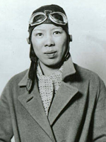
Photo, Leah Hing, ca. 1934, Pilot and WWII instrument mechanic, c. 1934, WSU
Annotation

This site offers a large archive of selected documents, reports, records, maps, photographs, newspapers, artifacts, and oral history interviews. Items are searchable by ethnic group, keyword, archive, type of material, date, or subject. Brief historical overviews and bibliographies for each ethnic group profiled are also available in the archive section. Another section has lessons plans for teachers on African Americans, immigration and settlement, migration, and ethnic culture and identity, 1850-1950. It also offers tutorials on using the archive, using history databases on the web, interpreting photographs, interpreting documents, and interpreting oral history. Historical overviews are provided on the various ethnic groups that settled the Columbia River Basin.

A discussion forum offers a place to talk about discoveries in the archive or questions. Topics currently include ethnic groups, ethnicity and race, work and labor, immigration and migration, family life, religion, social conditions, discrimination, and civil rights. A very useful site for researching or teaching the social and cultural history of the Columbia River Basin.

Ansel Adams's Photographs of Japanese-American Internment at Manzanar

Image
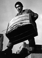
Photo, Tsutomu Fuhunago, Ansel Adams
Annotation

During World War II, the U.S. Government forced more than 100,000 Japanese Americans to leave their homes and businesses, relocating them to internment camps from California to Arkansas. Well-known photographer Ansel Adams documented the lives of Japanese Americans at the Manzanar War Relocation Center in California—from portraits to daily life, including agriculture and leisure.

This site presents 242 original negatives and 209 photographic prints, often displayed together to show Adams's developing and cropping techniques. His 1944 book on Manzanar, Born Free and Equal is also reproduced. Adams donated the collection to the Library of Congress in 1965, writing, "The purpose of my work was to show how these people, suffering under a great injustice . . . had overcome the sense of defeat and dispair [sic] by building for themselves a vital community in an arid (but magnificent) environment."

A More Perfect Union

Image
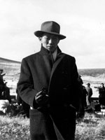
Photo, Tule Lake renunciant, November 23, 1945
Annotation

Based on a 1987 Smithsonian exhibition, this site allows visitors to click and drag through sections of text, music, personal accounts, and images that tell stories of the forced—and ultimately determined to be unconstitutional—internment during World War II of 120,000 Japanese Americans living on the West Coast. Also provides searching capabilities to retrieve images of more than 800 artifacts relating to the lives of those interned.

Sections in the narrative cover immigration, removal, internment, loyalty, service, and justice. Provides a 5,000-word audio file of interview excerpts; 6,400-word accompanying text from the 1994 traveling exhibition; annotated timeline; 72-title bibliography; 20 links to related sites; and two classroom activities. Also invites visitors to share their responses and to read those of others. Of value to students of Asian American history, the homefront during World War II, and constitutional issues.

Maryland Historical Society Collections Online

Image
Painted tin hat shield, Maryland Historical Society, 1940.23.1
Annotation

The Maryland Historical Society owns millions of objects which could be key to bringing history to life for your class. A growing number of these items can be found in their digital collections.

The collections can be searched by title, creator, individual collection, or subject. At the time of writing, there are nine collections—the American Civil War; War of 1812; Paintings; African American History; Women's History; Mining the Museum (items on exhibit); Benjamin Henry Latrobe, an architect known for design the U.S. Capitol and the Baltimore Basilica; and works on paper. Artifacts include photographic images, engravings, broadsides, handwritten documents, a flag, a shadowbox, a knife, sketches, clothing, paintings, swords, a shield, a canteen, and more.

The original handwritten version of "The Star-Spangled Banner" may be of particular interest.

Evolution of the Conservation Movement, 1850-1920

Image
Image for Evolution of the Conservation Movement, 1850-1920
Annotation

These published works, manuscripts, images, and motion picture footage address the formation of the movement to conserve and protect America's natural heritage. Materials include 62 books and pamphlets, 140 Federal statutes and Congressional resolutions, 34 additional legislative documents, and excerpts from the Congressional Globe and the Congressional Record. An additional 360 presidential proclamations, 170 prints and photographs, two historic manuscripts, and two motion pictures are available.

Materials include Alfred Bierstadt paintings, period travel literature, a photographic record of Yosemite, and Congressional acts regarding conservation and the establishment of national parks. An annotated chronology discusses events in the development of the conservation movement with links to pertinent documents and images.

History: The National Park Service

Image
Logo, NPS History and Culture website
Annotation

Historical aspects of many of the 384 areas under the National Park Service's stewardship are presented in this expansive site. A "Links to the Past" section contains more than 25 text and picture presentations on such diverse history-related topics as archeology, architecture, cultural groups and landscapes, historic buildings, and military history. Of particular interest to teachers, a section entitled "Teaching with Historic Places" features more than 60 lesson plans designed "to enliven the teaching of history, social studies, geography, civics, and other subjects" by incorporating National Register of Historic Places into educational explorations of historic subjects. Examples include an early rice plantation in South Carolina; the lives of turn-of-the-century immigrant cigar makers near Tampa, Florida; a contrast between the Indianapolis headquarters of African-American businesswoman Madam C. J. Walker and a small store in Kemmerer, Wyoming, that grew into the J. C. Penney Company, the first nationwide department store chain; the Civil War Andersonville prisoner of war camp; President John F. Kennedy's birthplace; the Liberty Bell; Finnish log cabins in Iowa; and the Massachusetts Bay Colony's Saugus Iron Works. Especially useful for teachers interested in connecting the study of history with historic sites.

Journals of the Lewis and Clark Expedition

Image
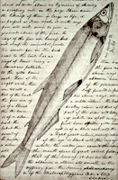
Image, Page from the journals, Journals of the Lewis and Clark Expedition
Annotation

This well-designed site presents the Nebraska edition of the Lewis and Clark journals, edited by Gary E. Moulton. The site provides the complete text of all the journals from the 1803–1806 expedition, as well as introductions, prefaces, and sources. The material is searchable by keyword and phrase.

There are 29 scholarly essays about the expedition. An image gallery offers 124 images of pages from the journals, 95 images of people and places, and 50 images of plants and animals encountered on the expedition. The maps section includes 12 explanatory maps and nine images of maps from the journals. Additionally, there are 27 audio excerpts of journal readings and eight video interviews with the editor of the project. The website stands as an outstanding resource for researching the history of the Lewis and Clark expedition.

Harvesting the River

Image
Color offset lithograph, "Whistling In," Bartlett Kassabaum, 1980
Annotation

Presents a narrative in exhibit format—with hyperlinks to archival documents and photographs—on the cultural and economic life of the people who came to the Central Illinois River region from 1875 to 1950. Organized into three sections on the harvesting of fish, waterfowl, mussels, and natural ice; transportation by boat, railroad, and plank roads; and the settlement and development of six area river towns. The site delivers oral histories (audio and video), as well as illustrations and photographs. It may serve as a useful introduction to those studying this particular region and regional history in general.

National Park Service: Links to the Past

Image
Image, History & Culture, http://www.nps.gov/history/.
Annotation

Visitors to this site are invited to explore historical aspects of the roughly 200 National Park Service locations designated important to U.S. history and prehistory. Materials are organized by "cultural resource subjects," including archeology, architecture and engineers, cultural groups, cultural landscapes, historic buildings, mapping, maritime and military history, and "cultural resource programs," such as the American Indian Liaison Program and Heritage Preservation Services.

Visitors can search for information on more than 2.5 million Civil War soldiers and sailors; more than 71,000 properties listed in the National Register of Historic Places; and approximately 240,000 reports on federal archaeological projects in the National Archaeological Database. National Register Travel Itineraries provide historic guides to 18 cities and communities. The National Underground Railroad Network to Freedom contains information on 51 sites of importance and on slavery and antislavery efforts.

Also of interest are bibliographies on the African American west and public history, and full-text publications on the Antiquities Act of 1906 and the promotion of the city of Seattle during the gold rush era. The homepage—"History and Culture"—presents several topical, comprehensive historical exhibits including the "Eisenhower Virtual Museum."

Historic USGS Maps of New England

Image
Map, "Mystic, CT-NY-RI Quadrangle," 1944
Annotation

A collection of more than 1,100 topographical maps created by the United States Geological Survey from the 1890s to the 1950s covering all of New England—Maine, New Hampshire, Vermont, Rhode Island, Massachusetts, and Connecticut—and selected areas of New York. The maps—which reveal roads, buildings, rail lines, bodies of water, and elevations—occur in 15-minute and 7.5-minute quadrangle series (a minute is one-sixtieth of a degree of latitude or longitude). In addition, the collection includes six maps with 30-minute quadrangles.

For states other than New York, users can view a state image map and select a point within a grid marked off in 15-minute increments to find listings for available images accompanied by dates the maps were surveyed, created, and revised. Towns within each quadrangle are also listed along with names of adjacent areas. Users also may search an alphabetical list of towns within each state. For New York, only an index of quadrangles names is available. Maps are presented in JPEG format. According to the site, "Each image is typically 2 megabytes, so download times are likely to be slow." A useful site for those studying changes in the New England landscape during the first half of the 20th century.